Education

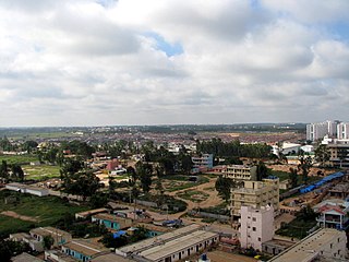
Hale Kesare is a small village in Mysore district of Karnataka state in India.
Hale Kesare village is located immediately north of the ring road near R.S.Naidu Nagar satellite bus station, Mysore Towards Teachers Layout Nagunahalli Road [1] 12°21′18″N76°40′12″E / 12.355131°N 76.670093°E
There is a post office at Hale Kesare and the PIN code is 570003 It comes under Note Mudrana Nagar
Hale Kesare village has surrounded by Teachers Layout, BMR Layout, Mathrusree Layout, Vittal Layout Adjacent villages Siddlingapura a big lake called KamanaKere. The end of the village is Kamana Kere Hundi and this point is marked by a square where bus No.150.AB turns back to the city bus station. There is a primary school in this location.
Hale Kesare village is about one kilometre north of the Ring Road circling Mysore city. It is two kilometres from R.S.Naidu satellite bus station. Direct buses are also available from Mysore city bus station every half an hour (Bus No.150.AB). The nearest railway station is Mysore.

Kengeri is a locality in Bangalore city. It is located on the western corridor along Mysore Road, bordered by Nagarbhavi to the north, Rajarajeshwari Nagar to the east and Uttarahalli to the south.

Pandavapura is a Municipality Town in Mandya district in the Indian state of Karnataka.
Vijayanagara, is a residential neighborhood in west Bangalore, India. It derives its name from the Vijayanagara empire that flourished in South India during the 15th and 16th centuries. It is bound by Mysore Road and Magadi Road, with Chord Road cutting through. It is the northernmost area in South Bangalore.

Nagarabhavi is a residential area of Bangalore, Karnataka, India. Located in West Bangalore, Nagarabhavi is located between Mysore Road and Magadi road.
Located in South Bangalore, Karnataka, India, Kumaraswamy Layout is a sub locality in Banashankari.
Bellandur is a suburb in south-east Bangalore, Karnataka, India. It is bounded by HSR Layout to the west, Devarabisanahalli to the east, Sarjapur Road to the south, and the Bellandur Lake to the north. The Bellandur Lake is the largest lake in Bangalore, and separates Bellandur from the HAL Airport. The Outer Ring Road passes through Bellandur, making the area an important transit point between east and south Bangalore.

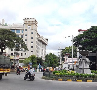
R. S. Naidu Nagar is a suburb in the northern side of Mysore. The local language spoken here is Kannada.

Gurur is a small village in Mysore district, Karnataka, India.

Raja Rajeshwari Nagar is a residential suburb of Mysore city in the state of Karnataka of the nation of India and is located in the Greater Bhogadi area of the city.

Konanur or Paduvalamarahalli is a village in Nanjangud taluk of Mysore district, Karnataka state, India.

Narayanapura is a small village in Mandya district of Karnataka state, India. Narayanapura is located 18.7 km (11.6 mi) north of Pandavapura town near Mysore city.
Jayachamarajendra Circle or Jayachamarajendra Wadiyar Circle, formerly known as Harding Circle or Arugatu is an intersection of six major roads in Mysore, Karnataka state, India.
Mandi Mohalla, K.T.Street or Ashoka Road, is a suburb of Mysore city in Karnataka state of India.
Akshaya Bhandar is a suburb of Mysore in Karnataka, India.

Hootagalli or Hutagalli is a city and a Suburb of Mysore, situated in Mysuru metropolitan area ಮೈಸೂರು ಜಿಲ್ಲೆ of Karnataka, India. Hootagalli is located in the outskirts of the city of Mysuru and forms a continuous urban area. Hootagalli city municipal council consists of previous census towns of Hinkal, Hootagalli and Gram Panchyats of Koorgalli and Belavadi totally covering an area of 28.48 square km. In November 2020, the government of Karnataka approved the formation of Hootagalli City Municipal Council by merging four gram panchayats. The initial plan was to include it with MCC to form Greater Mysuru City Corporation (BMMP) however, due to MCC disputing the proposal, a separate body was created. According to 2011 census, the city municipal council has combined population of 56,876. On November 26, 2020, a gazetted notification was passed making the CMC official.
Bannimantap is an historical place in the Indian city of Mysore, Karnataka, India. where the world famous Mysore Dasara Jumbo Savari parade marks the end and after which cultural programmes are host every year on Vijayadashami in the presence of the Governor of Karnataka, Chief Minister of Karnataka and other Council of Ministers of the Govt. of Karnataka.
Mysore North is a cluster of suburbs in the northern side of Mysore. City is divided as Northern and Southern clusters or blocks for administration Mysore North hosts separate Zone for many Government offices like Block Educational Officer, Sub-Registrar's Office and many other departments.
Hanumanthanagar is a locality in Bannimantap, a suburb of Mysore coming on the Northern side of the city. It is part of Mysore district in Karnataka state of India. Hanumanth Nagar is famous for the Jumbo Savari with the golden Howdah, a part of Mysore Dasara, which marks an end of the procession in Bannimantap via Highway Circle of Hanumanth Nagar.

Vijayanagar and Hebbal are two areas of Mysore city in India. the growth of technology-related industry in the first decade of the 21st century has resulted in the city emerging as the second largest software exporter in the state of Karnataka, next to Bangalore.
Kanthirava Narasimharajapura or K. N. Pura is a locality in Northern part of Mysore city. Soligara Colony and Ghousianagar are some of the prominent localities of Kanthirava Narasimharajapura. Indira Gandhi Road and Jilani Road are some of the major Roads of this area. K. N. Pura and Kyatamaranahalli, a nearby locality is famous for Communal clashes. This locality is sometimes referred as Kantheerava Narasarajapura.
| | This article related to a location in Mysore district, Karnataka, India is a stub. You can help Wikipedia by expanding it. |