Kesare

Last updated

Kesare
village
CountryFlag of India.svg  India
State Karnataka
District Mysore
Talukas Mysore
Government
  Type Panchayat raj
  Body Gram panchayat
Population
 (2001)
  Total5,289
Languages
  Official Kannada
Time zone UTC+5:30 (IST)
ISO 3166 code IN-KA
Vehicle registration KA
Website karnataka.gov.in

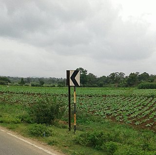
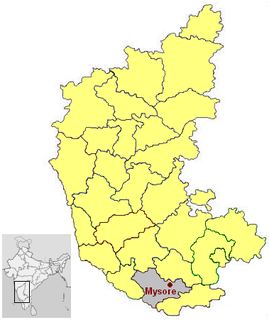
Kesare is a village in the southern state of Karnataka, India. [1] [2] It is located in the Mysore taluk of Mysore district.

Karnataka State in southern India

Karnataka is a state in the south western region of India. It was formed on 1 November 1956, with the passage of the States Reorganisation Act. Originally known as the State of Mysore, it was renamed Karnataka in 1973. The state corresponds to the Carnatic region. The capital and largest city is Bangalore.

Mysore City in Karnataka, India

Mysore, officially Mysuru, is a city in the southern part of the state of Karnataka, India. Mysore city is geographically located between 12° 18′ 26″ north latitude and 76° 38′ 59″ east longitude. It is located at an altitude of 2,427 ft (739.75 m).
Mysore district District in India


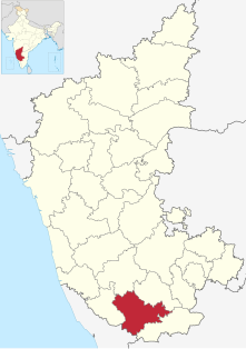
Mysore officially known as Mysuru District is an administrative district located in the southern part of the state of Karnataka, India. The district is bounded by Mandya district to the east and northeast, Chamrajanagar district to the southeast, Kerala state to the south, Kodagu district to the west, and Hassan district to the north. It features many tourist destinations, from Mysore Palace to Nagarhole National Park. This district has a prominent place in the history of Karnataka; Mysore was ruled by the Wodeyars from the year 1399 till the independence of India in the year 1947. Mysore's prominence can be gauged from the fact that the Karnataka state was known previously as Mysore state.

Contents

Demographics

As of 2001 India census, Kesare had a population of 5289 with 2696 males and 2593 females. [1]

Census Acquiring and recording information about the members of a given population

A census is the procedure of systematically acquiring and recording information about the members of a given population. This term is used mostly in connection with national population and housing censuses; other common censuses include traditional culture, business, supplies, and traffic censuses. The United Nations defines the essential features of population and housing censuses as "individual enumeration, universality within a defined territory, simultaneity and defined periodicity", and recommends that population censuses be taken at least every 10 years. United Nations recommendations also cover census topics to be collected, official definitions, classifications and other useful information to co-ordinate international practices.

See also

Related Research Articles

Asangi village in Karnataka, India

Asangi is a village in the southern state of Karnataka, India. It is located in the Jamkhandi taluk of Bagalkot district in Karnataka. They speak different languages: Kannada, Tulu, Konkani, Marathi, Urdu, Telugu and Gujarati. It is 774 feet above sea level. The minuscule village belongs to the Mysore Division. The literacy rate of the village is 74.6%.

Malali village in Karnataka, India

Malali is a village in Mysore district, Karnataka, India.

Arehalli village in Karnataka, India

Arehalli is a village in the state of Karnataka in southern India. It is located in the Belur taluk of Hassan district in Karnataka, and is about 230 kilometres from the state capital Bengaluru. It is well connected by road through the city of Hassan. The nearest airport is Mangalore International Airport, and Sakleshpur Railway Station is located at a distance of 14 kilometres.

Konanur, Hassan town in Karnataka, India

Konanur is a mid level town in the southern state of Karnataka, India. It is located in the Arkalgud taluk of Hassan district in Karnataka.

Masthi is a village in the southern state of Karnataka, India. It is located in the Malur taluk of Kolar district in Karnataka.

Algodu is a village in the southern state of Karnataka, India. It is located in the Tirumakudal Narsipur taluk of Mysore district.

Aspathrekaval is a village in the southern state of Karnataka, India. It is located in the Hunsur taluk of Mysore district.

Byrapura village in Karnataka, India

Byrapura is a village in the southern state of Karnataka, India. It is located in the Tirumakudal Narsipur taluk of Mysore district.

Danagalli village in Karnataka, India

Dhanagahalli is a village in the southern state of Karnataka,India. It is located in the Mysore taluk of Mysore district.

Doddaharve village in Karnataka, India

Doddaharve is a village in the southern state of Karnataka, India. It is located 8 km from Bylakuppe.

Elwala village in Karnataka, India

Elwala is a village in the southern state of Karnataka, India. It is located in the Mysore taluk of Mysore district in Karnataka.

Gandhaahalli is a village in the southern state of Karnataka, India. It is located in the Krishnarajanagara taluk of Mysore district in Karnataka.

Hullahalli Town in Karnataka, India

Hullahalli is a village in the southern state of Karnataka, India. It is located in the Nanjangud taluk of Mysore district in Karnataka.

Kadakola village in Karnataka, India

Kadakola is a village in the southern state of Karnataka, India. It is located in the Mysore taluk of Mysore district.

Kattemalalavadi is a village in the southern state of Karnataka, India. It is located in the Hunsur taluk of Mysore district in Karnataka.

Kestur is a village in the southern state of Karnataka, India. It is located in the Krishnarajanagara taluk of Mysore district.

Koorgalli is a village in the southern state of Karnataka, India. It is located in the Mysore taluk of Mysore district.

Mirle village in Karnataka, India

Mirle is a village in the southern state of Karnataka, India. It is located in the Krishnarajanagara taluk of Mysore district.

Rammanahalli is a village in the southern state of Karnataka, India. It is located in the Mysore taluk of Mysore district in Karnataka.

Agasthapura village in Karnataka, India

Agasthapura is a village in the southern state of Karnataka, India. It is located in the Tirumakudal Narsipur taluk of Mysore district in Karnataka.

References

  1. 1 2 Village code= 2819600 "Census of India : Villages with population 5000 & above". Registrar General & Census Commissioner, India. Archived from the original on 8 December 2008. Retrieved 18 December 2008.
  2. "Yahoomaps India :". Archived from the original on 18 December 2008. Retrieved 18 December 2008. Kesare, Mysore, Karnataka