Gummanahalli

Last updated

Gummanahalli
village
CountryFlag of India.svg  India
State Karnataka
District Mandya
Talukas Pandavapura
Government
  Body Gram panchayat
Population (2001)
  Total 5,668
Languages
  Official Kannada
Time zone IST (UTC+5:30)
ISO 3166 code IN-KA
Vehicle registration KA
Website karnataka.gov.in

Gummanahalli is a village in the southern state of Karnataka, India. [1] [2] It is located in the Pandavapura taluk of Mandya district in Karnataka.

Karnataka State in southern India

Karnataka is a state in the south western region of India. It was formed on 1 November 1956, with the passage of the States Reorganisation Act. Originally known as the State of Mysore, it was renamed Karnataka in 1973. The state corresponds to the Carnatic region. The capital and largest city is Bangalore (Bengaluru).

India Country in South Asia

India, also known as the Republic of India, is a country in South Asia. It is the seventh largest country by area and with more than 1.3 billion people, it is the second most populous country as well as the most populous democracy in the world. Bounded by the Indian Ocean on the south, the Arabian Sea on the southwest, and the Bay of Bengal on the southeast, it shares land borders with Pakistan to the west; China, Nepal, and Bhutan to the northeast; and Bangladesh and Myanmar to the east. In the Indian Ocean, India is in the vicinity of Sri Lanka and the Maldives, while its Andaman and Nicobar Islands share a maritime border with Thailand and Indonesia.

Pandavapura city in Karnataka, India

Pandavapura is a panchayat town in Mandya district in the Indian state of Karnataka.

Contents

Demographics

As of 2001 India census, Gummanahalli had a population of 5668 with 2837 males and 2831 females. [1]

Census Acquiring and recording information about the members of a given population

A census is the procedure of systematically acquiring and recording information about the members of a given population. The term is used mostly in connection with national population and housing censuses; other common censuses include agriculture, business, and traffic censuses. The United Nations defines the essential features of population and housing censuses as "individual enumeration, universality within a defined territory, simultaneity and defined periodicity", and recommends that population censuses be taken at least every 10 years. United Nations recommendations also cover census topics to be collected, official definitions, classifications and other useful information to co-ordinate international practice.

See also

Related Research Articles

Mandya district district in Karnataka, India

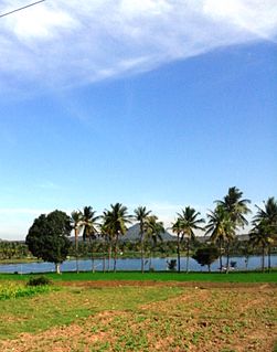
Mandya District is an administrative district of Karnataka, India. The district is bordered on the south by Mysore District, on the west by Hassan District, on the north by Tumkur District and on the east by Ramanagar district. The district Mandya was carved out of larger Mysore district in the year 1939.

Krishnarajpet Town in Karnataka, India

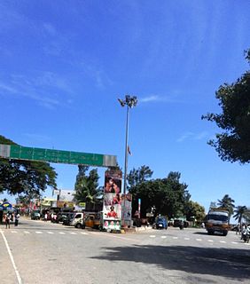
Krishnarajpet, also spelt as Krushnarajapete, is a municipality and taluk in Mandya District in the Indian state of Karnataka.

Arakere village in Karnataka, India

Arakere is a village in the southern state of Karnataka, India. It is located in the Shrirangapattana taluk of Mandya district in Karnataka.

Belagola is a village in the southern state of Karnataka, India. It is located in the Shrirangapattana taluk of Mandya district in Karnataka. It is around 7 km from famous K.R.S. dam.

Besagarahalli is a village in the southern state of Karnataka, India. It is located in the Maddur taluk of Mandya district in Karnataka.

Budanur village in Karnataka, India

Budanur is a village in the southern state of Karnataka, India. It is located in the Mandya taluk of Mandya district in Karnataka.

Doddarasinakere village in Karnataka, India

Doddarasinakere is a village in the southern state of Karnataka, India. It is located in the Maddur taluk of Mandya district in Karnataka.

Kalkuni is a village in the southern state of Karnataka, India. It is located in the Malavalli taluk of Mandya district in Karnataka.

Keelara village in Karnataka, India

Keelara is a village in the southern state of Karnataka, India. It is located in the Mandya taluk of Mandya district. The village is around 10 km from Mandya city and 96 km from the capital city of Karnataka via NH-275. Keelara is the hometown of former Education Minister of Karnataka Sri. K V Shankare Gowda who is popularly named as 'Nithya Sachiva'.

Kennalu is a village in the southern state of Karnataka, India. It is located in the Pandavapura taluk of Mandya district in Karnataka. In Kennal we have Shiva temple that is 400 years old. This temple is renovated by Mr. Veerendra Hegde of Dharmasthala.

Keregodu is a village in the southern state of Karnataka, India. It is located in the Mandya taluk of Mandya district in Karnataka. panchalingeshwara temple famous temple in keregodu.this village is near to Mandya only 12km.

Kirangur is a village in the southern state of Karnataka, India. It is located in the Srirangapatna taluk of Mandya district in Karnataka.

Mellahalli is a village in the southern state of Karnataka, India. It is located in the Maddur taluk of Mandya district in Karnataka.

Palahalli Village in Karnataka, India

Palahalli is a village in the southern state of Karnataka, India. It is located in the Shrirangapattana taluk of Mandya district in Karnataka. It is known for having the first sugar factory being built when it was a British colony.

Santhekasalagere village in Karnataka, India

Santhekasalagere is a village in the southern state of Karnataka, India. It is located in the Mandya taluk of Mandya district in Karnataka.

Agatahalli is a village in the southern state of Karnataka, India. It is located in the Pandavapura taluk of Mandya district in Karnataka.

Jakkanahalli Place in Karnataka, India

Jakkanahalli is a small village in Mandya district of Karnataka state, India.

Narayanapura

Narayanapura is a small village in Mandya district of Karnataka state, India.

Chinakurali

Chinakurali is a village in Pandavapura taluk, Mandya district of Karnataka state, India.

References

  1. 1 2 Village code= 2362900 "Census of India : Villages with population 5000 & above". Registrar General & Census Commissioner, India. Retrieved 2008-12-18.
  2. "Yahoomaps India :" . Retrieved 2008-12-18. Gummanahalli, Mandya, Karnataka