Hassan is a city and the district headquarters of Hassan district in the Indian state of Karnataka. The city is situated 980 m (3,220 ft) above sea level. It is named after the Hasanamba temple. The urban population in 2011 was 133,436. It is situated at a distance of 182 km (113 mi) from the state capital, Bangalore, and 166 km (103 mi) from Mangalore.

Kaduru, also known as Kadur, is a town and a Taluk in Chikkamagaluru district, in Karnataka with an area of 2,813 m2 (30,280 sq ft). It is located at 13.553345°N 76.011260°E.located in the rain shadow region of western ghats,most of the taluk is dry unlike much of the district.Kadur is known for Arecanut production.

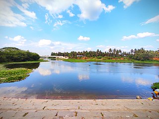
Holenarasipura is a town and taluk in Hassan district of Karnataka. The town is situated on the banks of the Hemavati, one of the tributaries of the Kaveri.
Kadambur is a panchayat town in Kayathar taluk of the Thoothukudi district in the Indian state of Tamil Nadu. The temples in and around Kadambur portray the authentic Chola art and architecture. There is also another village with the same name Kadambur in the district of Salem under Gangavalli taluk.
Kandanur is a panchayat town in Karaikudi taluk, Sivaganga district in the Indian state of Tamil Nadu. The town is famous for Kandanur Sivan Kovil, which is a replica to the Madurai meenatchi amman temple built by Nagarathars community. Kandanur Perumal temple is equally popular in the area. Also, near by town Puduvayal is famous for its Veerasekara Umaiyambigai Temple. Palaniappan Chidambaram is an Indian politician and former attorney who currently serves as Member of Parliament, Rajya Sabha and formerly served as the Union Minister of Finance of India is from Kandanur
Kottuvally is a census town in Paravoor.It is also a village in Paravur Taluk, Ernakulam district in the Indian state of Kerala. The village is situated in the south of the taluk. The nearest town is North Paravur, 4 km away. The Kottuvally panchayath is spread out on both sides of NH-66 road.
Kunigal is a town in Tumakuru district in the Indian state of Karnataka. It is the headquarters of Kunigal taluk. As of 2011 census, the town has a population of 34155.
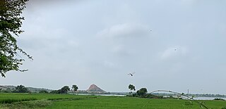
Kushtagi is a panchayat town in Koppal district in the Indian state of Karnataka. Kushtagi is a taluk center of Koppal district. This taluk has a population of 353,142 as per the 2021 census estimate. In this taluk, pomegranate fruits are popularly grown. To its North lies Ilkal, Gajendragad to the West, Hospet to the South and Sindhanur to the East. Red and black soil can be found in this taluk. There is a Durga Devi temple.
Lingasugur is a municipal town in Raichur district in the Indian state of Karnataka. There are many Temples, hills and forts (Quila). The festivals of Muharram and Maha Shivaratri are important here. Mudgal in Lingasugur taluk has a very ancient fort. It has often been mentioned in the autobiography of Philip Meadows Taylor. Lingasugur, then known as Chavani was the site of a major British cantonment in the region.
Maddur is a town in Mandya district in the Indian state of Karnataka. It lies on the banks of the river Shimsha. It is 82 kilometers from the state capital Bangalore and 60 kilometers from Mysore. Derived from Maddu a term referring to chemicals used for explosives. According to a Tamil inscription found in Ugra Narasimha temple, the town was called Marudhur during the Hoysala period, from which the name Maddur might have been derived.
Malavalli is a town and a taluka place in Mandya district in the Indian state of Karnataka. The pincode of Malavalli is 571430.
Manalmedu is a panchayat town in Mayiladuthurai district in the Indian state of Tamil Nadu. It comes under Mayiladuthurai Taluk.This town is located 15 km from Mayiladuthurai town, 33 km from Kumbakonam and 15 km from kattumannarkoil town.
Narasimharajapura is a town panchayat and tehsil headquarters in Chikmagalur, Karnataka, India. It resides in the Malenadu region of Chikmagalur district. The nearest railway stations that connect to it are in Bhadravathi, Channagiri (85), Shimoga and Tarikere. In 1915, Yuvaraja Shri Narasimharaja Wodeyar visited Yedehalli and in his memory, the town was named after him. The taluk was ruled by Ganga, Kadamba, Santhara, Hoysala and Vijayanagara kings.

Pandavapura is a Municipality Town in Mandya district in the Indian state of Karnataka.
Tarikere is a taluk in the Chikkamagaluru district in the state of Karnataka of India. The headquarters of the taluk is a town of the same name. It is popularly known as gateway of Malnad because the Malnad area starts from here. The town's name is derived from the number of water tanks which surround it.

Tirumakudalu Narasipura the temple city of Karnataka, commonly known as T. Narasipura or T.N. Pura, is a town in Mysore district in the Indian state of Karnataka. The first name refers to the land at the confluence, (trimakuta in Sanskrit at the confluence of the Kaveri, Kabini and Spatika Sarovara.

Turuvekere is a panchayat town and Taluk in Tumkur district in the Indian state of Karnataka.
Channarayapatna is a town and Taluk headquarters in Hassan district of Karnataka, India. It lies on the Bangalore-Mangalore National Highway 75 in Karnataka, India.It has number of temples like Channakeshava temple, Anjaneya temple, Tejigereyamma temple... etc. Famous Jain pilgrimage Shravanbelogola belongs to this taluk. Channarayapatna has major railway connection from Bengaluru to Mangaluru, Karwar and Mysuru.
Kanathur is a village in Turvekere taluk of Tumkur district, in the Indian state of Karnataka.
Asandi is a village in Kadur taluk, Chikkamagaluru district, Karnataka, India. It is situated 5 miles (8.0 km) from Ajjampura railway station.