Akkihebbal

Last updated

Akkihebbalu
Hobli
Coordinates: 12°37′19″N76°23′39″E / 12.62197°N 76.39423°E / 12.62197; 76.39423
CountryFlag of India.svg  India
State Karnataka
District Mandya
Taluk K R Pete
Government
  BodyVillage Panchayat
Area
  Total5.33 km2 (2.06 sq mi)
Elevation
804 m (2,638 ft)
Population
 (2011)
  Total3,946 [1]
Languages
  Official Kannada
Time zone UTC+5:30 (IST)
Vehicle registration KA-54, KA-11
Nearest cityMandya
Akkihabblu School Akkihebbal. Krishnarajapet (4).jpg
Akkihabblu School

Akkihebbalu is a Hobli in the southern state of Karnataka, India. [2] [3] It is located in the Krishnarajpet taluk of Mandya district in Karnataka.

Contents

It has an 800 year old Lakshmi Narasimha Swamy temple constructed by Goutama Maharshi. Rathotsava is celebrated every year in the month of February. Near to that a very old Eeshwara temple (Konkaneshwara) is located.

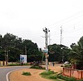
Akkihebbalu is connected by road(R) and rail(T) to Mysore(R&T), Hassan(R&T), Mandya(R) and Bangalore(R). It is located 55 km from Mandya, 64 km from Mysore, 61 km from Hassan and it is 168 km from Bangalore, via Somwarpet - Magadi Road.

The railway station of Akkihebbalu (station code: AKK) falls under the jurisdiction of Mysore division of South-western Railway and is the closest (16 km) railway station to Krishnarajapete.

Related Research Articles

<span class="mw-page-title-main">Mysore</span> City in Karnataka, India

Mysore, officially Mysuru, is the second-most populous city in the southern Indian state of Karnataka. It is the headquarters of Mysore district and Mysore division. As the traditional seat of the Wadiyar dynasty, the city functioned as the capital of the Kingdom of Mysore for almost six centuries. Known for its heritage structures, palaces, and its culture, Mysore has been called the "City of Palaces", the "Heritage City", and the "Cultural Capital of Karnataka". It is one of the cleanest cities in India according to the Swachh Survekshan.

<span class="mw-page-title-main">Mandya</span> City in Karnataka, India

Mandya is a city in the state of Karnataka. It is the headquarter of Mandya district and is located 45 kilometres (28 mi) from Mysore and 100 kilometres (62 mi) from Bangalore.

<span class="mw-page-title-main">Mysore division</span> Administrative division in Karnataka, India

Mysore division, officially Mysuru division, is an administrative division in the southern Indian state of Karnataka. It is one of four administrative divisions in Karnataka, the others being Bangalore division, Belagavi division, and Kalaburagi division. Mysore division comprises eight districts of Karnataka, namely, Chamarajanagar, Chikmagalur, Dakshina Kannada, Hassan, Kodagu, Mandya, Mysore and Udupi district. The city of Mysore is the administrative headquarters of the division. Mysore division covers parts of historical Old Mysore region and southern part of Coastal Karnataka.The total area of the division is 43,503 sq.km. The total population as of 2011 census is 12,563,598.

<span class="mw-page-title-main">Mandya district</span> District of Karnataka in India

Mandya district is an administrative district of Karnataka, India. The district is bordered on the south by Mysore and Chamarajangar districts, on the west by Hassan district, on the north by Tumkur district and on the east by Ramanagara district. The district Mandya was carved out of larger Mysore district in the year 1939.

<span class="mw-page-title-main">Kollur, Udupi district</span> Temple Town in Karnataka, India

Kollur is a village in the southern state of Karnataka, India. It is located in the Byndoor taluk of Udupi district in Karnataka.

<span class="mw-page-title-main">Pandavapura</span> Town in Karnataka, India

Pandavapura is a Municipality Town in Mandya district in the Indian state of Karnataka.

<span class="mw-page-title-main">Tourism in Karnataka</span> Overview of tourism in Karnataka, India

Karnataka, the sixth largest state in India, has been ranked as the third most popular state in the country for tourism in 2014. It is home to 507 of the 3600 centrally protected monuments in India, second only to Uttar Pradesh. The State Directorate of Archaeology and Museums protects an additional 752 monuments and another 25,000 monuments are yet to receive protection.

Punacha is a village in the southern state of Karnataka, India. It is located in the Bantwal taluk of Dakshina Kannada district in Karnataka.

Arehalli is a village in the state of Karnataka in southern India. As per census 2011, the location code number of Arehalli is 615144. It is located in the Belur taluk of Hassan district in Karnataka, and is about 230 kilometres from the state capital Bangalore, and 146 kilometres from the chief port city of Mangalore. It is well connected by road through the city of Hassan. The nearest airport is Mangalore International Airport at 160 km, and the nearest major railway station is Hassan Junction railway station located at a distance of 46 km; Sakleshpura railway station is 17 km away.

<span class="mw-page-title-main">Belluru Cross</span> Village in Karnataka, India

Belluru is a village in the southern state of Karnataka, India. It is located in the Nagamangala taluk of Mandya district in Karnataka.

<span class="mw-page-title-main">Halaguru</span> Town in Karnataka, India

Halaguru or Halagur is a town in the southern state of Karnataka, India.

Keelara is a village in the southern state of Karnataka, India. It is located in the Mandya taluk of Mandya district. The village is around 10 km from Mandya city and 96 km from the capital city of Karnataka via NH-275.

Kirugavalu is a village in the southern state of Karnataka, India. Kirugavalu is located in the Malavalli taluk of Mandya district in Karnataka.

<span class="mw-page-title-main">Kadakola</span> Town in Karnataka, India

Kadakola is a Town and a suburb of Mysuru metropolitan area in the southern state of Karnataka, India. It is located in the Mysore taluk of Mysore district. In November 2020, Kadakola was upgraded from a Gram Panchayat to a Town Panchayat and a gazetted notification was passed on November 26, 2020.2. The combined population of the newly formed town is 19,969.

Naganahalli is a small village in Mysuru district of Karnataka state, India.

<span class="mw-page-title-main">Byadarahalli</span> Village in Karnataka, India

Byadarahalli is a village in the Mandya district of Karnataka, India.

<span class="mw-page-title-main">Gorur, Hassan</span> Village in Karnataka, India

Gorur is a small village in Hassan district of Karnataka state in India.

Shivapura is a small village next to Maddur in Mandya district of Karnataka state, India.

<span class="mw-page-title-main">Dudda, Hassan</span>

Dudda is a small village in Hassan district of Karnataka state in India.

References

  1. "Census Data Handbook 2011" (PDF). Retrieved 3 August 2023.
  2. "Census of India : List of Villages Alphabetical Order > Karnataka". Registrar General & Census Commissioner, India. Retrieved 18 December 2008.[ permanent dead link ], Census Village code= 2312000
  3. "Yahoo! maps India :". Archived from the original on 18 December 2008. Retrieved 17 April 2009. Akkihebbalu, Mandya, Karnataka