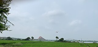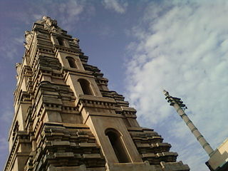
Hassan is a city in the southern part of the Indian state of Karnataka. It is the headquarters of Hassan district. The city is situated midway between Bangalore and Mangalore on National Highway 75.

Kaduru, also known as Kadur, is second largest town in the district and a Taluk in Chikmagalur district, in Karnataka. It is located at 13.553345°N 76.011260°E in the rain shadow region of western ghats. Most of the taluk is dry, unlike much of the district. Kadur is known for areca nut and also coconut production.
Hirekeruru is a panchayat town in Haveri district in the Indian state of Karnataka. The name "the village of the big pond". The name is pronounced as "Hee ray kay roor".
Hoovina Hadagali or Huvina Hadagali is a town and a taluk in the Vijayanagara district of Karnataka, India. It is the administrative headquarters of the HuvinaHadagali Taluk.
Kadambur is a panchayat town in Kayathar taluk of the Thoothukudi district in the Indian state of Tamil Nadu. The temples in and around Kadambur portray the authentic Chola art and architecture. There is also another village with the same name Kadambur in the district of Salem under Gangavalli taluk.
Kunigal is a town in Tumakuru district in the Indian state of Karnataka. It is the headquarters of Kunigal taluk. As of 2011 census, the town has a population of 34155.
Kushtagi is a panchayat town in Koppal district in the Indian state of Karnataka. Kushtagi is a taluk center of Koppal district. This taluk has a population of 353,142 as per the 2021 census estimate. In this taluk, pomegranate fruits are popularly grown.There is a Durga devi temple in heart of the town. To its North lies Ilkal, Gajendragad to the West, Hospet to the South and Sindhanur to the East. Red and black soil can be found in this taluk. A big lake 4kms away from the city is the main source of drinking water is situated in west side and covering the area of more than 300 acres.

Lingasugur is a municipal town in Raichur district in the Indian state of Karnataka. There are many Temples, hills and forts (Quila). The festivals of Muharram and Maha Shivaratri are important here. Mudgal in Lingasugur taluk has a very ancient fort. It has often been mentioned in the autobiography of Philip Meadows Taylor. Lingasugur, then known as Chavani was the site of a major British cantonment in the region.

Madukkarai is a suburb of Coimbatore city in the Indian state of Tamil Nadu. It is the gateway to Coimbatore city from Kerala State and is located around 12 km from the Kerala border. The Coimbatore International Airport is about 27 km from here. It is the administrative centre for Madukkarai taluk.

Malavalli is a town and a taluka in Mandya district in the Indian state of Karnataka. Malavalli town in history is quoted dates back to 27 March 1799 - Fourth Anglo Mysore War. Battle of Malavalli was fought between Tippu Sultan's Mysore Army against the British East India Company led by Arthur Wellesley. The men from the town fought fiercely and laid down their lives.
Narasimharajapura or NRpura is a town and taluk headquarter in Chikkmagaluru district, Karnataka, India. It is situated in the Malenadu region of the district. In 1915, Yuvaraja Shri Narasimharaja Wodeyar visited Yedehalli and in his memory, the town was named after him. The taluk was ruled by Ganga, Kadamba, Santhara, Hoysala and Vijayanagara kings.

Pandavapura is a Municipality Town in Mandya district in the Indian state of Karnataka.
Tarikere is a town, a taluk and is one of the two Subdivisional headquarter in the Chikmagalur district of Karnataka state, India. It is popularly known as gateway of Malnad because the Malnad area starts from here. The town's name is derived from the number of water tanks which surround it.

Turuvekere is a panchayat town and Taluk in Tumakuru district in the Indian state of Karnataka.
Aland is a city and taluka in Kalaburagi district in the state of Karnataka, India. It is the headquarters of Aland Taluka. Aland was formed in 1952 as a town municipal council. It is 683km from the state capital Bengaluru, 43km from district headquarters Kalaburagi. It shares a border with Maharashtra state and is also 85.3 km away from Sholapur.

Channarayapatna is a town and Taluk headquarters in Hassan district of Karnataka, India. It lies on the Bangalore-Mangalore National Highway-75 in Karnataka, India. Jain pilgrimage Shravanabelagola is a famous site in the taluk. Channarayapatna has major railway connection from Bangalore to Mangalore, Karwar, and Mysore.

Bikkavolu is a village in East Godavari district in the state of Andhra Pradesh in India. The village is known for its famous Subrahmanya Swamy Temple.
Kanathur is a village in Turvekere taluk of Tumkur district, in the Indian state of Karnataka.
Asandi is a village in Kadur taluk, Chikkamagaluru district, Karnataka, India. It is situated 5 miles (8.0 km) from Ajjampura railway station.
Devara Hipparagi is a New Taluk of Vijayapura district, Karnataka, India.


