Bangalore Urban is a district of the Indian state of Karnataka. It is surrounded by the Bangalore Rural district on the east and north, the Ramanagara district on the west and the Krishnagiri district of Tamil Nadu on the south. Bangalore Urban district came into being in 1986, with the partition of the erstwhile Bangalore into Bangalore Urban and Bangalore Rural districts. Bangalore Urban has five taluks: Yelahanka, Bangalore North, Bangalore East, Bangalore South and Anekal. The city of Bangalore is situated in the Bangalore Urban district. The district has 17 hoblies, 668 villages and 9 municipal corporations. Electronics City is situated in Anekal Taluk.

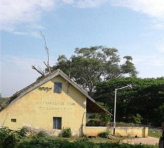
Holenarasipura is a town and taluk in Hassan district of Karnataka. The town is situated on the banks of the Hemavati, one of the many tributaries of the Kaveri.

Kanakapura is a city and the headquarters of Kanakapura Taluk in the Ramanagara district in the state of Karnataka, India. Situated 55 km from the city Bengaluru, this city is famous for the production of silk and granite. It is located among the lush green forests of the state of Karnataka and The town is a tourism hotspot and an often visited tourist favorite in the entire state of Karnataka, as it has something for everyone ranging from avid trekkers to history buffs and wildlife enthusiasts.

Chikkanayakana Halli is a town in Tumkur district, in the state of Karnataka, India. It is 67 km away from Tumkur and 132 km from Bangalore.

Herohalli is a census town in Bangalore district in the Indian state of Karnataka.

Krishnarajapuram,, also known as KR Puram, officially called Krishnarajapura or KR Pura, is an outlying neighborhood of Bangalore in the Indian state of Karnataka. It's one of the zones of BBMP. It is located 15 km from Bangalore City railway station. Old Madras Road passes through Krishnarajapuram. A lake called 'Vengayyana Lake' is in the heart of this area. The Yelemallappa Shetty lake near Medahalli, situated just outside the eastern limits of Krishnarajapuram, is one of the largest lakes in Bangalore.

Inchal is a village in the southern state of Karnataka, India. It is located in the Saundatti taluk of Belgaum district in Karnataka.

Saunshi is a village in the northern state of Karnataka, India. It is located in the Kundgol taluk of Dharwad district in Karnataka. largest grma Panchayat in Dharwad District

Nangali is a village in the southern state of Karnataka, India. It is in the Mulbagal taluk of Kolar district.

Alahalli is a village in the southern state of Karnataka, India. It is located in the Bangalore South taluk of Bangalore Urban district in Karnataka.
Belathur is a village in the southern state of Karnataka. It is located in the Bangalore South taluk of Bangalore Urban district.

Chikkabanavara is a town in Bengaluru, Karnataka, India. It is located in the Bangalore North taluk of Bangalore Urban district in Karnataka. It has one of the oldest surviving lakes in Bangalore. The lake is located at a distance of 1.5 km north of Chikkabanavara railway station on the Bangalore-Tumkur railway line.

Kaggalipura is a village along Kanakapura Road on the outskirts of Bangalore, in the southern state of Karnataka, India.. Kaggalipura is located on the Bangalore-Coimbatore National Highway NH 209, in South Bangalore. The village is named after the Kaggali tree which grows in abundance locally. The village was established after clearing several Kaggali trees from the area, hence the name Kaggalipura. Hindus are the largest religious group in the village with their Grama Devathe being "Pattalamma Devi". Major Hindu castes in the village are Gowda, Lingayatha, Bhanajiga and Bestha.
Konappana Agrahara is a village in the southern state of Karnataka, India. It is located in the Bangalore South taluk of Bangalore Urban district in Karnataka. This area is within Electronic City and is adjacent to Infosys Limited and Hewlett Packard.
Madanaiyakanahalli is a village in the southern state of Karnataka, India. It is located in the Bangalore North taluk of Bangalore Urban district in Karnataka.

Sarjapur is a town situated in Bangalore, Karnataka, India. It is a hobli of Anekal taluk, Bangalore Urban district and is located towards the south-east of Bangalore. It is one of the industrial areas in Anekal taluk, with others being Attibele, Bommasandra, Chandapura, Electronic City and Jigani.
Thanisandra is a village in the southern state of Karnataka, India. It is located in the Bangalore North taluk of Bangalore Urban district in Karnataka. Thanisandra area is slated for development with the expansion of the main road as an alternative road to Bangalore International Airport.
Ullalu is a village in the southern state of Karnataka, India. It is located in the Bangalore North taluk of Bangalore Urban district in Karnataka.

Kuruburu is a village in Chintamani Taluk in the Chikballapur district in the state of Karnataka, India.
Satanali is a village in Belgaum district of Karnataka, India. It has a population of 172 as of 2011. It is located 27 km towards South from district headquarters Belgaum and is 520 km from State capital Bangalore. The village is administrated by a Sarpanch elected by its populatipn.


