This article needs additional citations for verification .(November 2008) |
Kodigehalli | |
---|---|
Neighbourhood | |
Country | India |
State or Union Territory | Karnataka |
City | Bangalore |
Kodigehalli is a suburb of Bengaluru(, located in BBMP Ward 8) , and is part of the Bruhat Bengaluru Mahanagara Palike (BBMP). Blending history and modernity, Kodigehalli features historic temples alongside contemporary constructions and is a key part of Bengaluru's rapidly growing northern corridor.
Situated south of Sahakarnagar and near Hebbal, Kodigehalli is well-connected by the New Airport Road, which links Kodigehalli Main Road via the Kodigehalli Circle. Its strategic location provides easy access to the city center and Kempegowda International Airport.
To the west of Kodigehalli Railway Station, a road leads to Thindlu, while the Kodigehalli Bus Stop is marked by the Dodda Ganapa Devasthana, a prominent Ganapathi temple. Frequent BMTC buses connect Kodigehalli to Majestic and other central parts of Bengaluru.
To the south lies Tatanagar, also known as the I.I.Sc Layout, a planned residential area developed by current and former employees of the Indian Institute of Science (IISc). Tatanagar is also home to the Aadhaar headquarters. East of Kodigehalli is Bhadrappa Layout, located along the Outer Ring Road.
The road connecting Kodigehalli to Tatanagar is home to two notable temples, the Omkareswara Temple and the Ganga Temple, which add to the cultural and spiritual essence of the area.
Kodigehalli, located in the northern part of Bengaluru near Hebbal Lake, is steeped in history that reflects the evolution of the Bengaluru region from ancient to modern times. The locality holds a significant place in the narrative of the city, tracing its roots back to prehistoric and medieval eras.
The region surrounding Kodigehalli has been inhabited since prehistoric times. he Directorate of Census Operations completed its decadal Census recently.[ when? ] Archaeological discoveries in nearby areas such as Jalahalli, Siddapur, and Gavipura have revealed Stone Age tools dating from 2000 to 1000 BCE. During the Middle Stone Age (circa 4000 BCE), evidence of human habitation was found at Jalahalli, Sudasandra, Siddhapura, and Jadigenahalli, highlighting the region's role as a cradle of early human activity.
In the Iron Age (circa 1000 BCE), burial grounds were established in nearby localities, such as Koramangala and Chikkajala, further indicating the area's long-standing significance. Additionally, the discovery of Roman coins from the reigns of emperors Augustus, Tiberius, and Claudius in places like Yeshwantpur and HAL points to early trade and cultural exchanges with distant civilizations.
Kodigehalli shares a historical connection to the origins of Bengaluru's name, often referred to as the "City of Boiled Beans." According to folklore, the name "Bengaluru" originates from the Kannada term "Benda-Kaal-Ooru" (meaning "town of boiled beans"). This name was reportedly given by a Hoysala king, Veera Ballala II, who, during a hunting expedition, was served boiled beans by an old woman in the region.
Kodigehalli is closely linked to the ancient settlement of Halé Bengaluru (Old Bangalore). [1] , which was mentioned in inscriptions from the Ganga dynasty (circa 9th century CE). These records identify Halé Bengaluru as a small hamlet in the area, believed to be near modern Kodigehalli. The locality remained significant during the subsequent dynasties due to its strategic location and agricultural fertility.
The historical prominence of Kodigehalli grew during the 16th century when Kempe Gowda I established Bengaluru as a fortified town in 1537 CE. The name "Bengaluru" is said to have been inspired by Halé Bengaluru, as Kempe Gowda's mother and wife hailed from this village near Kodigehalli. This act intertwined the fate of Kodigehalli with the city's foundation, symbolizing its historical importance.
The name Kodigehalli itself reflects its regal past. The term Kodige translates to "gift" in Kannada, commemorating the land granted by King Veera Ballala of the Hoysala dynasty to two loyal brothers, Byregowda and Bacchegowda. The brothers were rewarded for their bravery in retrieving two of the king's prized horses that had escaped. This event not only gave the locality its name but also cemented its role as a vital area under royal patronage.
Through the Vijayanagara period and later under Mysore rulers, Kodigehalli remained an agricultural and administrative hub. Its proximity to the Hebbal Lake, one of the oldest man-made lakes in Bengaluru, added to its significance as a fertile and resource-rich area. The lake also supported the agrarian lifestyle of the Kodigehalli community.
Kodigehalli stands as a testament to Bengaluru's long and layered history, from the Stone Age to the modern era. Its evolution mirrors that of Bengaluru itself, making it a vital part of the city's cultural and historical heritage.
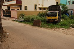
Today, Kodigehalli has transformed into a bustling urban area while retaining its historical roots. Located near Hebbal, it is well-connected by two major highways: Airport Road on NH 44. and central Bengaluru, and NH 75 Outer Ring Road , providing access to other parts of the city. This connectivity has made Kodigehalli a prime residential and commercial area.
The locality is close to major tech hubs like Manyata Tech Park and business districts in Hebbal and Nagavara. This has led to rapid urban growth, with modern apartments, gated communities, and shopping centers emerging in the area. New pubs, restaurants, and cafes have also come up along Bellary Road and in nearby Sahakaranagar, creating a vibrant social scene.
Kodigehalli will soon benefit from planned metro lines along Hebbal and Airport Road, as well as the suburban rail network under the KRIDE project. Despite its modernization, the area still retains green spaces and its proximity to Hebbal Lake adds to its appeal. Located just 10 km from Majestic, Kodigehalli offers a balance of urban convenience and historical charm.
The Hoysala kingdom was a Kannadiga power originating from the Indian subcontinent that ruled most of what is now Karnataka between the 10th and the 14th centuries. The capital of the Hoysalas was initially located at Belur, but was later moved to Halebidu.
Kempe Gowda I locally venerated as Nadaprabhu Kempe Gowda, or commonly known as Kempe Gowda, was a governor under the Vijayanagara Empire in early-modern India. He is famous for the development of Bengaluru Pete in the 16th century. Kempegowda erected many Kannada inscriptions across the region.
Basaveshwaranagara, also known as Basaveshwaranagar, Basaveshnagara or Basaveshnagar is a largely residential neighbourhood in the west of Bengaluru, Karnataka, India. It is located to the west of Rajajinagara and is sandwiched between the localities of Mahalakshmi Layout to the north and Vijayanagara to the south, spread across multiple sub-localities, three assembly constituencies and seven Bruhat Bengaluru Mahanagara Palike (BBMP) wards. The area of Basaveshwaranagara is often considered West of Chord Road as it lies to the west of Chord Road, an arterial road in the western part of Bengaluru.
Hebbal, is a neighbourhood in Bengaluru, Karnataka, India, which was once indicative of the north endpoint of the city. Though originally famous for Hebbal Lake, it is now better known for the serpentine maze of flyovers that network the Outer Ring Road and Airport Road on NH 44. The flyover spans a length of 5.23 kilometres (3.2 mi) over all the loops combined. The flyover was built by Gammon India. The lake area in Hebbal is well-known for its picnic spots, a well-maintained park, boating facilities and for the bird watching opportunities.
Arsikere is a city and taluka in the Hassan district in the state of Karnataka, India. It is the second largest city in Hassan district, demographically. Arsikere city municipal council consists of 35 wards. This region is known for its coconut production and is also called Kalpataru Nadu. Arsikere Junction is a major railway junction in the South Western Railway which links Mangalore and Mysore to North Karnataka and a central place for tourists who visit nearby places that do not have rail access, such as Belur, Halebidu and Shravanabelagola, Harnahalli, and Kodimata.
Hassan is one of the 31 districts of Karnataka, India. The district headquarter is Hassan. It was part of Manjarabad Faujdari between 1832-81. In 1882, it was reduced into a sub-division under erstwhile Kadur district. But in 1886, the Hassan district was restored to its current form.
Kengeri is a western suburb of Bangalore city, located along Mysore Road.It is bordered by Nagarbhavi and Ullal to the north, Rajarajeshwari Nagar to the east, Kumbalgodu to the west and Uttarahalli to the south.
Vidyaranyapura is situated in the northern part of Bangalore city in the state of Karnataka, India. Vidyaranyapura, along with several other extensions of the city, comes under a constituency called Byatarayanapura. It comes under the Greater Bangalore jurisdiction of the Bruhat Bengaluru Mahanagara Palike (BBMP).
Jalahalli is a suburb in northern part of Bengaluru is one of the greenest areas of Bengaluru. It is mainly divided into Jalahalli East and Jalahalli West. Gangamma Circle is the junction between the roads connecting Jalahalli East, Jalahalli West, Jalahalli Village, and Jalahalli Cross. The National Academy of Customs and Narcotics in Bengaluru is located here.
Located in South Bangalore, Karnataka, India, Kumaraswamy Layout is a sub locality in Banashankari.
Sahakara Nagar is a residential suburb near Bangalore, India. Sahakanagar is formed by the Ministry of Communication Employees housing society and has developed to this extent under the efforts of the Sahakaranagar Residents welfare association. Ever since the inclusion of 45 new wards to Bangalore city in 2008, Sahakara Nagar comes under the BBMP limits. The locality is accessible via NH 7 on the East. Sahakara Nagar was formed in the early 1980s as a co-operative society for Telecom and Post & Telegraph employees of the Government of India. It has over 8 well maintained parks and two Playgrounds maintained by BBMP. Owing to its proximity to Hebbal lake, Amrutahalli lake and GKVK forest land, it is often called the Prague of Bengaluru city.
The Kalleshwara temple is located in the town of Hire Hadagali of the Hoovina Hadagalitaluk in Vijayanagara district of Karnataka state, India.
Kempegowda Museum is a government museum located in the city of Bangalore, in the state of Karnataka, India. It was established in the year 2011 is dedicated to Yelahanka chieftain Kempegowda (1513-1569) who was the founder of Bangalore city. The museum is located on the first floor of Mayo Hall. The museum has Kempegowda's statue as well as posters and pictures of forts, temples, reservoirs and inscriptions from his time.
Akkana Basadi is a Jain temple (basadi) built in 1181 A.D., during the rule of Hoysala empire King Veera Ballala II. The basadi was constructed by the devout Jain lady Achiyakka, wife of Chandramouli, a Brahmin minister in the court of the Hoysala king. The main deity of the temple is the twenty-third Jain Tirthankar Parshwanath. The temple is protected as a monument of national importance by the Archaeological Survey of India. It is part of an Archaeological Survey of India Adarsh Smarak Monument along with other temples in the Shravanabelagola group of monuments.
Ramamurthy Nagar ( ) is an area in Bangalore in the Indian state of Karnataka. It is located in the eastern part of Bangalore and comes under the E3 subdivision of BBMP. It is a rapidly growing suburb, adjacent to other areas such as Banaswadi, CV Raman Nagar and Krishnarajapuram, also officially called Krishnarajapura.
Sagara is a city located in the Indian state of Karnataka. It is also a sub divisional and a taluk headquarters. Located in the Sahyadri Mountain range on the banks of river Varada, it is known for its proximity to Jog Falls and to the historical places of Ikkeri, Keladi and Varadamoola. The river Varada originates near Varada-moola. Sagara subdivision consists of Sagara, Soraba, Hosanagara and Shikaripur taluks.
Bengaluru ( ), formerly called Bangalore, is the capital and largest city of the southern Indian state of Karnataka. As per the 2011 census, the city had a population of more than 8.4 million, making it the third most populous city in India and the most populous in South India. The Bengaluru metropolitan area had a population of around 10.5 million, making it the fourth most populous urban agglomeration in the country. It is located near the center of the Deccan Plateau, at a height of over 900 m (3,000 ft) above sea level. The city is known as India's "Garden City", due to its parks and greenery.
Murphy Town or Knoxpete, is a suburb located near Bangalore Cantonment, India. It is one of the oldest planned suburbs of the Cantonment, and was earlier known as Knoxpete, and was later changed to Hoysala Nagar. It is located North of Halasuru, with Murphy Road running along its periphery, and is also bounded by Old Madras Road and Kensington Road, with part of Kensington Road overlooking Halasuru Lake Madras Sappers.
Hebbal is a locality situated in the northern part of Bengaluru, is recognized as one of Bengaluru’s oldest regions, with documented history extending back at least 1,300 years. Originally marking the northern boundary of the city, Bengaluru has since expanded significantly northward. The area is renowned for Hebbal Lake which is thought to have contributed to early settlement in the area. Additionally, Hebbal is home to 3 valuable historical inscriptions that contribute to Bengaluru's rich epigraphic heritage. Two of these inscriptions are being preserved physically and digitally, while the status of the third inscription is unknown.
Allalasandra is a historic locality in North Bengaluru adjoining the Gandhi Krishi Vigyan Kendra (GKVK) campus on Bellary road. Allasandra's historicity tracing back to about 500 years can be attested from the Rachur Narasappiah's Donation Inscription mentions the donation of the entire village of Allalasandra to the Allalanatha temple at Jakkur.