Related Research Articles

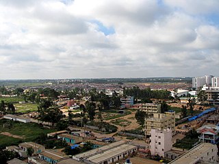
Basaveshwaranagara, also known as Basaveshwaranagar, Basaveshnagara or Basaveshnagar is a largely residential neighbourhood in the west of Bengaluru, Karnataka, India. It is located to the west of Rajajinagara and is sandwiched between the localities of Mahalakshmi Layout to the north and Vijayanagara to the south, spread across multiple sub-localities, three assembly constituencies and seven Bruhat Bengaluru Mahanagara Palike (BBMP) wards. The area of Basaveshwaranagara is often considered West of Chord Road as it lies to the west of Chord Road, an arterial road in the western part of Bengaluru.

HSR Layout, an abbreviation of Hosur Sarjapura Road Layout is a prominent suburb of South-Eastern Bangalore, India. The locality, initially developed by the Bangalore Development Authority in 1985 has now emerged into a coveted residential area due to its proximity to Electronic City, Sarjapur Road and the Outer Ring road on which I.T. Parks and other Special Economic Zones are located. It lies in the Bommanahalli constituency of the Karnataka State Assembly.

Bruhat Bengaluru Mahanagara Palike (BBMP) is the administrative body responsible for civic amenities and some infrastructural assets of the Greater Bengaluru metropolitan area. It is the fourth largest Municipal Corporation in India and is responsible for a population of 8.4 million in an area of 741 km2. Its boundaries have expanded more than 10 times over the last six decades.
Vidyaranyapura is situated in the northern part of Bangalore city in the state of Karnataka, India. Vidyaranyapura, along with several other extensions of the city, comes under a constituency called Byatarayanapura. It comes under the Greater Bangalore jurisdiction of the Bruhat Bengaluru Mahanagara Palike (BBMP).

Varthur is a suburb situated in the Eastern periphery of Bangalore City and part of the internationally famous Whitefield township. Varthur is a Hobli and part of the Bruhat Bangalore Mahanagara Palike. Varthur was a Legislative Assembly in the state of Karnataka but was split into three legislative assemblies C.V.Raman Nagar, Mahadevapura and Krishnarajapura in the year 2008. It is also one of the wards of BBMP. It is located in South-Eastern Bangalore between old Airport road and Sarjapur road. Varthur is very close to ITPB.

Padmanabhanagar is a residential locality in South Bangalore, India, covering an area of 1.68 km2. It is one of the zones of BBMP. Padmanabhanagar has a very famous park called Lakshmikanta Park. This park houses Lakshmi Kantha temple. It was looked after by residents association, in 2018 the corporator allotted funds and developed it further. The park was eyed for its medicinal trees and was sanctioned to be cut down completely and set up a landscaped area but the senior citizens of the locality who nurtured the park protested and stopped it. It is surrounded by Kumaraswamy Layout, Gowdanapalya, Chennamanakere, Kathriguppe, Kadirenahalli, Uttarahalli and Chikkakalasandra.
Located in South Bangalore, Karnataka, India, Kumaraswamy Layout is a sub locality in Banashankari.
Kaggadasapura, also known as Upper Indiranagar is a relatively new area located near DRDO township in CV Raman Nagar, Bangalore, India. Kaggadasapura is an area in Bangalore, and has many apartment complexes. It is located at the coordinates: 12°59'0"N, 77°40'32"E. It is about 4 km from Indiranagar and old (HAL) Airport Road in Bangalore. Defence Avionics Research Establishment (DARE), Center for Artificial Intelligence Research (CAIR) and DRDO Phase II are located at Kaggadasapura.
Bellandur is a suburb in south-east Bangalore, Karnataka, India. It is bounded by HSR Layout to the west, Devarabisanahalli to the east, Sarjapur Road to the south, and the Bellandur Lake to the north. The Bellandur Lake is the largest lake in Bangalore, and separates Bellandur from the HAL Airport. The Outer Ring Road passes through Bellandur, making the area an important transit point between east and south Bangalore.

Ramamurthy Nagar ( ) is an area in Bangalore in the Indian state of Karnataka. It is located in the eastern part of Bangalore and comes under the E3 subdivision of BBMP. It is a rapidly growing suburb, adjacent to other areas such as Banaswadi, CV Raman Nagar and Krishnarajapuram, also officially called Krishnarajapura.
Gandhi Nagar is a locality situated in Bangalore. It is a bustling neighbourhood of Central Bangalore.
Bommanahalli Assembly constituency is one of the 225 constituencies in the Karnataka Legislative Assembly of Karnataka, a southern state of India. Bommanahalli is also part of Bangalore South Lok Sabha constituency.
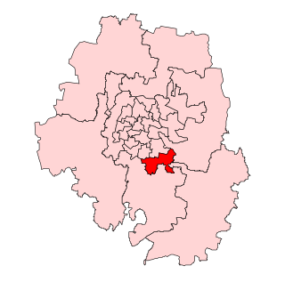
Mahalakshmi Layout Assembly Constituency is one of the 224 legislative assembly segments of the state of Karnataka. It is a part of Bangalore Urban district and comes under Bangalore North Lok Sabha constituency.

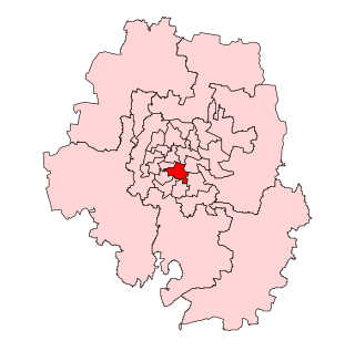
BTM Layout Assembly constituency is one of the 224 constituencies in the Karnataka Legislative Assembly of Karnataka a south state of India. It is also part of Bangalore South Lok Sabha constituency. It is in Bangalore Urban district.
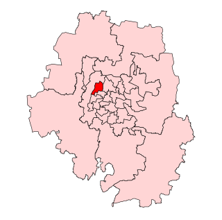
Chikkapete Assembly constituency is one of the 224 constituencies in the Karnataka Legislative Assembly of Karnataka, a southern state of India. It is also part of Bangalore South Lok Sabha constituency.

Jayanagar Assembly constituency is one of the 224 constituencies in the Karnataka Legislative Assembly of Karnataka, a southern state of India. It is also part of Bangalore South Lok Sabha constituency.

Vijayanagar Assembly constituency is one of the 224 constituencies in the Karnataka Legislative Assembly of Karnataka, a southern state of India. It is also part of Bangalore South Lok Sabha constituency. As of 2023, it is represented by M. Krishnappa of the Indian National Congress party.

Yelahanka Ward, officially known as Kempegowda Ward is one of the 225 Wards of Bruhat Bengaluru Mahanagara Palike, an administrative body responsible for civic amenities and some infrastructural assets of the Greater Bangalore metropolitan area in the Indian state of Karnataka.
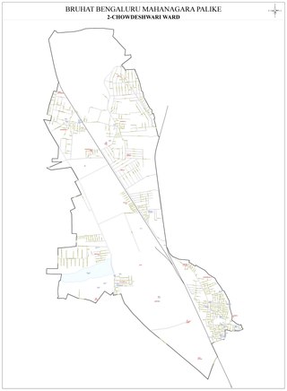
Chowdeshwari Ward, is one of the 198 Wards of Bruhat Bengaluru Mahanagara Palike, an administrative body responsible for civic amenities and some infrastructural assets of the Greater Bangalore metropolitan area in the Indian state of Karnataka.

Attur Ward, is one of the 198 Wards of Bruhat Bengaluru Mahanagara Palike, an administrative body responsible for civic amenities and some infrastructural assets of the Greater Bangalore metropolitan area in the Indian state of Karnataka.