The Birdwatchers' Field Club of Bangalore is a birdwatching club in Bangalore founded in the 1970s.

Bannerghatta Road is an Indian State Highway in Karnataka. It connects Bangalore with the towns of Bannerghatta, Jigani, and Anekal. It extends for 49 kilometres (30 mi). It starts as a branch from Hosur Road near the Adugodi Christian Cemetery and ends at Anekal.
Madiwala is a locality in southeastern Bangalore, India.
The Outer Ring Road (ORR), officially renamed as ಡಾ.ಪುನೀತ್ ರಾಜ್ಕುಮಾರ್ ವರ್ತುಲ ರಸ್ತೆ (Dr. Puneeth Rajkumar Vartula Raste), is a ring road that runs around most of the perimeter of the city of Bangalore, Karnataka, India. This 60-kilometre-long (37 mi) road was developed by the Bangalore Development Authority and different sections were opened progressively between 1996 and 2002. IT firms on the Outer Ring Road generate revenue of US$ 22 billion every year, accounting for 32% of Bengaluru’s total IT revenue.

The Bangalore Development Authority (BDA) of Bangalore, India, is a governmental organization and the principal planning authority for Bangalore in accordance with the Karnataka Municipal Corporation Act. Its functions, carried out under the Karnataka Town and Country Planning Act of 1961, include preparing a Comprehensive Development Plan for the Bangalore Metropolitan Region. It also oversees planning and development of infrastructure, provision of development-related sites and services, the housing needs of underprivileged citizens in Bangalore and is currently the city's largest land developer. No other authority or person may undertake development within the Bangalore Metropolitan Region without the permission of the BDA.
Bengaluru is the capital and the largest city of the Indian state of Karnataka. It is India's third largest city and fifth largest metropolitan area. Modern Bengaluru was founded in 1537 CE by Kempe Gowda, a vassal of the Vijayanagara Empire. Kempe Gowda built a mud fort in the vicinity of modern Bengaluru. By 1831, the city was incorporated into the British Raj with the establishment of the Bangalore Cantonment. The British returned dominion of the city to the King of Mysore, choosing however, to retain jurisdiction over the cantonment. Therefore, Bengaluru essentially became a twin city, with civic and infrastructural developments of the cantonment conforming to European styles of planning.
Arekere is a residential area on Bannerghatta Road in South Bangalore. The name Arekere originates from a water reservoir in the area.
Puttenahalli WS Lake also spelled as Puttanahalli Lake is a 10-hectare water body near Yelahanka, 14 km north of Bangalore.
BTM Layout, an abbreviation of Byrasandra, Tavarekere and Madiwala Layout is a locality in Bengaluru, Karnataka, India located in the South and Southeast parts of the city between Hosur Road and Bannerghatta Road. It is one of the first layouts in Bangalore.

Wonderla is the largest chain of amusement parks in India. It is owned and operated by Wonderla Holidays Limited which is headquartered near Bidadi, 28 kilometres (17 mi) from Bengaluru, Karnataka. It operates 4 amusement parks in Kochi, Bangalore, Hyderabad and Bhubaneswar.
Lakes and tanks in the metropolitan area of Greater Bangalore and the district of Bangalore Urban are reservoirs of varying sizes constructed over a number of centuries by various empires and dynasties for rainwater harvesting. Historically, these reservoirs were primarily either irrigation tanks or for the water supply, with secondary uses such as bathing and washing. The need for creating and sustaining these man-made dammed freshwater reservoirs was created by the absence of a major river nearby coupled with a growing settlement. As Bangalore grew from a small settlement into a city, both of the primary historical uses of the tanks changed. Agricultural land witnessed urbanization and alternate sources of water were provisioned, such as through borewells, piped reservoir water and later river water from further away.
Bilekahalli is a suburb in Bangalore, India, situated off Bannerghatta Road. It has gained prominence in recent times due to a boom in real estate and profusion of Information technology companies. Several prominent hospitals as well as residential complexes have been set up in this area.
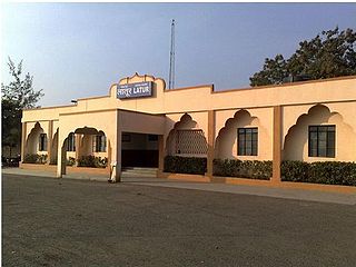
Latur railway station is a railway station in Central Railway zone which serves the city of Latur, Maharashtra. It is the start of the Latur–Miraj section of the Solapur (SUR) Division of Central Railway (CR). Latur is well connected to Latur Road Junction, Parli Vaijnath, Purna, Hingoli, Washim, Akola, Amravati, Wardha, Nagpur, Nanded, Nizamabad, Osmanabad, Pune, Lonavla, Karjat, Panvel, Thane, Kalyan, Mumbai, sangli, Pandharpur, Miraj, Kolhapur, Udgir, Bidar, Vikarabad, Secunderabad, Hyderabad, Yeshwantpur, Bangalore.

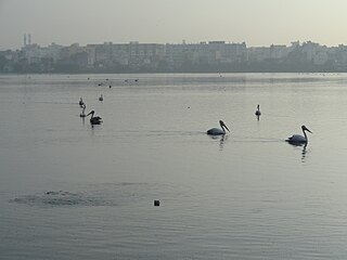
Agara lake is an 80-acre lake located in Agara, Bangalore. It is part of the Varthur lake series. Madiwala Lake is upstream while Bellandur Lake is downstream. Inter-lake connections have seen fragmentation and urbanisation.
Yelahanka Lake is a water body near Yelahanka, a suburb of Bangalore.

Sarakki lake is a lake in the southern part of Bengaluru, India, in the suburb of the J. P. Nagar. It is one of the largest lakes in Bangalore and located on Puttenahalli main road. Sarakki is a portmanteau of the native Kannada language words, Saavira Hakki, which translates to "a thousand birds".

Ramamurthy Nagar ( ) is an area in Bangalore in the Indian state of Karnataka. It is located in the eastern part of Bangalore and comes under the E3 subdivision of BBMP. It is a rapidly growing suburb, adjacent to other areas such as Banaswadi, CV Raman Nagar and Krishnarajapuram, also officially called Krishnarajapura.
Villivakkam lake is a lake spread over 36.34 acres in Villivakkam, Chennai, India. The lake is located to the south of the neighbourhood of Villivakkam, adjacent to the thickly populated Sidco Nagar, and drains into the Otteri Nullah. The lake belongs to the Chennai Metro Water Supply and Sewerage Board.

Hulimavu is an upcoming elevated metro station on the North-South corridor of the Pink Line of Namma Metro in Bangalore, India. This metro station serves mainly the Christ University, and the nearby prime locations such as Royal Meenakshi Mall, Sri Meenakshi Sundareshwara Temple, Hulimavu Police Station and Kothanur Metro Depot, which will handle all the Pink Line trainsets for maintenance purposes.
Akshay Nagar is a neighbourhood in Begur ward in Southeast Bangalore. It is surrounded by Hulimavu to the west and Begur to the east. The area has undergone rapid residential and commercial development since the early 2010s, including several high-rise apartment complexes. The locality is in close proximity to the Bannerghatta National Park, thus leading to occasional sightings of wild animals from the forest reserve. The area has a lake spread over 5 acres. It also features a wide mix of modern architecture and buildings.

