Konanakunte

Last updated

Ganapathipura, Konanakunte, Bengaluru, Karnataka, India - panoramio.jpg
Konanakunte
Neighborhood
Bangalore street Map.png
Red pog.svg
Konanakunte
Coordinates: 12°52′52″N77°34′19″E / 12.881°N 77.572°E / 12.881; 77.572
CountryIndia
State Karnataka
District Bangalore Urban
MetroBangalore
ZoneBommanahalli
Ward195
  Rank>140 out of 198
Population
 (2001)
  Total13,262
Languages
  Official Kannada
Time zone UTC+5:30 (IST)
PIN
560062
Telephone code91-80
Vehicle registration KA 05
Lok Sabha constituencyBangalore Rural
Vidhan Sabha constituencyBangalore South

Konanakunte, formerly a census town, is a suburb of Bangalore in the Indian state of Karnataka.The MP of this area is DK Suresh (brother of DK Shivakumar, former karnataka minister),mla for this area is M.Krishnappa , Corporator is Shashirekha Jayaram.

Contents

Demographics

As of 2001 India census, [1] Konanakunte had a population of 13,262. Males constitute 54% of the population and females 46%. Konanakunte has an average literacy rate of 77%, higher than the national average of 59.5%: male literacy is 81%, and female literacy is 73%. In Konanakunte, 11% of the population is under 6 years of age.

Brief Description

Over the last two decades, Konanakunte has undergone transition from a secluded area on the city's outskirts having only graveyards and grape wines to a partially developed, semi urban residential area. The name "Konanakunte" likely means "buffalo pond". Harijan colony in Konanakunte, a small area occupied by slum dwellers had a natural pond, which was put into use as a source of drinking water for buffalos. The vast portion of Konanakunte was filled with cultivation of crops such as avarekai, huchellu & ragi to name a few. It gained popularity during the assassination of Rajiv Gandhi in early 1990s. The main accused Shivarasan along with his aides was found to be hiding here. The only landmark in the area was the huge Khoday's factory, employing local people. Over the years, Konanakunte has experienced a great deal of development in terms of population infrastructure and urbanization. But urbanization has brought along with it the evils such as improper civic amenities and security issues. The area has come under the influence of cosmopolitan life but without forgoing the characters of a typical Indian village. The city of Bangalore is attracting immigration from all parts of the country. Konanakunte once known as the sleeping village on the city's outskirts known only for farming and underemployment is today a sprawling locality with people of various origins making it their home. The main attraction in this colony and the crux of the issue is the booming real estate opportunities. Thousands of hectares of land in and around Konanakunte has been converted into residential layouts and the value of land had gone up in geometrical proportions. In spite of the area attracting inhabitants and business, civic amenities are as low as it could be infrastructure like stable roads; drainage, streetlights, security and medical facilities are not in place.This area lacks Cauvery water isn't available.With the completion of the ambitious Namma Metro project, Konanakunte has become much more easily accessible and hence it is foreseen that a further surge in the population of this area will occur.


Related Research Articles

<span class="mw-page-title-main">Bangalore Urban district</span> District of Karnataka in India

Bangalore Urban district is the most densely populated of the thirty-one districts that comprise the Indian state of Karnataka. It is surrounded by the Bangalore Rural district on the east and north, the Ramanagara district on the west and the Krishnagiri district of Tamil Nadu on the south. Bangalore Urban district came into being in 1986, with the partition of the erstwhile Bangalore district into Bangalore Urban and Bangalore Rural districts. Bangalore Urban has three taluks : Bangalore City, Yelahanka and Anekal. It has seventeen hoblies, 872 villages, eleven rural habitations, five towns, one tier-three city and one tier-one city, administered by ninety-six Village Panchayats , ninety-seven Taluk Panchayats , five Town Municipal Councils (Purasabes), one City Municipal Council (Nagarasabe) and one City Corporation .

<span class="mw-page-title-main">Bantwal</span> Suburb in Dakshina Kannada, Karnataka, India

Bantwal is a suburb of Mangalore in Dakshina Kannada district, Karnataka, India, and the headquarters of Bantwal taluk. It is located 25 km (16 mi) East of Mangalore city center. BC Road-Kaikamba of Bantwal is one of the fastest developing areas in Dakshina Kannada district of Karnataka.

Perungudi is a neighbourhood of Chennai in the state of Tamil Nadu, India. It is situated about 10 kilometres (6.2 mi) south of Adyar. It is bordered on two sides by the Old Mahabalipuram Road and the Perungudi lake. It is situated on the Old Mahabalipuram IT Expressway right in middle of an Information Technology (IT) Estate. It is between Taramani and Thoraipakkam and parallel to Kottivakkam and Palavakkam in the East Coast Road.

<span class="mw-page-title-main">Bangalore Rural district</span> District of Karnataka in India

Bangalore Rural district is one of the 31 districts in Karnataka, India. It was formed in 1986, when Bangalore District was divided into Bangalore Rural and Bangalore Urban. Presently in Bangalore Rural district, there are 4 talukas: Devanahalli, Nelamangala, Doddaballapura, Hoskote. It has 20 hoblies, 294 villages, 3 towns, 2 tier-three cities, administered by 66 Village Panchayats , 3Town Municipal Councils (Purasabes) and 2 City Municipal Councils (Nagarsabes).

<span class="mw-page-title-main">Yelahanka</span> Suburb / satellite town in Bengaluru Urban, Karnataka, India

Yalahanka is a suburb and Taluk of Bangalore Urban district in the Indian state of Karnataka. One of the zones of BBMP. It is the oldest part of present Municipal Bengaluru (Bangalore) city and is in the north of the city. It is Nadaprabhu Kempegowda I, of the Yelahanka Prabhu clans, who laid the foundation of present-day Bengaluru through the creation of a "mud fort town" in 1537 CE

<span class="mw-page-title-main">Devanahalli</span> Town in Karnataka, India

Devanahalli, also called "Devandahalli", "Dyaavandalli", Devanadoddi, and Devanapura, is a town and Town Municipal Council in Bengaluru Rural district in the state of Karnataka in India. The town is located 40 kilometres (25 mi) to the north-east of Bengaluru. Devanahalli is the site of Kempegowda International Airport. A multibillion-dollar Devanahalli Business Park with two IT Parks are coming up on nearly 400 acres (1.6 km2) adjoining the airport. An Aerospace Park, Science Park and a 10 billion (US$130 million) Financial City are also coming up. A new satellite ring road will connect the city with Doddaballapur. Devanahalli is situated near the upcoming 1,500 billion (US$19 billion), 12,000-acre (49 km2) BIAL IT Investment Region, to be the largest IT region in India.

<span class="mw-page-title-main">Kanakapura</span> City in Karnataka, India

Kanakapura is a city in the Ramanagara district of Karnataka on the banks of the Arkavathi river and the administrative center of the taluk of the same name. Kanakapura is largest cocoon silk producer in India. River Cauvery flows around 21 km in Kanakapura Taluk.Previously belonged to Bangalore Rural District. It was formerly the largest constituency in the country. (1,553 km2 [600 sq mi]). It is located among the lush green forests of the state of Karnataka. The town is a tourism hotspot and an often visited tourist favorite in the entire state of Karnataka, as it has something for everyone ranging from avid trekkers to history buffs and wildlife enthusiasts. The forest area in this taluk is very wide and about half of the Bannerghatta National Park is located in our Kanakapura area. Kodihalli wildlife range and harohalli wildlife range its division. The Kaveri Wildlife Sanctuary consists of two main zones namely the Sangam Wildlife range, the Muggur Wildlife range

<span class="mw-page-title-main">Bommasandra</span> Neighbourhood in Bangalore, Karnataka, India

Bommasandra is located at Bangalore in the state of Karnataka, India.

Chandkheda is a well-developed area in northwestern Ahmedabad. It is situated on west of Sabarmati River.

Char Maijdia is a census town in the Nabadwip CD block in the Krishnanagar Sadar subdivision of the Nadia district in the state of West Bengal, India.
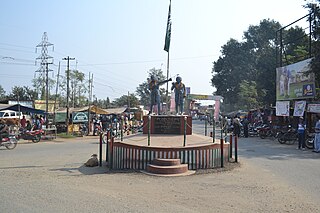
Chikkanayakanahalli is a town in Tiptur sub-division of Tumakuru district, in the state of Karnataka, India. It is 30 km away from Tiptur and 132 km from Bangalore.

<span class="mw-page-title-main">Gottigere</span> Suburb in Bengaluru, Karnataka, India

Gottigere is a suburb in the southern periphery of Bangalore city, along Bannerghatta Road in the Indian state of Karnataka. It is surrounded by the famous NICE Road and smaller areas like Basavanapura and Kalena Agrahara. It has been named after "Gottigere lake" which is near NICE Road. This area has seen fast growth due to many IT companies establishment near Bannerghatta Road & Electronic city.

<span class="mw-page-title-main">Kalaghatagi</span> Town/Taluka in Karnataka, India

Kalaghatagi is an administrative division, or Taluka, in the Dharwad district of the Indian state of Karnataka.

Kothnur is a census town in Bangalore district in the Indian state of Karnataka.

<span class="mw-page-title-main">Krishnarajapuram</span> Neighbourhood in Bengaluru Urban, Karnataka, India

Krishnarajapuram often abbreviated as K R Puram or K R Pura, is a neighborhood of in North-Eastern Bangalore, the capital of the Indian state of Karnataka. It is one of the zones of BBMP. It is located 15 km (9.3 mi) from Bangalore City railway station. The Old Madras Road passes through this locality. A lake called 'Vengayyana Lake' is in the heart of this area. The Yele Mallappa Shetty Lake near Medahalli, situated just outside the eastern limits of KR Pura, is one of the largest lakes in Bangalore.

<span class="mw-page-title-main">Mahadevapura, Bangalore</span> Neighbourhood in Bengaluru Urban, Karnataka, India

Mahadevapura is a suburb and one of the zones of BBMP in Bangalore Urban district in the Indian state of Karnataka. It was a city municipal council. It is well connected with Outer Ring Road, Whitefield Road and Krishnarajapuram Railway Station is the nearest station to board trains. It is a developing area, which has a high growth potential in terms of residential development. Leading schools, shopping malls, showrooms have come up in the area.JBR Legal.

Minjur is a town located in the outskirts of North Chennai, India. It is located in the Thiruvallur district in the Indian state of Tamil Nadu. Minjur is called 'Vada Kanchi' meaning North Kanchipuram. The town has two famous temples for Shiva and Vishnu, similar to Kanchipuram. The neighbourhood is served by Minjur railway station of the Chennai Suburban Railway Network.

<span class="mw-page-title-main">Mundgod</span> Town in Karnataka

Mundgod is a town in Uttara Kannada district of Karnataka state in India, Mundgod is known for its Tibetan Colony; it is also known as Mini Tibet.

<span class="mw-page-title-main">Vimanapura</span> Neighbourhood in Bangalore, Karnataka, India

Vimanapura or Baiyyappanahalli Vimanapura is an eastern suburb of Bangalore in Karnataka in India. It is so called because it is near Bangalore HAL airport. Vimanapura houses many of the HAL offices and the HAL hospital. The busy Old Airport Road goes through it.

Kerur is a town in Bagalkot district in Karnataka, which located on NH 218. It has an average elevation of 617 meters (2024 feet). It's the birthplace of Jagadish Shettar, a former Chief Minister of Karnataka. Kerur is a Town Panchayat city in the district of Bagalkot, Karnataka. The Kerur city is divided into 16 wards for which elections are held every five years. The Kerur Town Panchayat has a population of 19,731 of which 9,929 are males while 9,802 are females as per report released by Census India 2011.

References

  1. "Census of India 2001: Data from the 2001 Census, including cities, villages and towns (Provisional)". Census Commission of India. Archived from the original on 16 June 2004. Retrieved 1 November 2008.