
Mysore, officially Mysuru, is the second-most populous city in the southern Indian state of Karnataka. It is the headquarters of Mysore district and Mysore division. As the traditional seat of the Wadiyar dynasty, the city functioned as the capital of the Kingdom of Mysore for almost six centuries. Known for its heritage structures, palaces, and its culture, Mysore has been called the "City of Palaces", the "Heritage City", and the "Cultural Capital of Karnataka". It is one of the cleanest cities in India according to the Swachh Survekshan.

Mysore division, officially Mysuru division, is an administrative division in the southern Indian state of Karnataka. It is one of four administrative divisions in Karnataka, the others being Bangalore division, Belagavi division, and Kalaburagi division. Mysore division comprises eight districts of Karnataka, namely, Chamarajanagar, Chikmagalur, Dakshina Kannada, Hassan, Kodagu, Mandya, Mysore and Udupi district. The city of Mysore is the administrative headquarters of the division. Mysore division covers parts of historical Old Mysore region and southern part of Coastal Karnataka.The total area of the division is 43,503 sq.km. The total population as of 2011 census is 12,563,598.
The Vrishabhavathi River is a minor river, a tributary of the Arkavathy, that flows through the south of the Indian city of Bangalore. The river was once so pristine that the water from it was used for drinking and used by the famous Gali Anjaneya temple but is now highly polluted due to pollutants from industrial, agricultural and domestic sources.
The Bangalore Cantonment (1806–1881) was a military cantonment of the British Raj based in the Indian city of Bangalore. The cantonment covered an area of 13 square miles (34 km2), extending from the Residency on the west to Binnamangala on the east and from the Tanneries on Tannery Road in the north to AGRAM in the south. By area, it was the largest British military cantonment in South India. The British garrison stationed in the cantonment included three artillery batteries, and regiments of the cavalry, infantry, sappers, miners, mounted infantry, supply and transport corps and the Bangalore Rifle Volunteers. The Bangalore Cantonment was directly under the administration of the British Raj, while Bangalore City itself was under the jurisdiction of the Durbar of the Kingdom of Mysore.
Kengeri is a western suburb of Bangalore city, located along Mysore Road.It is bordered by Nagarbhavi and Ullal to the north, Rajarajeshwari Nagar to the east, Kumbalgodu to the west and Uttarahalli to the south.
Achooranam is a village near Pozhuthana, Vythiri in Wayanad district in the state of Kerala, India.

Chundale is a village in Wayanad district in the state of Kerala, India. Chundale is located near Kalpetta, the district headquarters of Wayanad.
Kottappadi-Part is a village near guruvayoor in Thrissur district in the state of Kerala, India.
Kunnathidavaka is a village near Vythiri in Wayanad district in the state of Kerala, India.

Muppanad is a village near Meppadi in Wayanad district in the state of Kerala, India.

The Purple Line is a part of the Namma Metro rail system for the city of Bengaluru, Karnataka, India. As of 2023, the line is 43.49 km (27.02 mi) long and spans 37 stations from Challaghatta in the southwest to Whitefield (Kadugodi) to the east. The Purple Line is mostly elevated, with 31 elevated stations, 5 underground stations and 1 at-grade station. The Line passes through many prime activity centers of the city including Whitefield, Krishnarajapura, MG Road, Vidhana Soudha and Majestic station, which is an interchange station between Purple and Green Lines. Phase I of the Purple Line was the first underground metro section in South India.

Sir Mokshagundam Visvesvaraya, also referred to by his initials, MV, was an Indian civil engineer, administrator, and statesman, who served as the 19th Dewan of Mysore from 1912 to 1918.

Banashankari, commonly abbreviated as BSK, is a locality spread across South and West Bangalore. Its name is derived from the Banashankari Amma Temple on Kanakapura Road, one of Bangalore's renowned temples constructed by Subramanya Shetty in 1915.
The Karnataka Central Diocese is one of the twenty-two dioceses of the Church of South India covering the central part of Karnataka. The Church of South India is a United Protestant denomination.

Bengaluru, formerly called Bangalore, is the capital and largest city of the southern Indian state of Karnataka. As per the 2011 census, the city had a population of more than 8.4 million, making it the third most populous city in India and the most populous in South India. The Bengaluru metropolitan area had a population of around 10.5 million, making it the fourth most populous urban agglomeration in the country. It is located near the center of the Deccan Plateau, at a height of over 900 m (3,000 ft) above sea level. The city is known as India's "Garden City", due to its parks and greenery.
Fraser Town, Bengaluru or Mootocherry, is a locality of Bangalore Cantonment, located in the central part of the city spread over 4 km2. It was established in 1906 and is named after Stuart Mitford Fraser (1864–1963), who was the tutor and guardian of Krishna Raja Wadiyar IV, Maharaja of Mysore. Fraser Town was established to de-congest the growing Bangalore Civil and Military Station. The foundation of Fraser Town was laid in August 1910 by Mrs. F J Richards, with a commemorative plaque on the corner of Coles Road and Mosque Road.

Bengaluru East railway station, also known as Bangalore East railway station, is an old British-era railway station surrounded by Pottery Road, Kumaraswamy Naidu Road, Murgesha Mudaliar Road and Kenchappa Road. It is a small quaint station located in Fraser Town, Bangalore Cantonment. This station is very convenient for residents traveling towards or returning from Kolar Gold Fields or Madras. Express and Mail trains did not stop here until the 1920s. The station is now renovated with a larger platform. Adjacent to the railway station is the Bangalore East Football Grounds, which nowadays is more used for playing cricket. Well-known cartoonist Paul Fernandes remembers as a young boy befriending train drivers at this station and getting grease for his bicycle.
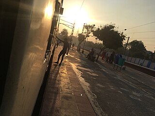
Nayandahalli railway station is an Indian Railways Train station located in Nayandahalli, Bangalore in the Indian state of Karnataka and is located about 10 km away from the Bangalore City railway station. This station serves the Rajarajeshwari Nagar, Baapuji Nagara, Deepanjalinagara, and Vijayanagara areas of Bangalore city. It is located on Mysore–Bangalore line

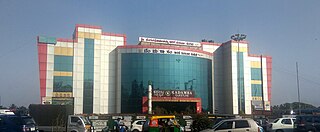
Mysuru Road is an elevated metro station on the East-West corridor of the Purple Line of Namma Metro serving Muthachari Industrial Estate, Nayandahalli and Deepanjali Nagar in Bengaluru. It was opened to the public on 16 November 2015. This metro station is proposed to act as an interchange for the upcoming Orange Line under Phase 3.

Pantharapalya -Nayandahalli is an elevated metro station on the East-West corridor of the Purple Line of Namma Metro serving the borders of Banashankari and Mysore Road along with Bangalore University campus in Bengaluru, India. It was inaugurated on 29 August 2021 and opened to the public on 30 August 2021.
