
Whitefield is a suburb of Bangalore in the state of Karnataka, India. Established in 1882 as a settlement for the Eurasians and Anglo Indians of Bangalore, Whitefield remained a quaint little settlement at the eastern periphery of Bangalore city till the late 1990s when the local IT boom turned it into a major suburb. It is now a major part of Greater Bangalore. Whitefield is Bengaluru's first tech corridor to be connected by Namma Metro.

Kempe Gowda I locally venerated as Nadaprabhu Kempe Gowda, or commonly known as Kempe Gowda, was a governor under the Vijayanagara Empire in early-modern India. He is famous for the development of Bangalore Town in the 16th century. Kempegowda erected many Kannada inscriptions across the region.

Basaveshwaranagara, also known as Basaveshwaranagar, Basaveshnagara or Basaveshnagar is a largely residential neighbourhood in the west of Bengaluru, Karnataka, India. It is located to the west of Rajajinagara and is sandwiched between the localities of Mahalakshmi Layout to the north and Vijayanagara to the south, spread across multiple sub-localities, three assembly constituencies and seven Bruhat Bengaluru Mahanagara Palike (BBMP) wards. The area of Basaveshwaranagara is often considered West of Chord Road as it lies to the west of Chord Road, an arterial road in the western part of Bengaluru.

HSR Layout, an abbreviation of Hosur Sarjapura Road Layout is a prominent suburb of South-Eastern Bangalore, India. The locality, initially developed by the Bangalore Development Authority in 1985 has now emerged into a coveted residential area due to its proximity to Electronic City, Sarjapur Road and the Outer Ring road on which I.T. Parks and other Special Economic Zones are located. It lies in the Bommanahalli constituency of the Karnataka State Assembly.

The Someshwara temple, situated in Kolar town of Karnataka state, India is an ornate 14th century Vijayanagara era Dravidian style construction. Someshwara, another name for the Hindu god Shiva is the presiding deity in the temple. The temple is protected by the Archaeological Survey of India as a monument of national importance.

Malleshwaram is a northwest neighborhood and one of the zones of Bruhat Bengaluru Mahanagara Palike in Bengaluru, India. It was planned in 1889 after the great plague of 1898, developed as a suburb in 1892 and handed over to the city municipality in 1895. As per the 1878 Survey of India map, the area came under the village of Ranganatha Palya and was later named after the Kadu Malleshwara Temple. The neighbourhood houses many offices, one them being World Trade Center Bengaluru. It has two shopping malls, Mantri Square and Orion Mall. As an education hub,it houses the education boards of the state KSEEB and PU boards,Mysore Education Society and Indian Institute of Science.
Vidyaranyapura is situated in the northern part of Bangalore city in the state of Karnataka, India. Vidyaranyapura, along with several other extensions of the city, comes under a constituency called Byatarayanapura. It comes under the Greater Bangalore jurisdiction of the Bruhat Bengaluru Mahanagara Palike (BBMP).
Vijayanagara, is a residential neighborhood in west Bangalore, India. It derives its name from the Vijayanagara empire that flourished in South India during the 15th and 16th centuries. It is bound by Mysore Road and Magadi Road, with Chord Road cutting through. It is the northernmost area in South Bangalore.
BTM Layout, an abbreviation of Byrasandra, Tavarekere and Madiwala Layout is a locality in Bengaluru, Karnataka, India located in the South and Southeast parts of the city between Hosur Road and Bannerghatta Road. It is one of the first layouts in Bangalore.

Madiwala lake is one of the biggest lakes in Bangalore, India spread over an area of 114.3 hectare. The water in the lake was fit for drinking till the early 1990s. Since then it has become unfit for drinking due to industrial waste and sewage entering the waterbody. It has gradually become polluted.
Located in South Bangalore, Karnataka, India, Kumaraswamy Layout is a sub locality in Banashankari.
Bangalore (Bengaluru), the capital of Karnataka state, India, reflects its multireligious and cosmopolitan character by its more than 1000 temples, 400 mosques, 100 churches, 40 Jain derasars, three Sikh gurdwaras, two Buddhist viharas and one Parsi fire temple located in an area of 741 km2 of the metropolis. The religious places are further represented to include the few members of the Jewish community who are making their presence known through the Chabad that they propose to establish in Bangalore and the fairly large number of the Baháʼí Faith whose presence is registered with a society called the Baháʼí Centre. In the demographically diverse, major economic hub and India's fastest-growing major metropolis of Bangalore, the number of religious places of each religion reported reflects growth in proportion to the population growth. According to the 2001 census of India, 79.37% of Bangalore's population is Hindu, roughly the same as the national average. Muslims comprise 13.37% of the population, which again is roughly the same as the national average, while Christians and Jains account for 5.79% and 1.05% of the population, respectively, double that of their national averages. Anglo-Indians also form a substantial group within the city.

Agara lake is an 80-acre lake located in Agara, Bangalore. It is part of the Varthur lake series. Madiwala Lake is upstream while Bellandur Lake is downstream. Inter-lake connections have seen fragmentation and urbanisation.

Rajarajeshwari Nagar, officially Rajarajeshwari Nagara is a western suburb of Bangalore, Karnataka, India. It is located in the southwestern part of Bangalore along the Mysore Road, with Nagarbhavi and the Bangalore University to the north and north-west, Hosakerehalli to the east and Kengeri to the south-west. There is a prominent arch-shaped structure on Mysore Road which serves as the most popular entrance to this locality.
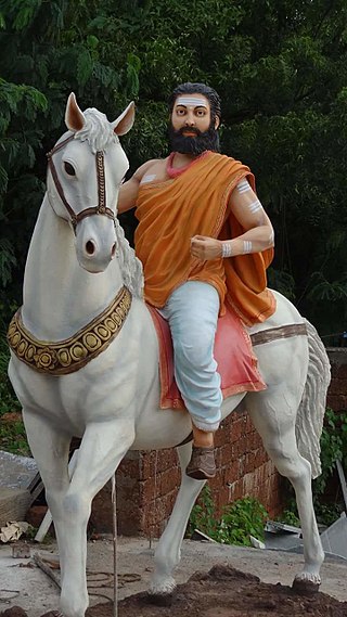
Madivala Machideva, also known as Veera Ganachari Madivala Machideva, was an Indian warrior of the 12th-century.
Old Madiwala Sri Someshwara Temple located in Bangalore city, Karnataka, India is dedicated to the deity Someshwara. It is one among the oldest temples in the city and dates back to the Chola Empire period. The temple belongs to the early 12th century.(1247 AD).
There are nearly a thousand inscriptions in Tamil in the Southern Karnataka districts of Bangalore, Mysore, Kolar and Mandya in India. Nearly one third of these inscriptions are found in the Kolar District. Of all the inscriptions collected and published in the Epigraphia Carnatica Vol X for Kolar district, a fourth are in Tamil. The Tamil inscriptions start to appear around 1000 AD, after the conquest of the region by the Chola dynasty king Rajaraja I. Even after the Cholas left the area, the Hoysala and later the Vijaynagar kingdoms continued to use Tamil in the inscriptions.
Jakkasandra is a locality in Bangalore, Karnataka, India. Located in the center of Koramangala and HSR Layout areas, it is one of the largest neighborhoods, alongside the Agara village, Venkatapura, Sreenivagilu, Ejipura, Madiwala, Kattalipalya, Mesthripalya, and Koramangala village. Jakkasandra is also home to many educational institutions such as the Hottekullappa Government School, the Goldwyn Memorial Public School, and the Asia Pacific World High School.
The region of Bangalore in Karnataka contains over 1,500 historical stone inscriptions. Spanning more than 1,500 years, these inscriptions detail the political, social, religious, and economic aspects of the region's past, making them key sources for tracing Bengaluru's transformation from a modest settlement to a bustling metropolis. Within the limits of Bruhat Bengaluru Mahanagara Palike, approximately 175 stone inscriptions have been documented in various publications.

