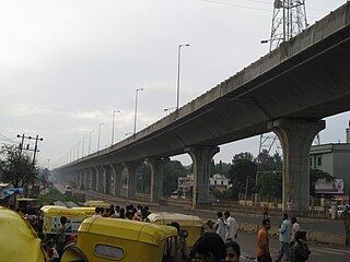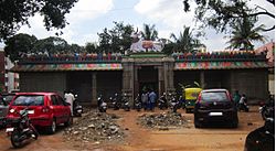
Electronic City is an information technology hub in Bangalore, India, located in Anekal taluk. Spread over 800 acres (3.2 km²) near Konappana Agrahara and Doddathogur it houses a large number of electronic/IT industrial parks.

Whitefield is a suburb of Bangalore in the state of Karnataka, India. Established in 1882 as a settlement for the Eurasians and Anglo Indians of Bangalore, Whitefield remained a quaint little settlement at the eastern periphery of Bangalore city till the late 1990s when the local IT boom turned it into a major suburb. It is now a major part of Greater Bangalore. Whitefield is Bengaluru's first tech corridor to be connected by Namma Metro.

Kempe Gowda I locally venerated as Nadaprabhu Kempe Gowda, or commonly known as Kempe Gowda, was a governor under the Vijayanagara Empire in early-modern India. He is famous for the development of Bangalore Town in the 16th century. Kempegowda erected many Kannada inscriptions across the region.

Basaveshwaranagara, also known as Basaveshwaranagar, Basaveshnagara or Basaveshnagar is a largely residential neighbourhood in the west of Bengaluru, Karnataka, India. It is located to the west of Rajajinagara and is sandwiched between the localities of Mahalakshmi Layout to the north and Vijayanagara to the south, spread across multiple sub-localities, three assembly constituencies and seven Bruhat Bengaluru Mahanagara Palike (BBMP) wards. The area of Basaveshwaranagara is often considered West of Chord Road as it lies to the west of Chord Road, an arterial road in the western part of Bengaluru.
Begur is a suburb of Bangalore in the Indian state of Karnataka. It is located off Bengaluru-Hosur highway. It is said to have been a prominent place during the rule of the Western Ganga Dynasty and later the Chola Kingdom.
Vidyaranyapura is situated in the northern part of Bangalore city in the state of Karnataka, India. Vidyaranyapura, along with several other extensions of the city, comes under a constituency called Byatarayanapura. It comes under the Greater Bangalore jurisdiction of the Bruhat Bengaluru Mahanagara Palike (BBMP).
Vijayanagara, is a residential neighborhood in west Bangalore, India. It derives its name from the Vijayanagara empire that flourished in South India during the 15th and 16th centuries. It is bound by Mysore Road and Magadi Road, with Chord Road cutting through. It is the northernmost area in South Bangalore.

Jalahalli is a suburb in northern part of Bengaluru is one of the greenest areas of Bengaluru. It is mainly divided into Jalahalli East and Jalahalli West. Gangamma Circle is the junction between the roads connecting Jalahalli East, Jalahalli West, Jalahalli Village, and Jalahalli Cross. The National Academy of Customs and Narcotics in Bengaluru is located here.
Neraluru is a village in Anekal taluk, Bangalore urban district, India. It is around 28 kilometers from Bangalore and 10 kilometers from Hosur, Tamil Nadu. The nearest mofussil towns are Attibele and Chandapura, both of which are within a 5 kilometer radius of Neralur. Electronics City, one of India's largest Information Technology parks, is around 10 kilometres from the village. A few of the villages which share its boundaries with Neralur are - Guddahatti, Balagaranahalli, Lakshmisagara, Old Chandapura, Thirumagondanahalli, Bandapura, Yadavanahalli and Bendaganahalli. Kannada is the most widely spoken language in the village.

Padmanabhanagar is a residential locality in South Bangalore, India, covering an area of 1.68 km2. It is one of the zones of BBMP. Padmanabhanagar has a very famous park called Lakshmikanta Park. This park houses Lakshmi Kantha temple. It was looked after by residents association, in 2018 the corporator allotted funds and developed it further. The park was eyed for its medicinal trees and was sanctioned to be cut down completely and set up a landscaped area but the senior citizens of the locality who nurtured the park protested and stopped it. It is surrounded by Kumaraswamy Layout, Gowdanapalya, Chennamanakere, Kathriguppe, Kadirenahalli, Uttarahalli and Chikkakalasandra.

Kodigehalli is a suburb of Bangalore(B.B.M.P. Ward 8). Historic temples and modern constructions are cheek by jowl. Kodigehalli is to the south of Sahakarnagar. The new airport road to Kodigehalli main road via Kodigehalli circle connects the Kodigehalli area.
Located in South Bangalore, Karnataka, India, Kumaraswamy Layout is a sub locality in Banashankari.
Bilekahalli is a suburb in Bangalore, India, situated off Bannerghatta Road. It has gained prominence in recent times due to a boom in real estate and profusion of Information technology companies. Several prominent hospitals as well as residential complexes have been set up in this area.
Sahakara Nagar is a residential suburb near Bangalore, India. Sahakanagar is formed by the Ministry of Communication Employees housing society and has developed to this extent under the efforts of the Sahakaranagar Residents welfare association. Ever since the inclusion of 45 new wards to Bangalore city in 2008, Sahakara Nagar comes under the BBMP limits. The locality is accessible via NH 7 on the East. Sahakara Nagar was formed in the early 1980s as a co-operative society for Telecom and Post & Telegraph employees of the Government of India. It has over 8 well maintained parks and two Playgrounds maintained by BBMP. Owing to its proximity to Hebbal lake, Amrutahalli lake and GKVK forest land, it is often called the Prague of Bengaluru city.
Bharathnagar is a well planned residential layout in the city of Bangalore, India. Located off the arterial Magadi Road and approximately 13 km (8.1 mi) from the Bangalore Central Railway station, this layout was primarily created for the employees of the public sector giant Bharat Electronics Limited. Bharathnagar is divided into Phase 1 & 2. Phase 2 is the larger of the two and has the capacity to accommodate 4000 independent homes, whereas Phase 1 can accommodate 2,000 homes. Bharathnagar was carved out of the larger village of Byadarahalli.
Banaswadi is a locality situated in northeastern Bangalore, about 6 km from the city centre on the outskirts of Bangalore Cantonment, bounded by Lingarajapuram, Hebbal, Nagawara, Thanisandra, Krishnarajapuram, Benniganahalli, Baiyyappanahalli and Maruthi Sevanagar. It is Ward no 27 of the BBMP and is further divided into two regions; Chikka Banaswadi and Dodda Banaswadi. Historically the area was known as primarily residential; little more than a village on the city outskirts; however the ongoing expansion of the city limits, the proximity of the locality to the international airport and the arrival of the outer ring road connecting Banaswadi to the city's IT hubs has seen the rapid improvement of the area and the growth of commercial and business activities.
Brookefield is a neighbourhood of Bangalore. Established in the late 19th century as a settlement for the Eurasians of Bangalore. It is a wealthy area, with high real estate prices and relatively new commercial roads such as ITPL road.

Ramamurthy Nagar ( ) is an area in Bangalore in the Indian state of Karnataka. It is located in the eastern part of Bangalore and comes under the E3 subdivision of BBMP. It is a rapidly growing suburb, adjacent to other areas such as Banaswadi, CV Raman Nagar and Krishnarajapuram, also officially called Krishnarajapura.

Hanumanthanagara, is a locality in the Banashankari suburb of South Bangalore. It gets its name from the Ramanjaneya Temple near the Kengal Hanumanthaiah Kalaa Soudha, which was built during the time of Kengal Hanumanthaiah, the then chief minister of Karnataka.
Akshay Nagar is a neighbourhood in Begur ward in Southeast Bangalore. It is surrounded by Hulimavu to the west and Begur to the east. The area has undergone rapid residential and commercial development since the early 2010s, including several high-rise apartment complexes. The locality is in close proximity to the Bannerghatta National Park, thus leading to occasional sightings of wild animals from the forest reserve. The area has a lake spread over 5 acres. It also features a wide mix of modern architecture and buildings.


