
Belur is a town and taluk in Hassan district in the state of Karnataka, India. The town is renowned for its Chennakeshava Temple dedicated to Vishnu, one of the finest examples of Hoysala architecture and the largest Hindu temple complex that has survived from pre-14th-century Karnata-Dravida tradition. A historic site inspired by the teachings of Ramanujacharya, it has been a Vaishnava Hindu pilgrimage center since at least the 12th century. It was also the first capital of the Hoysala dynasty, before they built Dwarasamudra.

Hassan is a city and district headquarter of Hassan district in Karnataka state of India.
Arsikere is a city and taluka in the Hassan district in the state of Karnataka, India. It is the second largest city in Hassan district, demographically. Arsikere city municipal council consists of 35 wards. This region is known for its coconut production and is also called Kalpataru Nadu. Arsikere Junction is a major railway junction in the South Western Railway which links Mangalore and Mysore to North Karnataka and a central place for tourists who visit nearby places that do not have rail access, such as Belur, Halebidu and Shravanabelagola, Harnahalli, and Kodimata.

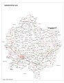
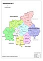
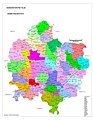
Hassan is one of the 31 districts of Karnataka, India. The district headquarter is Hassan. It was part of Manjarabad Faujdari a.k.a. Patnada Rayada between 1832-81. In 1882, it was reduced into a sub-division under erstwhile Kadur district. But in 1886, the Hassan district was restored to its current form.

Somwarpet is a panchayat town in Kodagu district in the Indian state of Karnataka. It is the main town of the Somwarpet taluk, in the north-east of the district. 2nd highest Administrative town in Karnataka in terms of elevation. The main crops grown in the area are coffee and spice crops such as cardamom, peppers, oranges, ginger and vegetables.

Ulikkal is a growing town in Kannur District in Kerala. It is the HQ of Ulikkal Grama Panchayat in Iritty Taluk. Kerala State Hill highway SH 59 passes through Ulikkal Town.

Holenarasipura is a town and taluk in Hassan district of Karnataka. The town is situated on the banks of the Hemavati, one of the tributaries of the Kaveri.
Kanakapura is a city in the Ramanagara district of Karnataka on the banks of the Arkavathi river and the administrative center of the taluk of the same name. Its founder is Shrihan Kanaka Sigmanath, hence its name. Kanakapura is largest cocoon silk producer in India. River Cauvery flows around 21 km in Kanakapura Taluk. Previously belonged to Bangalore Rural District. It was formerly the largest constituency in the country. (1,553 km2 [600 sq mi]). It is located among the lush green forests of the state of Karnataka. The town is infamous with the traffic of Kanakpura Road in Benglaluru, one of the most narrow and traffic-prone roads of the state. The town is a tourism hotspot and an often visited tourist favorite in the entire state of Karnataka, as it has something for everyone ranging from avid trekkers to history buffs and wildlife enthusiasts. The forest area in this taluk is very wide and about half of the Bannerghatta National Park is located in our Kanakapura area. Kodihalli wildlife range and harohalli wildlife range its division. The Kaveri Wildlife Sanctuary consists of two main zones namely the Sangam Wildlife range, the Muggur Wildlife range.
Arkalgud, also known as Arakalagudu is a panchayat town and is one among the eight taluks of Hassan district in the state of Karnataka, India. It is situated 30 km from Hassan, 181 km from Mangalore and 195 km from Bangalore. The river Hemavati forms the entire northern boundary of the Taluk; river Kaveri runs through a portion of the south. It is well connected by road to many towns and cities of Karnataka. Hassan Junction railway station is the nearest major railway station and Kannur International Airport is the nearest airport at 150 kilometres.

Sakleshpur, also known as Sakleshpura or Sakleshapura, is a hill station town and headquarters of Sakleshpur taluk and one of the two Sub-divisional headquarters in Hassan district in the Indian state of Karnataka.

Srinivaspur is a town located in the Kolar district of Karnataka state, India. The latitude 13.33 and longitude 78.22 are the geocoordinate of the Srinivaspur. Bengaluru is the nearby state capital for Srinivaspur town. It is located around 106 km away from Bengaluru and 80 km from BIAL. The other surrounding state capitals are Chennai 225.9 km., Pondicherry 233.2 km., Hyderabad 453.4 km.,
Tarikere is a town, a taluk and is one of the two Subdivisional headquarter in the Chikmagalur district of Karnataka state, India. It is popularly known as gateway of Malnad because the Malnad area starts from here. The town's name is derived from the number of water tanks which surround it.
Alur also spelled as Alooru is a town and the taluk headquarters of Alur Taluk in Hassan district in the state of Karnataka, India. It is 14 km from Hassan City. Alur town is offset by 2 km from NH-75. Alur has a railway station, named "Alur Halt", located on Mangalore-Hassan line. But no train stops at this station.

Hirisave is a village in Channarayapatna taluk, of Hassan district in the state of Karnataka, India. It is 18 km from the popular Jain pilgrimage centre of Shravanabelagola. It lies on National Highway 75 which connects Bangalore with the port city of Mangalore. Most of the population speaks Kannada and major income source is from agriculture. The main tourist attraction is Hirisave Chowdeswary temple and Channakeshava temple.

Kurumathur is a census town in Taliparamba taluk of Kannur district in Kerala state, India. Kurumathur is located 8 km (5.0 mi) east of Taliparamba town in SH 36.

Payyavoor is a small town in Kannur district in the Indian state of Kerala. It's the headquarters of Payyavoor Grama Panchayat.

Karadka is a village, block panchayat and grama panchayat in Kasaragod district in the state of Kerala, India.
A. Kalenahalli is a village in the southern state of Karnataka, India. For revenue and land management purposes it is under Dandiganahalli Hobli, of Channarayapatna Taluka of Hassan District in Karnataka state; for other administrative and governmental purposes it is under Kumbenahalli gram panchayat of Channarayapatna Taluka.

Shravanabelagola is one of the 224 Legislative Assembly constituencies of Karnataka in India. It is part of Hassan district.
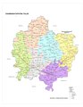
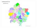
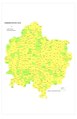
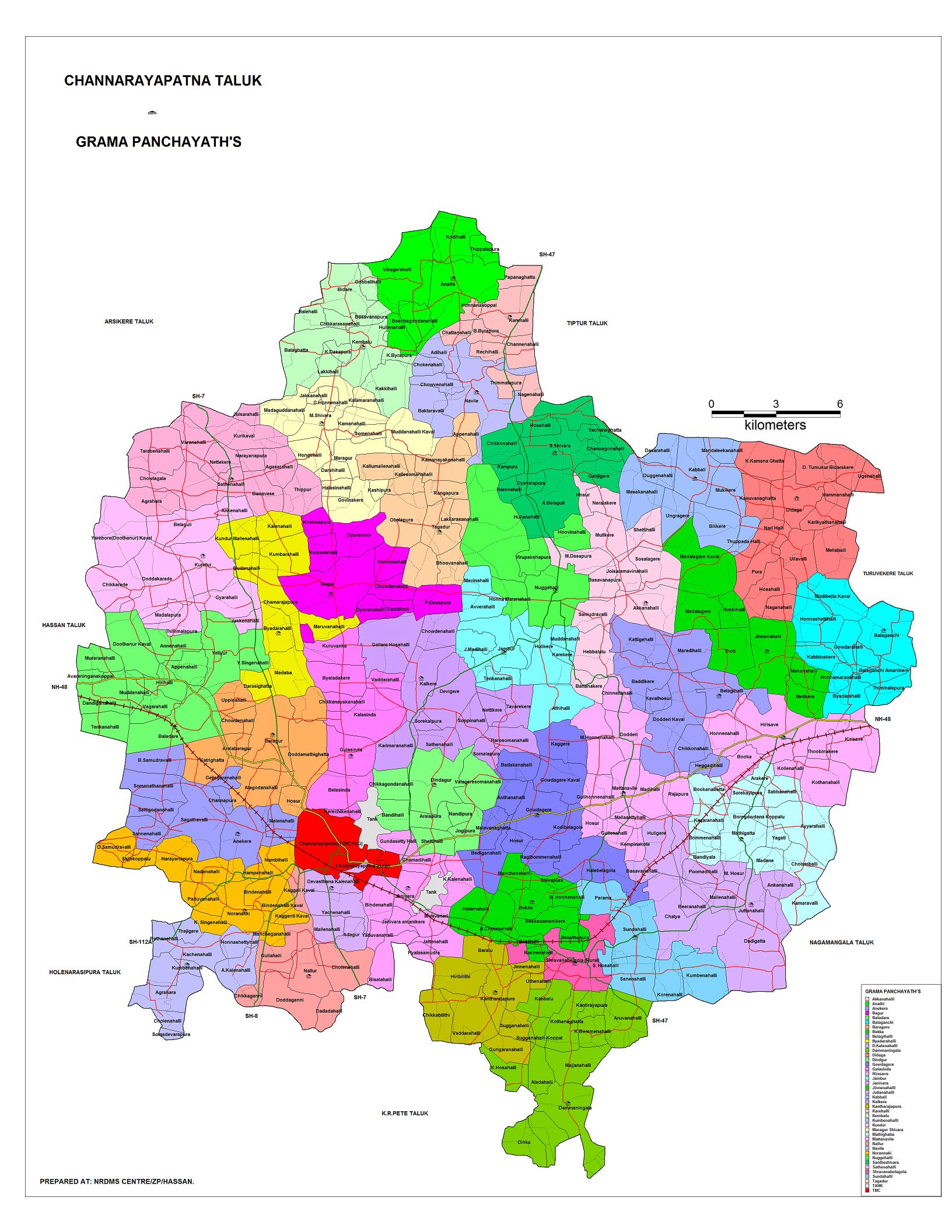
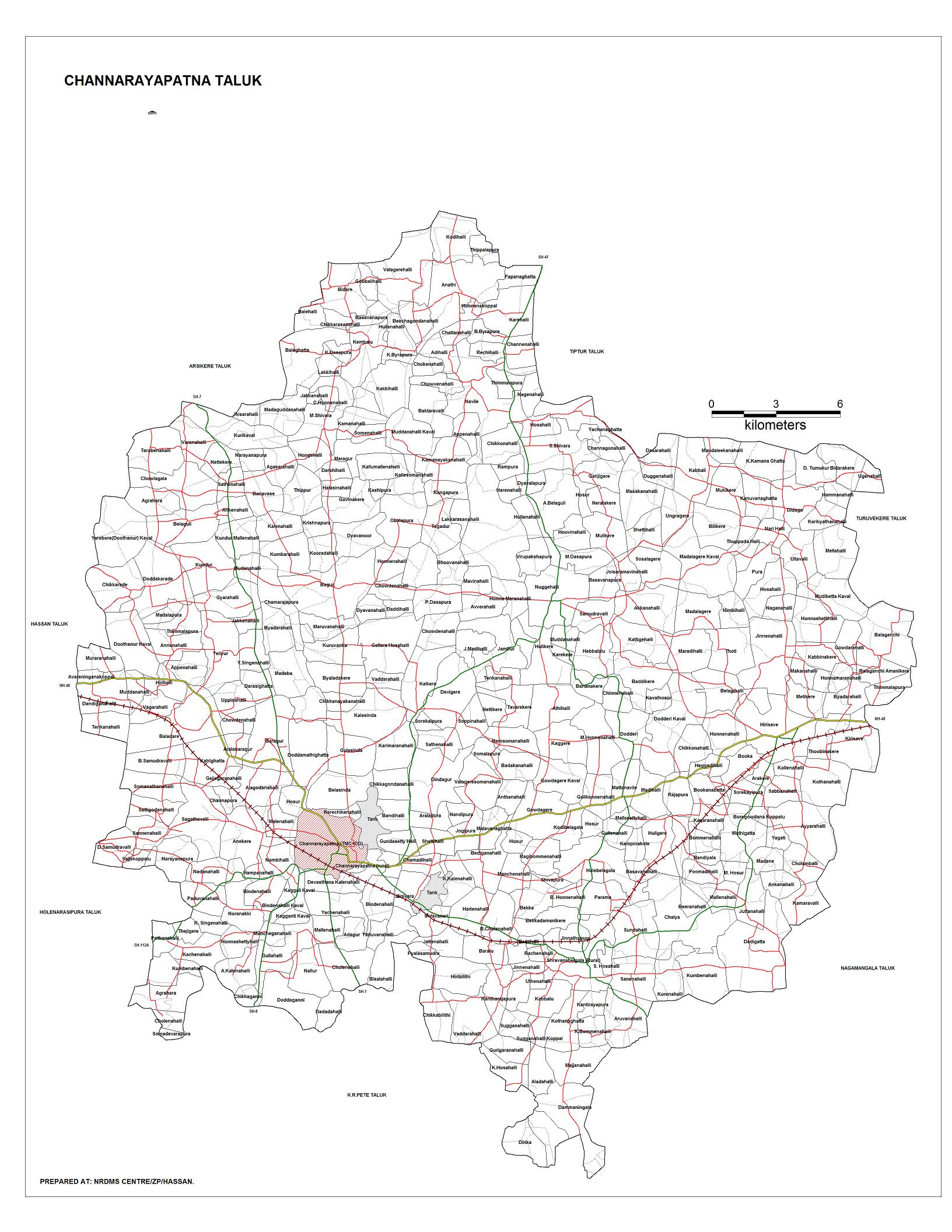
Channarayapatna Taluk is one of the eight taluks of Hassan District, Karnataka, India. Channarayapatna town, being the taluka headquarters, lies on the Mangalore - Bangalore National highway 75 in Karnataka, India. Its popularity can be attributed to its historical and religious significant, coconut farming, sugar and also to its fields of literature, culture, religion etc. Now it is growing predominantly towards improvements in the modern era. The Taluk Office, Channarayapatna is located off the Bangalore-Mangalore highway in Channarayapatna town. The office is housed in the royal and majestic Mini Vidhana Soudha. In addition to the Taluka office, it also houses the Sub-Registrar office, Sub-Treasury office & Labour Inspector offices. The Taluk Office is headed by the Tahsildar who is of KAS cadre. They include Shirastedars, Deputy Tahsildars, Revenue Inspectors, FDAs, SDAs & Village Accountants. The Tahsildar also heads survey section which has survey supervisors, surveyors, Band Jawans, Licensed Surveyors besides managing food & civil supplies section, which includes Food Shirastedars and Food Inspectors. The Tahsildar has to manage the Muzrai section to take care of Muzrai temples. In addition to conventional revenue duties, the Tahsildar has to perform magisterial functions as provided in the CrPC. The Tahsildar also has many other functions related to election, disaster management, SC/ST, Backward classes, women, children welfare etc. Overall, they will be responsible for the peace and tranquillity of the taluk. Channarayapatna has an average elevation of 827 metres (2713 ft). There are 40 panchayat villages in Channarayapatna Taluk, for 407 villages.


