Mysore, officially Mysuru, is a city in the southern part of the state of Karnataka, India. Mysore city is geographically located between 12° 18′ 26″ north latitude and 76° 38′ 59″ east longitude. It is located at an altitude of 770 m (2,530 ft) above mean sea level.

Mysuru District is an administrative district located in the southern part of the state of Karnataka, India. It is the administrative headquarters of Mysore Division.Chamarajanagar District was carved out of the original larger Mysore District in the year 1998. The district is bounded by Chamrajanagar district to the southeast, Mandya district to the east and northeast, Kerala state to the south, Kodagu district to the west, and Hassan district to the north.

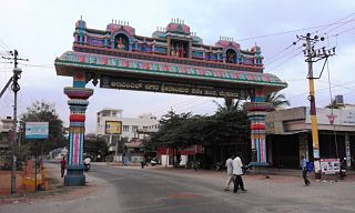
Nanjangud, officially known as Nanjanagudu, is a city in the Indian state of Karnataka. Nanjangud lies on the banks of the river Kapila, 23 km from the city of Mysore. Nanjangud is famous for the Srikanteshwara Temple located here. Nanjangud is also called Dakshina Kashi. This city is also famous for a type of banana grown in the region called the Nanjanagoodu rasabale. Nanjangud's local administrative unit was designated as a Municipal Committee in 2015 by including Devirammanahalli and Kallahalli village.

Mysore division, officially Mysuru division, is an administrative division in the southern Indian state of Karnataka. It is one of four administrative divisions in Karnataka, with others being Bangalore division, Belgaum division, Gulbarga division. Mysore division comprises eight districts of Karnataka, namely, Chamarajanagar, Chikmagalur, Dakshina Kannada, Hassan, Kodagu, Mandya, Mysore and Udupi district. The city of Mysore is the administrative headquarters of the division. Mysore division covers parts of historical Old Mysore region and southern part of Coastal Karnataka.The total area of the division is 43,503 sq.km. The total population as of 2011 census is 12,563,598.

Hassan is a city and the district headquarters of Hassan district in the Indian state of Karnataka. The village is situated 980 m (3,220 ft) above sea level. It is named after the Hasanamba temple. The urban population in 2011 was 133,436. It is situated at a distance of 182 km from the state capital, Bangalore, and 166 km from Mangalore.

Hassan is one of the 31 districts of Karnataka, India. The district headquarter is Hassan.
Kushalanagar is a city located in the Kodagu district of Karnataka state of India. Surrounded by Kaveri river, it is the gateway of the Coorg district. It also serves as the headquarters of Kushalanagar Taluk. By population, Kushalanagar is the third largest town in the district after Madikeri and Virajpet. Kushalnagar is an important commercial centre in Kodagu.

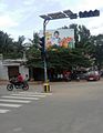
Bhogadi is a town within the limits of the Mysore Urban Development Authority, and Mysuru metropolitan area in Mysore district, Karnataka.
Aspathrekaval is a village in the southern state of Karnataka, India. It is located in the Hunsur taluk of Mysore district.

Harohalli is a village in the southern state of Karnataka, India. It is located in the Harohalli also kanakpura taluk of Ramanagar district in Karnataka.
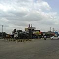
Kadakola is a Town and a suburb of Mysuru metropolitan area in the southern state of Karnataka, India. It is located in the Mysore taluk of Mysore district. In November 2020, Kadakola was upgraded from a Gram Panchayat to a Town Panchayat and a gazetted notification was passed on November 26th 2020. The notification combines Kadakola and Mandakalli villages coming under Kadakola GP, Badipalya, Gudumadanahalli, S. Uttanahalli and Hosahundi villages coming under Hosahundi GP, Marase and Madaragalli villages coming under Devalapura GP, K.M. Hundi, K.N. Hundi, Gejjagalli and Yeligehundi villages, covering a total area of 34.71 sq. km. The combined population of the newly formed town is 19,969.

Thandavapura is a village in the southern state of Karnataka, India. It is located in the Nanjangud taluk of Mysore district in Karnataka.

The MysoreUrban Development Authority (MUDA) of Mysore, India, is a governmental organization that oversees planning and development of infrastructure, provision of development-related sites and services, and the housing needs of underprivileged citizens in Mysore.

The Mysore City Corporation (MCC) is the administrative body responsible for civic amenities and some infrastructural assets of the Mysore City area in India. It is the third largest Municipal Corporation in Karnataka responsible for a population of 1 million in an area of 235 km2. It's boundaries have expanded more than 2 times over the last decade.
Srirampura is a town and residential suburb of Mysore city in India. It is located in the Southern part of the city. It has a population of approximately 11,000 according to the 2011 Census. The main landmarks of this area are Brahmarahbha Choultrey, SBM park, Madhuvana Park. There are several schools in and around this area. North of Srirampura is Vivekananda Nagar and Kuvempunagar. West of Srirampura is Ramakrishnanagar, East of Srirampura is Asokapuram. South of Srirampura is the Mananthavady-Mysore Highway. In November 2020, a gazetted notification was passed upgrading the census town to a town panchayat. The notification combines towns and villages of Srirampura, Lingambudhipalya, Gurur, Koppalur and Kalalavadi villages coming under Srirampura GP, covering a total area of 17.99 sq. km. According to 2011 census, the town has a combined population of 18,511.

Nadanahalli is a small village near Mysore city in Karnataka province of India.

Hootagalli or Hutagalli is a city and a Suburb of Mysore, situated in Mysuru metropoltian area ಮೈಸೂರು ಜಿಲ್ಲೆ of Karnataka, India. Hootagalli is located in the outskirts of the city of Mysuru and forms a continuous urban area. Hootagalli city municipal council consists of previous census towns of Hinkal, Hootagalli and Gram Panchyats of Koorgalli and Belavadi totally covering an area of 28.48 square km. In November 2020, the government of Karnataka approved the formation of Hootagalli City Municipal Council by merging four gram panchayats. The initial plan was to include it with MCC to form Greater Mysuru City Corporation (BMMP) however, due to MCC disputing the proposal, a separate body was created. According to 2011 census, the city municipal council has combined population of 56,876. On November 26, 2020, a gazetted notification was passed making the CMC official.

Mysore is one of the most important cities in Karnataka due to its tourism and proximity with the capital city of Bangalore. It is the second largest urban agglomeration in the state of Karnataka. It has a well established road and rail transport with other cities in the country.
Mysuru Local Planning Area is the metropolitan area limit defined in City Development Plan 2031 by Mysore Urban Development Authority. Mysuru Planning Area is divided into 45 planning districts spanning across the Taluks of Mysore, Nanjangud and Srirangapatna of Mandya district. As per City Development Plan 2031, this metropolitan area covers 509sq.km of area and has a population of 1,696,577.