
The Bhima River is a major river in Western India and South India. It flows southeast for 861 kilometres (535 mi) through Maharashtra, Karnataka, and Telangana states, before entering the Krishna River. After the first sixty-five kilometers in a narrow valley through rugged terrain, the banks open up and form a fertile agricultural area which is densely populated.
The Godachinmalki Falls is a waterfall located on Markandeya river in Belgaum district, Gokak Taluk, Karnataka, India. It is 15 kilometers away from Gokak and 40 kilometers from Belgaum. It is located in a deep green valley.

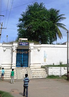
Aurad is a city and taluka in Bidar district in the southern Indian state of Karnataka. The city is famous for the Amreshwar Temple.

POSTAL CODE -431710
Chikkodi is a taluka and Town Municipal Council city in the Belagavi district of Karnataka, India.It is a Subdivision of the district.Chikodi,Athani,Hukkeri,Raibag,Nipani,Kagwad taluks come under Chikodi Subdivision.Chikkodi has many district level offices but it is not designated as a district by the State Government.
Hukkeri is a Town Municipal Council and taluka in Belagavi district in the Indian state of Karnataka.
Malavalli is a town and a taluka place in Mandya district in the Indian state of Karnataka. The pincode of Malavalli is 571430.
Inchal is a village in the southern state of Karnataka, India. It is located in the Saundatti taluk of Belgaum district in Karnataka.
Shelavadi is a panchayat town in Dharwad district in the India
Mandikal is a village located in present Kolar district in Karnataka, India. It is a small village of a population more than 1000. The main occupation is agriculture and sericulture. Kannada and Telugu are the two main languages people speak here. This village is about 5 km from the pilgrimage centre, Kurudumale and about 14 km from Mulabagil.

Honnihalli is a village in Belagavi district in the southern state of Karnataka, India.
Hulloli is a village which comes under Hukkeri Taluka in Belgaum district in the southern state of Karnataka, India.
Kolavi is a village in Gokak taluka and Belagavi district in Karnataka, India.It is located around 12 km from Gokak and 54 km from district headquarter Belagavi.The common language in use is Kannada. The main occupation of the people here is agriculture.
Konnur is a city in Gokak taluk, Belgaum district in Karnataka, India. The Konnur railway station is located in Konnur 11 km from Gokak. It is near famous water falls like Gokak falls and Godachinamalki.
Midakanatti is a small village in the Gokak Taluk and Belagavi District of Karnataka State in India. It is administered by the Midakanatti Panchayat. It is located 33 km east of the divisional headquarters in Belagavi, 18 km from the town of Gokak, and 452 km from the State capital, Bengaluru.
Patharwadi is a village in Parner taluka in Ahmednagar district of state of Maharashtra, India.
Sulikunte is a village located south-east of Bangalore, Karnataka, India. This village is in close proximity to Kodathi Grama Panchayath, and Bengaluru East Taluk.
Mungurwadi is a town in Gadhinglaj Taluka of Kolhapur district in Maharashtra, India. In 2001 it had a population of 3,271, but as of 2011, it has a population of 12,199. It is a major market place and the tenth largest settlement in Gadhinglaj taluka. Mungurwadi is about 24 km from Gadhinglaj, 29 km from second-largest settlement Kadgaon and 12 km from National Highway 4(NH4).
Harali is a Town in Gadhinglaj Taluka Kolhapur district situated in the southwest corner of state Maharashtra, India. Harali is situated on banks of Hiranyakeshi river originated from the Great Amboli Ghats is about 7 km from Gadhinglaj towards south and 12 km from the second largest city Kadgaon in Gadhinglaj Taluka and just 2 km from Mahagaon,Gadhinglaj. It is managed by Town Council.In 2011 it has a population of about 15,856. Harali is the eight largest city and town in Gadhinglaj Taluka. Shri Appasaheb Nalawade Gadhinglaj Taluka Sahakari Sakhar Karkhana is situated in the town.


