Shivapeth | |
|---|---|
Village | |
| Country | |
| State | Karnataka |
| District | Belgaum |
| Talukas | Ramdurg |
| Languages | |
| • Official | Kannada |
| Time zone | UTC+5:30 (IST) |
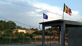
Shivapeth is a village in Belgaum district of Karnataka, India. [1]
Shivapeth | |
|---|---|
Village | |
| Country | |
| State | Karnataka |
| District | Belgaum |
| Talukas | Ramdurg |
| Languages | |
| • Official | Kannada |
| Time zone | UTC+5:30 (IST) |
Shivapeth is a village in Belgaum district of Karnataka, India. [1]

Jalna district is an administrative district in the state of Maharashtra in western India. Jalna town is the district headquarters. The district is part of Aurangabad division.

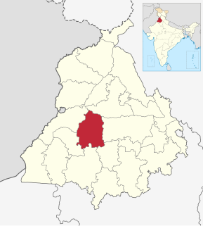
Moga district is one of the twenty-two districts in the state of Punjab, India. It became the 17th district of Punjab State on 24 November 1995 cut from Faridkot district. Moga District is among the largest producers of wheat and rice in Punjab, India. People from Moga City and Moga District belong to the Malwa culture.

Awantipora or Avantipur or Aavantipur, known as Woontpor in Kashmiri, is a town on the banks of the river Jhelum in the Pulwama district of the Indian union territory of Jammu and Kashmir. It is on the Jammu-Srinagar National Highway, south of Srinagar and north of Anantnag. Awantipora was named after the Kashmiri king Avantivarman and has the ruins of two 9th century Hindu temples built by him.

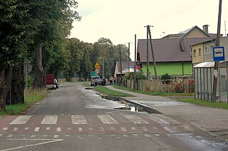
Milewo-Gawary is a village in the administrative district of Gmina Krasne, within Przasnysz County, Masovian Voivodeship, in east-central Poland. It lies approximately 15 kilometres (9 mi) south of Przasnysz and 75 km (47 mi) north of Warsaw.

Płociczno is a village in the administrative district of Gmina Ełk, within Ełk County, Warmian-Masurian Voivodeship, in northern Poland. It lies approximately 8 kilometres (5 mi) north of Ełk and 126 km (78 mi) east of the regional capital Olsztyn.

Unin is a village in the administrative district of Gmina Wolin, within Kamień County, West Pomeranian Voivodeship, in north-western Poland.

Mahapalwas is a Medium village in SURAJGARH Tehsil of Jhunjhunu district in Rajasthan.

Konjska Reka is a village in the municipality of Bajina Bašta, Serbia. "Konjska Reka" means "horse's river" in Serbian. According to the 2002 census, the village has a population of 112 people.
Anigol is a village in Belgaum district in the southern state of Karnataka, India.
Bijagarni is a village in Belgaum district in the southern state of Karnataka, India.
Hampiholi is a village on the banks of river Malaprabha in Belgaum district, 14 kilometres (8.7 mi) from Ramdurga taluk in the southern state of Karnataka, India.
Kundargi is a village in Gokak taluk Belagavi district in Karnataka, India. beside the river Hedkal Dam.
Modage is a village in Belgaum district of Karnataka, India.
Gudisagar is a village in Dharwad district of Karnataka, India.
Jinnur is a village in Dharwad district of Karnataka, India.
Bichpari is a village in Gohana tehsil of the Sonipat district in Haryana, India. During the 2011 census, its population was 6,032.
Arakeri is a small village in Bijapur district, Karnataka, India. It is around 14 km from Bijapur city, located near to the Solapur, Mangalore highway.

Chapparapadavu is a village (panchayath) in Kannur district in the Indian state of Kerala. The villages of Koovery, Kottakkanam, and Therandi are part of the panchayath. Chapparapadavu has 14,883 people. Board of Members of the Grama Panchayat, Chapparapadava during 1987-95 Ward 1 Kariyil Narayanan Ward 2. I Damodaran Master 3. M Assainar Haji 4. C P Safiya 5. P Kunhiraman 6. V P Kunhiraman 7. E Kunhiraman 8. Mary Thomas Poovanpuzha 9.V J Chacko Master 10.K Madhavan Master 11. T.C Sebastian.
Jaura Singha is a village in Batala in Gurdaspur district of Punjab State, India. It is located 9 kilometres (5.6 mi) from sub district headquarter, 47 kilometres (29 mi) from district headquarter and 40 kilometres (25 mi) from Sri Hargobindpur. The village is administrated by Sarpanch an elected representative of the village.
Teja Khurd is a village in Batala in Gurdaspur district of Punjab State, India. It is located 20 kilometres (12 mi) from sub district headquarter, 50 kilometres (31 mi) from district headquarter and 10 kilometres (6.2 mi) from Sri Hargobindpur. The village is administrated by Sarpanch an elected representative of the village.
Coordinates: 15°53′N75°24′E / 15.883°N 75.400°E