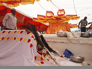
Halasi is a town in Khanapur Taluk, Belgaum District in Karnataka, India. It is 14 km from Khanapur and about 25 km from Kittur. As known from inscriptions, the ancient name of the town was Palāśikā. A centre of the early Kadamba Dynasty, it was a minor capital of the Goa Kadambas (980-1025). The town is notable for a series of medieval temples. The most famous are the Varāha Narasiṃha temple and Suvarṇeśvara temple in the town, and a third temple of Rāmeśvara. On a hill about 1.9 km. south-west of the town is a pilgrimage place known as Rāmatītha.
Khanapur known as Khanapura is a panchayat town in Belagavi district, Karnataka, India. It is about 26 km from Belagavi. The Khanapur Municipal Council governs the town. Khanapur is the headquarters for Khanapur taluk. The town is on the Belgaum-Panaji National Highway, NH 4A. Khanapur is well connected by train and road to important cities in Karnataka, Goa, and Maharashtra. Kannada is the official language.
Gandigawad is a village in the southern state of Karnataka, India. It is located in the Khanapur taluk of Belgaum district in Karnataka.
Inchal is a village in the southern state of Karnataka, India. It is located in the Saundatti taluk of Belgaum district in Karnataka.
Mouje Nandgad is a village in the southern state of Karnataka, India. It is located in the Khanapur taluk of Belgaum district in Karnataka.
U Khanapur is a village in the southern state of Karnataka, India. It is located in the Hukeri taluk of Belgaum district in Karnataka.

Abanali is a village in the southern state of Karnataka, India. It is located in the Khanapur taluk of Belgaum district in Karnataka.

Adi (Khanapur) is a village in the southern state of Karnataka, India. It is located in the Khanapur taluk of Belgaum district in Karnataka.

Akrali is a village in the southern state of Karnataka, India. It is located in the Khanapur taluk of Belgaum district in Karnataka.
Anagadi is a village in Belgaum district in the southern state of Karnataka, India. The official spoken languages of this region is Marathi.
Avarolli is a village in Belgaum district in the southern state of Karnataka, India.

Badachi is a village in Belgaum district in the southern state of Karnataka, India. It is located in Athani Taluka of Belgaum District, near Bijapur -Athani Highway.
Hattar Gunji is a village in khanapur Talukha and Belgaum district in the southern state of Karnataka, India. It comes under Hattar Gunji Panchayath. It belongs to Belgaum Division. Bharatiya Janata Party, BJP, Indian National Congress (INC), INC are the major political parties in this area.
Kagganagi is a village in Belgaum district in Karnataka, India.
Kakamari is a village in Belgaum district in the southwestern state of Karnataka, India. It belongs to Belgaum Division. It is located 164 km towards North from District headquarters Belgaum. 35 km from Athni. 583 km from State capital Bangalore
Kalabhavi is a village in Belgaum district in Karnataka, India.
Karambal is a village in Belgaum district in Karnataka, India. Karambal village is located in Khanapur Tehsil of Belgaum district in Karnataka, India. It is situated 3 km (1.9 mi) from sub-district headquarters Khanapur and 28 km (17 mi) from district headquarters Belgaum. As per 2009 stats, Karmbla is the gram panchayat of Karambal village. The total geographical area of village is 387.3 hectares. Karambal has a total population of 1,400 people. There are about 294 houses in Karambal village. Khanapur is the nearest town to Karambal, and is approximately 3 km (1.9 mi) away.
Kyarakoppa is a small village in the taluk of Kittur of Belgaum district in North Karnataka, India. About 100 families, with total population of around 500 people, live in this village. This tiny village is surrounded by streams and the Malaprabha River. It comes under Devarashigihalli Village Panchayat and Marganakoppa as revenue village. This village is located around 40 km from Belgaum district headquarters to its south and around 17 km from Kittur taluk headquarters to its north west. 475 km from State capital Bangalore.

Hulikal is a village located in the Hosanagara taluk of the Shimoga district in the Indian state of Karnataka and is known for its heavy rainfall. The Hulikal village lies in the Western Ghat region of Karnataka state. The range of ghat is known by the name Hulikal ghat or Balebare ghat. The road running between Hosangadi and Mastikatte through Hulikal ghati connects the coastal district of Udupi with Shivamogga (Shimoga) district. The Mani dam reservoir and Savehoklu reservoir are nearby. KPCL has its colony at Mastikatte near to Hulikal. The nearest airport is at Mangalore, situated 123 km south-west of Hulikal. It has an elevation of 600m.
Markandeya is a river of southern India. It rises in the Bailur in Khanapur Taluk of Belgaum district, Karnataka state, enters Belagavi taluk on southern side and flows towards western side of the Belagavi city and flows 66 kilometres (41 mi) in Belgaum district forming beautiful Godchinamalaki Falls before reaching its confluence into the Ghataprabha River at Gokak about 60 kilometres (37 mi) from Belgaum.


