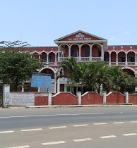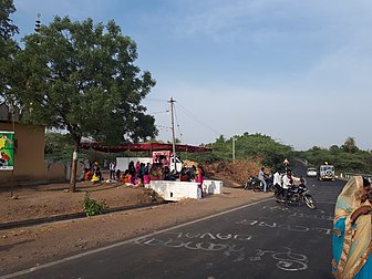
Gokak is a taluka headquarters in the Belagavi district of Karnataka state, India. It is located around 70 km from Belagavi at the confluence of two rivers, the Ghataprabha and the Markandeya. The population of the city is according to 2011 census is 79,121. Gokak city has second highest GDP in the district of Belagavi after Belagavi city. The common language is Kannada.
Bailhongal is a Taluk in Belagavi district of Karnataka state in southern India. Bailhongal Taluk is located towards the north-east part of Belagavi. The taluk headquarters is about 44 km from the district headquarters. The total geographical area of the taluk is 1122.40 km2. There are 126 revenue villages and 14 hamlets with a total population of 356,400 people, according to the 2001 census.

Chikkodi is a taluka and Town Municipal Council in the Belagavi district of Karnataka, India. It is a Subdivision of the district. Chikodi, Athani, Hukkeri, Raybag, Nipani and Kagwad are the taluks that come under Chikodi Subdivision. It is 75 kilometers from the city of Belgaum, 65 kilometers from Kolhapur, 51 kilometers from Miraj, 160 kilometers from Hubballi, and 570 kilometers from the capital of Karnataka state, Bengaluru. Chikodi has many district level offices but it is not designated as a district by the Government of Karnataka. It is one of the major cities that lies in the border between Karnataka and Maharashtra states.official language is Kannada.

Athani is a town in the Belagavi district of Karnataka, India. It is 140 kilometers from the city of Belagavi, 70 kilometers from Vijayapura, 55 kilometers from Miraj, 100 kilometers from Kolhapur, and 624 kilometers from Bengaluru.
Joida is a town located in the Uttara Kannada district in the Indian state of Karnataka. The town is the headquarters of the eponymous taluk. Earlier it was known as Supa taluka but as Supa village got submerged due to dam built across river Kali, Joida taluka came into existence. Joida town has a Post office, branch of nationalised banks and a Police station.
Ainapur is a town in the southern state of Karnataka, India. It is located in the Athani taluk of Belgaum district in Karnataka. Ainapur village is famous for Peda, the village situated near river Krishna. Sugarcane is the chief cultivated crop and Kannada is the primary spoken language.
Inchal is a village in the southern state of Karnataka, India. It is located in the Saundatti taluk of Belgaum district in Karnataka.
Kabbur is a town in the southern state of Karnataka, India. It is located in the Chikodi taluk of Belgaum district in Karnataka.
Kurli is a village in Sindhudurg District, the south-easternmost district of Konkan Division, Maharashtra, India. Kurli is located 7.9 km from its Taluk Main Town Vaibhavwadi. Kurli is 33.6 km from its District main city, Oras. It is 307 km from its State Main City Mumbai. This is a culturally and historically important village. Kurli consists of wadis like Temb Wadi, Khadakwadi, Bajarpeth. Also it is famous because of the newly made Kurli Dam.
Madabhavi is a village located in Athani taaluk of Belagavi district, Karnataka state of India.
Shegunashi is a village in the southern state of Karnataka, India. It is located in the Athani taluk of Belagavi district in Karnataka.
Ugar Budruk is a village in the southern state of Karnataka, India. It is located in the Athni taluk of Belgaum district in Karnataka. It is around 38 km from the city of Sangli, Maharashtra. Ugar comes under the Kagwad constituency.
Kalas is a village in the southern state of Karnataka, India. It is located in the Kundgol taluk of Dharwad district in Karnataka. This is the native place of Guru Govindabhatta, who is the guru of Santha Shishunal Sharif. Today we can find Samadhi of Guru Govindabhatta here. His aradhana takes place every year during summer.
Holealur also spelled as Holealooru is a large village in the Ron taluk of Gadag district in the Indian state of Karnataka.

Adalatti is a village in the southern state of Karnataka, India. It is located in the Athni taluk of Belgaum district in Karnataka.
Chamakeri is a village in the Belgaum district of Athani Taluk in the southern Indian state of Karnataka.
Kakamari is a village in Belgaum district in the southwestern state of Karnataka, India. It belongs to Belgaum Division. It is located 164 km towards North from District headquarters Belgaum. 35 km from Athni. 583 km from State capital Bangalore
Koligudda is a village in the Raybag Taluk of the Belgaum district in Karnataka, India. It is situated 123 kilometers northeast of Belgaum, between the Athani-Gokak road.
Radderahatti is a small village/hamlet in Athani Taluk in Belagavi District of Karnataka, India. It comes under Radderahatti Grama Panchayath with 13 members. It belongs to Belgaum Division. It is located 124 km (77 mi) north of district headquarters Belgaum, 10 km (6.2 mi) from Athni and 570 km (350 mi) from the state capital Bangalore. The local language is Kannada and the population is 5700 with 1138 houses. The female population is 49.3%, the overall literacy rate is 72.4% and the female literacy rate is 61.3%. Basaveshwara temple, Girimalleshwar Math, and Durgadevi temple are some spiritual and religious places.
Athani Taluk is the largest taluk in Belgaum District, Karnataka, India. It has a total area of 2,070.54 square kilometres (799.44 sq mi), of which 70% is cultivated. This includes 4 towns, 115 inhabited villages and hamlets with a rural population of 4,07,485, according to the 2011 census. The total population of the taluk is 5,25,832. It is bounded by Sangli District of Maharashtra in the north, Bijapur District in the east, and Bagalkot District in the southeast. Geologically the area is covered by Deccan Trap formations. The average annual rainfall is 582 millimetres (22.9 in). Two rivers flow through the taluk: the Krishna River and the Agrani.


