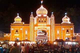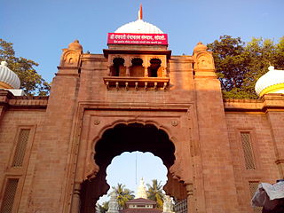
Sangli is a Metro city and the headquarters of Sangli District in Maharashtra, in western India. It is known as the Turmeric City of India due to its production and trade of spice. Sangli is situated on the banks of river Krishna and houses many sugar factories. Sangli is a significant city in Western India, 376 km from Mumbai, 230 km from Pune, 47 km from Kolhapur, and 638 km from Bangalore. Sangli is known as Turmeric city for its global turmeric trade, grapes, raisins, jaggery and the most significant number of sugar factories in India. The only district has more than 30 sugar factories. Sangli Miraj Kupwad, along with its Urban Agglomeration, together known as Sangli Miraj Kupwad Metropolitan Region (SMKMR).

Sangli district is a district of Maharashtra state in India. Sangli city is the district headquarters. It is bordered by Satara district, Solapur district to the North, Karnataka state to the South-East, by Kolhapur district to South-West and by narrow portion on the East side to Ratnagiri district. It is present on the southern tip of Maharashtra.
Sangli-Miraj & Kupwad is urban agglomeration and a municipal corporation in Sangli district in the Indian state of Maharashtra.
Tasgaon Tasgaon is a city in Maharashtra and Taluka in Sangli district in the Indian state of Maharashtra. Tasgaon city is developing city in Maharashtra. Tasgaon was given as Jahagir to Parshuram Bhau Tasgaonkar by Narayanrao Ballal Peshwa in 1774. Tasgaon Sansthan was lapsed by British during ruling of Shrimant Ganpatrao Tasgaonkar.
Kavathe-Mahankal is a tehsil in Miraj subdivision of Sangli district in the Indian state of Maharashtra. This is famous for Mahankali Devi temple and Mallikarjun Temple. There is also a Sugar Factory, named after the same Goddess Mahankali Sugar Factory.

Mangasuli is a village located in Northern Karnataka, India. It is located in the Athani taluk of Belgaum district in Karnataka.
Tasgaon-Kavathe Mahankal Assembly constituency is one of the 288 Vidhan Sabha constituencies of Maharashtra state in western India.

Kharsundi is a village located in Atpadi Taluka, Sangli District of Maharashtra, India.
Arjunwad is a village in Belagavi district in the Northern state of Karnataka, India.
Bhood is a village in Khanapur tehsil of Sangli district in Maharashtra, India. It is located near the city Vita.
Ondipudur is a major residential neighbourhood of the city of Coimbatore in Tamil Nadu, India. It is situated in the south-eastern part of the city. It is one of the well developed neighborhoods in the city and has been part of Coimbatore Corporation since 1981.
Miraj Assembly constituency is one of the 288 Vidhan Sabha constituencies of Maharashtra state in western India
Sanjaykaka Ramchandra Patil is a politician from Tasgaon of Sangli district of Maharashtra state in India. He was Vice President of Sangli Municipal Corporation and President of Indian Youth Congress in Sangli district. In 1996, he was the member of Zila Parishad, Sangli. He was arranging the fronts against Government for the farmers problems in Sangli district. He is also the President of Shri Ganapati Jilha Krushi Audyogik Sarv Seva Sahkari Society, Sangli. He was former President of Annasaheb M. K. Patil Arthik Vikas Mahamandal, Maharashtra.
The 11045 / 11046 Deekshabhoomi Express via Latur is the Express trains which connect Shri Chhatrapati Shahu Maharaj Terminus, Kolhapur, Maharashtra and Dhanbad Junction, Jharkhand. This train runs via Latur from 19 February 2021. During its travel it covers a distance of 2,505 km (1,557 mi), for that it takes 52 hrs 00 mins. It runs with an average speed of 48 km/h (30 mph) during its journey and covers 38 halts and 337 intermediate stations.
Hasur is a village in Maharashtra, India. It is located in the Krishna river basin, in the Desh region. The village is a part of the Shirol taluka of Kolhapur district, Pune Division.
Kausadi is a village in Jintur taluka of Parbhani district in Maharashtra state of India.
Hingangaon is a village and Gram panchayat in Kavathe Mahankal, Sangli district of Maharashtra, India. It is located near the Maharashtra-Karnataka border and is approximately 10 km from the Miraj-Pandharpur highway, 50 km from Sangli........
Solapur - Shri Chhatrapati Shahu Maharaj Terminus Kolhapur Superfast Express is a superfast train of the Indian Railways connecting Shri Chhatrapati Shahu Maharaj Terminus, Kolhapur in Maharashtra and Solapur of Maharashtra. It is currently being operated with 22133/22134 train numbers on a daily basis.
Kalburgi–Miraj-Kolhapur Superfast Express is an intercity Superfast Express train of the Indian Railways connecting Kalburgi in Karnataka and Kolhapur of Maharashtra.
Venkatachalapuram is a small village situated in Theni District, Tamil Nadu, India and with direct road connectivity to Theni and Odaipatti. The district headquarters, Theni, is situated 11 kilometres (6.8 mi) north of this village.


