Machali | |
|---|---|
Village | |
| Country | |
| State | Karnataka |
| District | Belgaum |
| Talukas | Khanapur |
| Languages | |
| • Official | Kannada |
| Time zone | UTC+5:30 (IST) |
Machali is a village in Belgaum district in Karnataka, India. [1]
Machali | |
|---|---|
Village | |
| Country | |
| State | Karnataka |
| District | Belgaum |
| Talukas | Khanapur |
| Languages | |
| • Official | Kannada |
| Time zone | UTC+5:30 (IST) |
Machali is a village in Belgaum district in Karnataka, India. [1]
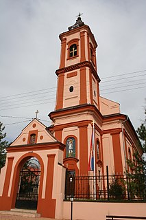
Manđelos is a village located in the Sremska Mitrovica municipality, in the Syrmia District of Vojvodina, Serbia. The village has a Serb ethnic majority and its population numbering 1,533 people.

Kosihy nad Ipľom is a village and municipality in the Veľký Krtíš District of the Banská Bystrica Region of southern Slovakia.
Karaputugala is a village in Matara District, Sri Lanka, 22 kilometers away from Matara. It is about 4 kilometers from Kamburupitiya.
Angah, is a village and one of the 51 union councils of Khushab District in the Punjab Province of Pakistan. It is located at 32° 36' N 72° 5' E.

Ostrów is a village in Ropczyce-Sędziszów County, Subcarpathian Voivodeship, in south-eastern Poland. It is the seat of the gmina called Gmina Ostrów. It lies approximately 3 kilometres (2 mi) west of Ropczyce and 30 km (19 mi) west of the regional capital Rzeszów.
Indrapur is a town in Banke District in Province No. 5 of south-western Nepal. At the time of the 1991 Nepal census it had a population of 5,403 and had 1056 houses in the town. It had been a part of Nepalgunj sub-metropolitan city while expansion of municipality in to sub metropolitan city. However, this part of Sub-metropolitan city was structured under Janaki Rural Municipality.

Zogbodomey or Zogbodomè is a town, arrondissement, and commune in the Zou Department of south-western Benin. The commune covers an area of 600 square kilometres and as of 2002 had a population of 72,338 people.

Adahalli is a village in the southern state of Karnataka, India. It is located in the Athni taluk of Belgaum district in Karnataka.
Võiera is a village in Põhja-Pärnumaa Parish, Pärnu County in western-central Estonia.
Barkachha Khurd is a village in Mirzapur, Uttar Pradesh, India.Khurd and Kalan Persian language word which means small and Big respectively when two villages have same name then it is distinguished as Kalan means Big and Khurd means Small with Village Name.
Hagedal is a village in Belgaum district in the southern state of Karnataka, India.
Wetagepota is a village in Sri Lanka. It is located within Central Province.
Talikatte ತಾಳೀಕಟ್ಟೆ is a village in the Holalkere Taluk of Chitradurga District in Karnataka. About 1400 families live in this village. Majority of people living in this village belong to the Kuruba Gowda caste.
Brđani is a village situated in Novi Pazar municipality in Serbia.
Balgudar is a village Located in Lakhisarai District of Bihar, India, with total 1200 families residing. The total population of the village is 7,326, in which 3654 are males while 3672 are females. Child Sex Ratio for the Balgudar as per census is 1044, higher than Bihar average of 935. Balgudar village has lower literacy rate compared to Bihar. In 2011, literacy rate of Balgudar village was 59.13 % compared to 61.80% of Bihar. In Balgudar male literacy stands at 67.34% while female literacy rate was 50.89%. This village is situated near the temple called 'Ashok dham'.
Nelliharvi is a village in Dharwad district of Karnataka, India.
Kudalgi is a village in Dharwad district of Karnataka, India.
Rattigeri is a village in Dharwad district of Karnataka, India.
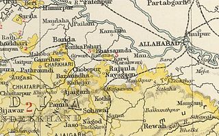
The Chaube Jagirs, also known as 'Kalinjar Chaubes', jagir states were a group of five feudatory states of Central India during the period of the British Raj. They were a British protectorate from 1823 to 1947 and belonged to the Bagelkhand Agency. Their last rulers acceded to India in 1948.

Jakkur is a suburb in the northern part of Bangalore, Karnataka, India. Located on the eastern side of the National Highway 44 between Yelahanka and Hebbal, the area is best known for the Jakkur Aerodrome and Jakkur lake.
Coordinates: 19°36′N80°05′E / 19.600°N 80.083°E
| | This article related to a location in Khanapur taluk, Belgaum district, Karnataka, India is a stub. You can help Wikipedia by expanding it. |