Belgaum is a city in the Indian state of Karnataka located in its northern part along the Western Ghats. It is the administrative headquarters of the eponymous Belgaum division and Belgaum district. The Government of Karnataka has proposed making Belgaum the second capital of Karnataka, hence a second state administrative building Suvarna Vidhana Soudha was inaugurated on 11 October 2012.

Belagavi district, also known as Belgaum district, is a district in the state of Karnataka, India. The district is known as Sugar Bowl of Karnataka with 1.5 lakh (150,000) hectares being used for commercial production and it has displaced Mandya district in sugar cane production over the last decade. The city of Belagavi is the district headquarters in North Karnataka. It houses the second legislative building, where the Karnataka Legislature will meet once a year. A popular sweet is kunda. According to the 2011 Census of India, it has a population of 4,779,661, of which 24.03% live in urban areas, making it the second most populous district in Karnataka, after Bangalore. The district has an area of 13,415 km2 (5,180 sq mi) making it the largest district in Karnataka, and is bounded by Kolhapur District and Sangli district of Maharashtra state on the west and north, on the northeast by Bijapur district, on the east by Bagalkot district, on the southeast by Gadag district, on the south by Dharwad and Uttara Kannada districts, and on the southwest by the state of Goa.

Bailhongal is a Taluk in Belagavi District of Karnataka state in southern India. Bailhongal Taluk is located towards the north-east part of Belagavi. The taluk headquarters is about 44 km from the district headquarters. The total geographical area of the taluk is 1122.40 km2. There are 126 revenue villages and 14 hamlets with a total population of 356,400 people, according to the 2001 census.
Gadag is a district in the state of Karnataka, India. It was formed in 1997, when it was split from Dharwad District. As of 2011, it had a population of 1064570. The overall population increased by 13.14 percent from 1991 to 2001. Gadag District borders Bagalkot District on the north, Koppal District on the east, Vijayanagara district on the southeast, Haveri District on the southwest, Dharwad District on the west and Belgaum District on the northwest. It is famous for the many monuments from the Western Chalukya Empire. It has seven talukas: Gadag, Gajendragad, Ron, Shirhatti, Nargund, Lakshmeshwar and Mundargi.
Khanapur is a panchayat town in Belgavi district, Karnataka, India. It is about 26 km from Belagavi. The town is governed by the Khanapur Municipal Council. Khanapur is the headquarters for Khanapur taluk. The town is on the Belgaum-Panaji National Highway, NH 4A. Khanapur is well connected by train and road to important cities in Karnataka, Goa, and Maharashtra. Kannada is the official language but Marathi is widely spoken in the town.
Ron is a taluka headquarters in Gadag district, Karnataka in India. Of historical importance, the town was termed Dronapur in ancient times. The temples are believed to be constructed by the ancient architect and warrior-priest Dronacharya.
Aigali is a village in the southern state of Karnataka, India. It is located in the Athani taluk of Belgaum district in Karnataka.
Ammanagi is a village in the southern state of Karnataka, India. It is located in the Hukeri taluk of Belgaum district in Karnataka.
Benadi is a village in the North-Western region of Karnataka state near Maharashtra Border in India. It is located in the Chikodi taluka of Belgaum district in Karnataka. Before it was a part of Bombay State and Princely state of Kolhapur. It is a part of Twin Village Aadi-Benadi. People who has origin from this village are known as Benadikar.
Hirekudi is a village in the southern state of Karnataka, India. It is located in the Chikodi taluk of Belgaum district in Karnataka.
Kabbur is a town in the southern state of Karnataka, India. It is located in the Chikodi taluk of Belgaum district in Karnataka.
Kunnur is a village in the southern state of Karnataka, India. It is located in the Chikodi taluk of Belgaum district in Karnataka.

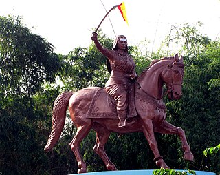
M. K. Hubli is a village in the southern state of Karnataka, India. It is located in the Kittur taluk of Belgaum district in Karnataka. M K Hubballi's full form is Mugut Khan Hubballi
Raibag (Rural) is a town in the southern state of Karnataka, India. It is located in the belagavi district of Karnataka.

For Sampagaon Taluka, see Bailhongal.
Shamanewadi is a village in the southern state of Karnataka in Chikodi taluka, India. It is in the Chikodi taluk of Belgaum district in Karnataka.
Ugar Budruk is a village in the southern state of Karnataka, India. It is located in the Athni taluk of Belgaum district in Karnataka. This place is very well known as Jain people maa Parshwa Padmavati Mondir is very popular in north Karnataka state and South Maharashtra every year all Jain people celebrate Navratri festival is big festival.it has a parshwanat gharderasar for the Jain shewtamber community.It is around 38 km from the city of sangli, Maharashtra.Ugar comes under the Kagwad constituency.
Garag is a village in the northern part of Karnataka of India. India. It is located in the Dharwad taluk of Dharwad district in Karnataka.
Dodwad is a village in Belgaum district in the southern state of Karnataka, India.
Krishna-kittur is a village in the southern state of Karnataka, India. It is located in the Athani taluka of Belgaum district in Karnataka.

