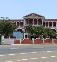
Khammam is the city in Khammam district of the Indian state of Telangana. It is the fourth largest city in the state. It is the headquarters of the Khammam district and Khammam mandal also. It is located about 193 kilometres (120 mi) east of the state capital, Hyderabad, 61 kilometres (38 mi) from Suryapet, 120 kilometres (75 mi) from Warangal and also it is located about 121 kilometres (75 mi) North of the Andhra Pradesh state capital, Amaravathi. The river Munneru flows on the western side of the city. As of 2011 census of India, Khammam urban agglomeration has a population of 313,504. However, on 19 October 2012, the civic body of Khammam was upgraded to a municipal corporation. Post- upgradation to corporation, the population of Khammam was approximated to be 3,07,000.

Mahad ( [məɦaːɖ]) is a city in Raigad district situated in the North Konkan region of Maharashtra state, India. It is located 108.5 km (67.4 mi) from District Headquarters Alibag, and 167 km (104 mi) from Mumbai. Mahad is known for Raigad Fort, the capital of the Maratha Empire in Shivaji's era and the revolutionary Mahad Satyagraha launched by at Chavdar Tale in the wake of modern India.
Anandapur(ଆନନ୍ଦପୁର) is a town and a municipality of Kendujhar district in the state of Odisha, India.

Chikkodi is a taluka and Town Municipal Council in the Belagavi district of Karnataka, India. It is a Subdivision of the district. Chikodi, Athani, Hukkeri, Raybag, Nipani and Kagwad are the taluks that come under Chikodi Subdivision. It is 75 kilometers from the city of Belgaum, 65 kilometers from Kolhapur, 51 kilometers from Miraj, 160 kilometers from Hubballi, and 570 kilometers from the capital of Karnataka state, Bengaluru. Chikodi has many district level offices but it is not designated as a district by the Government of Karnataka. It is one of the major cities that lies in the border between Karnataka and Maharashtra states.official language is Kannada.
Pawai is a town and a nagar panchayat in the Panna district of Madhya Pradesh state in central India. It is mostly surrounded by rocky area.
Chandgad is a Small city and tehsil headquarters of chandgad taluka, of Kolhapur district that is in the Indian state of Maharashtra.

Athani is a town in the Belagavi district of Karnataka, India. It is 140 kilometers from the city of Belagavi, 70 kilometers from Vijayapura, 55 kilometers from Miraj, 100 kilometers from Kolhapur, and 624 kilometers from Bengaluru.
Karekatte is a village in the Indian state of Karnataka. Karekatte is located on Davanagere-Channagiri connecting road. At a distance of about 34 km (21 mi) from the Davanagere (District). At a distance of about 28.6 km (18 mi) from the Channagiri (Taluk).

Kolad is a village in Raigad district, Maharashtra State, India. It is 117 km from Mumbai on the National Highway no 66(Mumbai-Goa) its also connected to Pune via Kolad Pune- Kolad state highway. It lies on the banks of River Kundalika. The village post office Postal Index Number is 402304 & 402109.
Hirekudi is a village in the southern state of Karnataka, India. It is located in the Chikodi taluk of Belgaum district in Karnataka.

Uppinangady or Ubar is a town in the Dakshina Kannada district in the state of Karnataka. It is surrounded by the Kumaradhara River on one side and Nethravathi River on the other. When the town's two surrounding rivers rise during the rainy season and meet, this is called the "Sangam" which is a Sanskrit word for confluence. The Sangam is a major event as people from the surrounding villages crowd the river banks to witness the merge. The population of Uppinangady is 7,172.

Bandakpur is a small town in the district of Damoh in Madhya Pradesh, India. The town is known for a temple of Shiva -the Jageshwar Nath temple.

Gundwad is a village in Belgaum district in the southern state of Karnataka, India. situated on the bank of Krishna River. There is a Parshvanatha Basadi in the village which can be seen from few kilometres.

Honnihalli is a village in Belagavi district in the southern state of Karnataka, India.
Madurapuram is a small village in India that lies on the banks of the Vaigai River and on the National Highway 49 that connects Madurai with Rameshwaram. The village is situated 18 kilometres (11 mi) from Madurai. Though Madapuram is near Madurai it is within Sivagangai district. The famous Madurapuram Badhrakali amman and ayyanar temple is situated at this place. Today this temple is managed by HR & CE ministry of Government of Tamil Nadu.

Punthalathazham is a landlocked neighbourhood of the city of Kollam in the Indian state of Kerala. It is located around six kilometres east of the core Kollam (Quilon) city towards Kannanalloor . This place has a little geographical importance and serves as the tail boundary of Kollam Municipal Corporation. Inhabitants belong to working and middle classes.
Rorathang is a town situated in the bank of Rangpo River on National Highway-717A, in Pakyong District of Sikkim, India.
Kamashasan is one of the village in the district of Jagatsinghpur, Odisha, India. Bagula is famous for the vegetable cultivation and its quality and varieties of vegetables in major cities Odisha.
Bellary Nala is a river of southern India. It rises in the Yellur in Belgaum Taluk of Karnataka state, flows towards South-eastern side of the Belagavi city and flows through Halga, Vadgaon, Shahapur, Bastwad, Basavan Kudchi, Angol, Mutga, Sambra, Muchandi, Sulebhavi Khangaon, Hudali, Suldhal, Malamaradi, Budihal, Ankalgi, Akkatangerahal, Kundargi and many villages before reaching its confluence into the Markandeya river at near Karaguppi in Hukkeri Taluk
Belagavi Nala is a river of southern India. It rises at Laxmi Tekdi in Belgaum city of Karnataka state, flows towards South-eastern side of the Belagavi city and flows through Camp, Station Road, Shastry Nagar, Shivaji Garden and Vishwakarmanagar right up to Old PB Road, before reaching its confluence into the Bellary Nala at Laxminagar in Belgaum.


