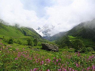
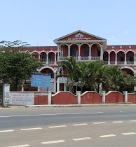
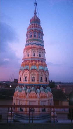
Khammam is the city in Khammam district of the Indian state of Telangana. It is the fourth largest city in the state. It is the headquarters of the Khammam district and Khammam mandal also. It is located about 193 kilometres (120 mi) east of the state capital, Hyderabad, 61 kilometres (38 mi) from Suryapet, 120 kilometres (75 mi) from Warangal and also it is located about 121 kilometres (75 mi) North of the Andhra Pradesh state capital, Amaravathi. The river Munneru flows on the western side of the city. As of 2011 census of India, Khammam urban agglomeration has a population of 313,504. However, on 19 October 2012, the civic body of Khammam was upgraded to a municipal corporation. Post- upgradation to corporation, the population of Khammam was approximated to be 3,07,000.

The climate of India consists of a wide range of weather conditions across a vast geographic scale and varied topography. Based on the Köppen system, India encompasses a diverse array of climatic subtypes. These range from arid and semi-arid regions in the west to highland, sub-arctic, tundra, and ice cap climates in the northern Himalayan regions, varying with elevation. The northern lowlands experience subtropical conditions, with some areas at higher altitudes, like Srinagar, touching continental climates. In contrast, much of the south and the east exhibit tropical climate conditions, which support lush rainforests in these territories. Many regions have starkly different microclimates, making it one of the most climatically diverse countries in the world. The country's meteorological department follows the international standard of four seasons with some local adjustments: winter, summer, monsoon or rainy season, and a post-monsoon period.

Penna is a river of southern India. This is a unique river in world where after originating from Nandi hills, it flows as two different streams, one in North and South directions. The Penna rises in the Nandi Hills in Chikkaballapur District of Karnataka state, and runs north and east through the states of Karnataka and Andhra Pradesh to empty into bay of bengal in Andhra Pradesh. It is 597 kilometres (371 mi) long, with a drainage basin covering 55,213 km2: 6,937 km2 in Karnataka and 48,276 km2 in Andhra Pradesh. Along with this main stream there is another stream south towards Tamilnadu with the name Then Pennai or south Pennar which further moves towards the east to empty into the Bay of Bengal. The Penna river basin lies in the rain shadow region of Eastern Ghats and receives 500 mm average rainfall annually.
Shivpuri is a city and a municipality in Shivpuri district, located in the central Indian state of Madhya Pradesh. It is in the Gwalior Division of northwest Madhya Pradesh and is the administrative headquarters of Shivpuri District. It is situated at an altitude of 1,515 feet (462 m) above sea level.

Gokak is a taluka headquarters in the Belagavi district of Karnataka state, India. It is located around 70 km from Belagavi at the confluence of two rivers, the Ghataprabha and the Markandeya. The population of the city is 79,121, according to the 2011 census. Gokak city has the second highest GDP in the district of Belagavi after Belagavi city. The common language is Kannada.

Baran district is a district in the Indian state of Rajasthan. The headquarters of the district are located at the city of Baran.
Chikhaldara is a hill station and a municipal council in the Amravati district in the Indian state of Maharashtra.

Sirsi is a city and a taluk headquarter in Uttara Kannada district of Karnataka state in India. It was also known as Kalyana Pattana during the Sonda Dynasty. It is a tourist destination with evergreen forest and waterfalls and is also a commercial centre. The main businesses around the city are mostly subsistence and agriculture-based. Areca nut or betel nut, locally known as Adike, is the primary crop grown in the nearby villages, making it one of the major trading centres for areca nut. The region is also known for spices such as cardamom, pepper, betel leaves, and vanilla. The major food crop is paddy.

Chikkodi is a town, taluka and one of three Subdivisional headquarter, in the Belagavi district of Karnataka, India. Chikodi, Athani, Hukkeri, Raybag, Nipani and Kagwad are the taluks that come under Chikodi Subdivision. It is 75 kilometers from the city of Belgaum, 65 kilometers from Kolhapur, 51 kilometers from Miraj, 160 kilometers from Hubli, and 570 kilometers from the capital of Karnataka state, Bangalore. Chikodi has many district level offices but it is not designated as a district by the Government of Karnataka. It is one of the major cities that lies in the border between Karnataka and Maharashtra states.
Hukkeri is a Town Municipal Council and taluka in Belgavi district in the Indian state of Karnataka.
Kalavai is a panchayat town in Ranipet district in the Indian state of Tamil Nadu. The main occupation represented in the area is farming. The town has a pond and a lake after rainy season. Villagers use the lake water and palar river for irrigation. Corporation Bank, State Bank Of India and Indian Bank are the banks that have branches in the locality. The secondary occupation is garment outlets. One government higher secondary school is also located in a nearby village.
Pawai is a town and a nagar panchayat in the Panna district of Madhya Pradesh state in central India. It is mostly surrounded by rocky area.

The Indian State of Karnataka is located between 11°30' North and 18°30' North latitudes and between 74° East and 78°30' East longitude.It is situated on a tableland where the Western Ghats and Eastern Ghats converge into the complex, in the western part of the Deccan Peninsular region of India. The State is bounded by Maharashtra and Goa States in the north and northwest; by the Lakshadweep Sea in the west; by Kerala in the south-west and Tamil Nadu in the south and south-east, Andhra Pradesh in the south-east and east and Telangana in the north-east. Karnataka extends to about 850 km (530 mi) from north to south and about 450 km (280 mi) from east to west.

Athani is a town in the Belagavi district of Karnataka, India. It is 140 kilometers from the city of Belagavi, 70 kilometers from Vijayapura, 55 kilometers from Miraj, 100 kilometers from Kolhapur, and 624 kilometers from Bengaluru.
Ainapur is a town in the southern state of Karnataka, India. It is located in the Athani taluk of Belgaum district in Karnataka. Ainapur village is famous for Peda, the village situated near river Krishna. Sugarcane is the chief cultivated crop and Kannada is the primary spoken language.
Chinchali is a village in Raybag Taluk, Belagavi District, Karnataka, India. It is located near the state boundary with Maharashtra, approximately 84 kilometres north of the district seat Belgaum, and 10 kilometres northeast of the taluk seat Raibag. In the year 2011, the village has a population of 18,986.
Hirekudi is a village in the southern state of Karnataka, India. It is located in the Chikodi taluk of Belgaum district in Karnataka.
Kagganagi is a village in Belgaum district in Karnataka, India.
Laxmanpur is a village in Vaishali district within the Indian state of Bihar. It is about 11 kilometers southwest of Mahua, 24 kilometres (15 mi) northeast of the district headquarters, Hajipur, 34 kilometres (21 mi) northeast of Patna, the state capital. Laxmanpur is 875 kilometres (544 mi) south east of New Delhi and 1,490 kilometres (930 mi) northeast of Mumbai. The nearest railway station is Desari, which is 13 kilometres from the main village.
Sakkaramallur is an Indian village panchayat located in Arcot Taluk of Ranipet District in the state of Tamil Nadu. Sakkaramallur is located on Right Bank of Palar River.


