Athani is a city in the Belagavi district of Karnataka, India. It is 140 kilometers from the city of Belagavi, 70 kilometers from Vijayapura, 55 kilometers from Miraj, 100 kilometers from Kolhapur, and 624 kilometers from Bengaluru.

Aigali is a village in the southern state of Karnataka, India. It is located in the Athani taluk of Belgaum district in Karnataka.

Ainapur is a town in the southern state of Karnataka, India. It is located in the Athani taluk of Belgaum district in Karnataka. Ainapur village is famous for Peda, the village situated near river Krishna. Sugarcane is the chief cultivated crop and Kannada is the primary spoken language.

Darur is a village in the southern state of Karnataka, India. It is located in the Athani Taluk of Belagavi district in Karnataka.

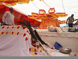
Hulagabali is a village in the southern state of Karnataka, India. It is located in the Athani taluk toward north-east of Belgaum district. The basic occupation in Hulagabali is agriculture and there are also many landlords in the village who are famous in agriculture. Sugarcane is the highest percentage of agriculture as per the survey. There are quite a few temples in the village. The Birappa temple located in this village is well known in surrounding villages. Birappa temple has a large fair and festivities twice a year that draws huge crowd in the region. Sri Sangameshwara temple stands at the juncture of River Krishna and River Agrani. The famous landlords are Patil (Gouda).

Jugul is a village in the southern state of Karnataka, India. It is located in the Athani taluk of Belagavi district in Karnataka.

Kottalagi is a village in the southern state of Karnataka, India. It is located in the Athani taluk of Belagavi district in Karnataka.

Kudachi (Rural) is an urban area in the southern state of Karnataka, India. It is located in the Raybag taluk of Belgaum district in Karnataka.

Mangasuli is a village located in Northern Karnataka, India. It is located in the Athani taluk of Belgaum district in Karnataka.

Raibag (Rural) is a town in the southern state of Karnataka, India. It is located in the belagavi district of Karnataka.

Saptasagar is a village in the southern state On River Bank of Krishna Karnataka, State India. It is located in the Athani taluk of Belgaum district in Karnataka.

Savadi is a village in the southern state of Karnataka, India. It is located in the Athani taluk of Belgaum district. Located on the banks of the Krishna river, also called Uttaravahini - which flows northwards at Savadi, most of the population here is largely dependent on agriculture for its sustenance. Animals domesticated are buffaloes, goats, dogs, horse, bullocks, sheep and fowl. Historically being a belt of Jowar cultivation, with the recent irrigation projects near the village, from the past two decades, the chief crop has been sugarcane. Savadi is closely located to many sugar industries of the Krishna basin, and is part of the major supplier belt of sugarcane in Athani Taluk, and consequently Belgaum district.

Shedbal is a town in the southern state of Karnataka, India. It is located in the Athni taluk of Belagavi district in Karnataka. Shedbal is very close to Sangli Miraj twin cities.

Shegunashi is a village in the southern state of Karnataka, India. It is located in the Athani taluk of Belagavi district in Karnataka.

Adalatti is a village in the southern state of Karnataka, India. It is located in the Athni taluk of Belgaum district in Karnataka.

Badachi is a village in Belgaum district in the southern state of Karnataka, India. It is located in Athani Taluka of Belgaum District, near Bijapur -Athani Highway. Maashahibi Darga is situated in the village managed by native Mulla(s) .Allabax S MULLA, Peeralal s mulla, Badashahlal d mulla and every year Maashahibi and Shakarbashah Uras is happen in April or may month,

Chamakeri is a village in the Belgaum district of Athani Taluk in the southern Indian state of Karnataka.
Kakamari is a village in Belgaum district in the southwestern state of Karnataka, India. It belongs to Belgaum Division. It is located 164 km towards North from District headquarters Belgaum. 35 km from Athni. 583 km from State capital Bangalore

Krishna-kittur is a village in the southern state of Karnataka, India. It is located in the Athani taluka of Belgaum district in Karnataka.
Shivanoor is a village in Belgaum district of Karnataka, India. According to Census 2011 information the location code or village code of Shivanoor village is 597265. Shivanoor village is located in Athni Tehsil of Belgaum district in Karnataka, India. It is situated 13km away from sub-district headquarter Athani and 167km away from district headquarter Belgaum. As per 2009 stats, Jambagi is the gram panchayat of Shivanoor village.


