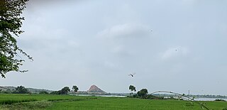
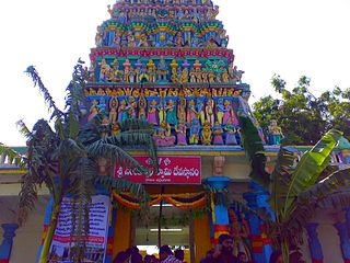
Puttur is a city in Dakshina Kannada district, in Karnataka state of India. It is the second largest and the fastest growing city in Dakshina Kannada district of Karnataka. The Puttur Shree Mahalingeshwara Temple is located here. Many Temples and Masjids are located here. Puttur central to the south eastern part of the district. Most people of the district depend on this city for their needs after Mangalore city.

Kushalanagara or Kushalnagar is a city located in the Kodagu district of the Indian state of Karnataka. Surrounded by Kaveri river, it is the gateway to Kodagu district. It also serves as the headquarters of Kushalanagar Taluk. By population, Kushalanagar is the second largest town in Kodagu district after Madikeri and the fastest developing town in the district. Kushalnagar is an important commercial centre in Kodagu.
Begumganj is a town and a municipality in Raisen district in the state of Madhya Pradesh, India. and is located on the Bhopal - Sagar National Highway 120 km away from Bhopal. It is one of the five divisions of the Raisen district.
Dhariawad is a census town in Pratapgarh district in the state of Rajasthan, India. It is the administrative headquarters for Dhariawad Tehsil.
Ganj Dundawara is a city and a municipal board in Kasganj District and the Aligarh zone in the state Uttar Pradesh, India. Sanjeev Kumar Gupta Mahajan, of the BJP He is current mayor of Nagar Palika Parishad Ganjdundwara
Gurh is a town and a nagar panchayat in Rewa district in the Indian state of Madhya Pradesh. It is 23 kilometres (14 mi) from Rewa city. It is also famous for the Bhairav Baba statue. Approx 20 kilometres (12 mi) eastward, a village, Tamara Desh, is located which is the endpoint of the Gurh nagar panchayat. The village is at a triangle of Gurh, Mauganj and Sidhi district. Its nearest towns are Manikwar 37 km and Mangawan 25 km and Rewa District 23 km.
Harapanahalli is a city and sub-divisional headquarter of Harapanahalli, Huvina Hadagali, and Kotturu Taluks; and the headquarter of Harapanahalli taluk in the Vijayanagara district. it is the second largest and fastest growing city in the Vijayanagara district in the Indian state of Karnataka. The famous Kannada humorist "Beechi" was born here. the place which connects Kalyana Karnataka with Middle Karnataka, Harapanahalli city have a very good transport connectivity, water facility and availability of quality education from Pre KG to Master's and it was the main revenue, trading and educational center since from Madras Presidency.
Kadathur is a panchayat town in Dharmapuri district in the Indian state of Tamil Nadu. Kadathur is situated 20 kilometres (12 mi) southeast of Dharmapuri. It is in the southern region of the district.

Lingasugur is a municipal town in Raichur district in the Indian state of Karnataka. There are many Temples, hills and forts (Quila). The festivals of Muharram and Maha Shivaratri are important here. Mudgal in Lingasugur taluk has a very ancient fort. It has often been mentioned in the autobiography of Philip Meadows Taylor. Lingasugur, then known as Chavani was the site of a major British cantonment in the region.
Mangawan is a town and a nagar panchayat in Rewa district in the Indian state of Madhya Pradesh. It is 30 km (19 mi) from the District headquarters of Rewa city. NH 7 and NH 27 goes through Mangawan. Prayagraj is 96 km (60 mi) on NH 27 and Varanasi is 220 km (140 mi) on NH 7 and Manikwar is 15 km (9.3 mi)

Meerpet–Jillelguda is a satellite city of Hyderabad and a municipal corporation in Rangareddy district of the Indian state of Telangana. The municipal corporation was formed after merging municipality of Meerpet and Jillelguda.
Mulgund or Mulagunda is a panchayat town in Gadag district in the Indian state of Karnataka.
Mundaragi is a municipal town in Gadag district in the Indian state of Karnataka. Mundargi is close to two district headquarters, being 36 kilometres (22 mi) from Gadag and 50 kilometres (31 mi) from Koppal. It is 99 kilometers from Gajendragad. Mundargi is also the taluka headquarter of the same name. Pin code of Mundaragi is 582118.
Naregal is a panchayat town in Gadag district in the Indian state of Karnataka. It is about 27 kilometers from Gajendragad and 28 kilometers from Gadag.
Naragunda is a town in Gadag district in the Indian state of Karnataka.
Pithora is a town and a nagar panchayat in Mahasamund district in the Indian state of Chhattisgarh.
Shiggaavi is a municipal town in Haveri district in the Indian state of Karnataka.

Singtam is a town which lies mostly in Gangtok District and partly in Pakyong District in the Indian state of Sikkim about 30 kilometres (19 mi) from the state capital Gangtok. The town lies on the banking of the rivers Teesta and Ranikhola, which join together just below the town. NH10 and NH510 meet in Singtam. The Indreni Bridge and Sherwani Bridge over the river Teesta are in the town. Singtam District Hospital, the district hospital of Pakyong District, lies at Golitar, Singtam.
Yalaburga also called Yelburga is a panchayat town in Koppal district in the Indian state of Karnataka.
Sirmaur is a town and a nagar panchayat in Rewa district in the Indian state of Madhya Pradesh. It is about 42 kilometers from Rewa.


