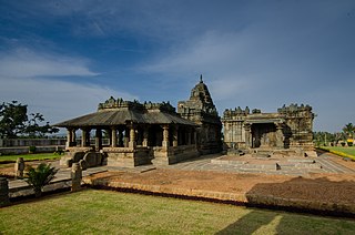
Gadag District is a district in the state of Karnataka, India. It was formed in 1997, when it was split from Dharwad District. As of 2011, it had a population of 1064570. The overall population increased by 13.14 percent from 1991 to 2001. Gadag District borders Bagalkot District on the north, Koppal District on the east, Bellary District on the southeast, Haveri District on the southwest, Dharwad District on the west and Belgaum District on the northwest. It features monuments from the Western Chalukya Empire. It has seven talukas/ tehsils: Gadag, Gajendragad, Ron, Shirhatti, Nargund, Lakshmeshwar and Mundargi.

Gadag-Betageri is a city municipal council in Gadag district in the state of Karnataka, India. It is the administrative headquarters of Gadag District. The original city of Gadag and its sister city Betageri have a combined city administration. The municipality of Gadag-Betageri has a population of 172,813 and an area of 54.0956 km². Kanaginahal of Gadag is the birthplace of the first co-operative society in Asia. The temples of Veera Narayana and Trikuteshwara are places of religious and historic importance.

Naregal is a panchayat town in Gadag district in the Indian state of Karnataka. It is about 27 kilometers from Gajendragad and 28 kilometers from Gadag.
Sudi, is a panchayat town in the Gadag District of Karnataka, India. It is about 30 km from Badami, 12 km from Gajendragad and 3 km from Itagi Bhimambika temple. In the past it was an important town of the Kalyani Chalukyas during 1000 AD. It is notable for rare stone carved monuments like Twin towered temple, Mallikarjuna temple and nagakunda , and few other structural temples. For long time these structures were abandoned, but recently they caught the eye of the Indian Archaeological Department.

Kuknoor is a city in Yelburga taluk in the Koppal District of the Indian state of Karnataka, which is located about 40 km northwest of Hospet and 7 km from the Mahadeva Temple in Itagi. Kuknoor is known for the temples of the Rashtrakutas and Chalukyas in the town, with the most notable being the Navalinga Temple.

Balehosur is a village in the Lakshmeshwar taluk of Gadag district in the Indian state of Karnataka.

Belavanaki is a village in southern state of Karnataka, India. It is located in Ron Taluka of Gadag district in Karnataka. It belongs to Belagavi Division.
Bellatti is a village in the southern state of Karnataka, India. It is located in the Shirhatti taluk of Gadag district in Karnataka.
Hirewaddatti is a village in the southern state of Karnataka, India. It is located in the Mundargi taluk of Gadag district in Karnataka.

Holealur also spelled as Holealooru is a village in the Ron taluk of Gadag district in the Indian state of Karnataka.

Hombal is a village in the southern state of Karnataka, India. It is located in the Gadag taluk of Gadag district.

Soratur also spelled as Soratooru is a village in the Gadag taluk of Gadag district in the Indian state of Karnataka. It is located in the Gadag taluk of Gadag district in Karnataka.
Suranagi is a village in the southern state of Karnataka, India. It is located in the Shirhatti taluk of Gadag district in Karnataka.

Abbigeri (Koppal) is a village in the southern state of Karnataka, India. It is located in the Koppal taluk of Koppal district.
Adarakatti is a village in the southern state of Karnataka, India. It is located in the Shirhatti taluk of Gadag district in Karnataka. Adarakatti is about one mile from Laxmeshwar. laxmeshwar is the closest commercial town.

Adavisomapur (Gadag) is a village in the southern state of Karnataka, India. It is located in the Gadag taluk of Gadag district in Karnataka.
Adrahalli is a village in the southern state of Karnataka, India. It is located in the Shirhatti taluk of Gadag District.

Akkigund is a village in the southern state of Karnataka, India. It is located in the Shirhatti taluk of Gadag district in Karnataka.

Savadu is a village in the Ron taluk of Gadag district in the Indian state of Karnataka.

Yalishirur is a village in the southern state of Karnataka, India. It is located in the Gadag taluk of Gadag district in Karnataka.


