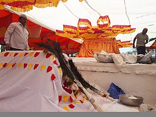
Kagal is a town in Kolhapur district of the Indian state of Maharashtra.
Hukkeri is a Town Municipal Council and taluka in Belgavi district in the Indian state of Karnataka.
Nipani is a third largest city, taluka in the Belgaum district in the state of Karnataka, India. It is an important agricultural and commercial trade and education centre in the district. Nipani and its surrounding villages are known for growing high-quality tobacco, which is rolled into beedis.

Athani is a town in the Belagavi district of Karnataka, India. It is 140 kilometers from the city of Belagavi, 70 kilometers from Vijayapura, 55 kilometers from Miraj, 100 kilometers from Kolhapur, and 624 kilometers from Bengaluru.
Benadi is a village in the North-Western region of Karnataka state near Maharashtra Border in India. It is located in the Chikodi taluka of Belgaum district in Karnataka. Before it was a part of Bombay State and Princely state of Kolhapur. It is a part of Twin Village Aadi-Benadi. People who has origin from this village are known as Benadikar.
Chinchali is a village in Raybag Taluk, Belagavi District, Karnataka, India. It is located near the state boundary with Maharashtra, approximately 84 kilometres north of the district seat Belgaum, and 10 kilometres northeast of the taluk seat Raibag. In the year 2011, the village has a population of 18,986.
Hirekudi is a village in the southern state of Karnataka, India. It is located in the Chikodi taluk of Belgaum district in Karnataka.
Kabbur is a town in the southern state of Karnataka, India. It is located in the Chikodi taluk of Belgaum district in Karnataka.
Khadaklat is a village in the southern state of Karnataka, India. It is located in the Chikodi taluk of Belgaum district in Karnataka.It is located at a distance of 88 km from the district headquarters, 18 km(11 miles) from tehsil Chikkodi, 14 km from nearest city Nippani and 40 km from Kolhapur city in Maharashtra State. It was part of the then Kapashi Sansthan, most part of which is now part of the Maharashtra state, while Khadaklat was included in Karnataka. Kannada is the administrative language. The village is well known for its communal harmony. Yearly 'Urus' celebration is a great symbol of Hindu-Muslim brotherhood with both the communities celebrating it with equal zeal and enthusiasm. Main temples in Khadaklat include Mahadev Mandir, Vashikan mandir, Biradev mandir, Virupakshling, Mahalaxmi & Vitthal-Rakhumai mandir. Dargah is in itself a master piece of Adilshahi architecture. Khadaklat is a hometown of veteran Marathi/Hindi actress SULOCHANA ji, she spent her childhood in gallis of Khadaklat.
Nandikurali is a village in the southern state of Karnataka, India. It is located in the Raybag taluk of Belgaum district in Karnataka.
Ugar Budruk is a village in the southern state of Karnataka, India. It is located in the Athni taluk of Belgaum district in Karnataka. It is around 38 km from the city of Sangli, Maharashtra. Ugar comes under the Kagwad constituency.
Belavanaki is a village in southern state of Karnataka, India. It is located in Ron Taluka of Gadag district in Karnataka. It belongs to Belagavi Division.
Jat is a town and taluka headquarters in Miraj subdivision of Sangli district in southern Maharashtra.

Badachi is a village in Belgaum district in the southern state of Karnataka, India. It is located in Athani Taluka of Belgaum District, near Bijapur -Athani Highway.
Chamakeri is a village in the Belgaum district of Athani Taluk in the southern Indian state of Karnataka.
Diggewadi is a village in Raybag taluk in Belgaum Panchayat in the southern state of Karnataka, India. The official language of Diggewadi is Kannada.
Kurli is a village in Sindhudurg District, the south easternmost district of Konkan Division, Maharashtra, India. Kurli is located 7.9 km from its Taluk Main Town Vaibhavwadi. Kurli is 33.6 km from its District main city, Oras. It is 307 km from its State Main City Mumbai. This is a culturally and historically important village. Kurli consists of wadis like Temb Wadi, Khadakwadi, Bajarpeth. Also it is famous because of the newly made Kurli dam.
Mungurwadi is a town in Gadhinglaj Taluka of Kolhapur district in Maharashtra, India. In 2001 it had a population of 3,271, but as of 2011, it has a population of 12,199. It is a major market place and the tenth largest settlement in Gadhinglaj taluka. Mungurwadi is about 24 km from Gadhinglaj, 29 km from second-largest settlement Kadgaon and 12 km from National Highway 48 (NH48).

Gadhinglaj is a taluka in Maharashtra. The city of Gadhinglaj is the taluka headquarters and Gadhinglaj subdivision headquarters as well. As of 2011, the taluka had a population of 874,015, of which 35% were urban. Languages spoken in this area are Marathi, Kannada, Hindi and English also. But the most-spoken language is Marathi, as Marathi is a state language.
Korhalli is a large village located in Almel Taluk in Bijapur District of Karnataka State, India.


