Sangal | |
|---|---|
Village | |
| Country | |
| State | Karnataka |
| District | Belgaum |
| Talukas | Ramdurg |
| Languages | |
| • Official | Kannada |
| Time zone | UTC+5:30 (IST) |
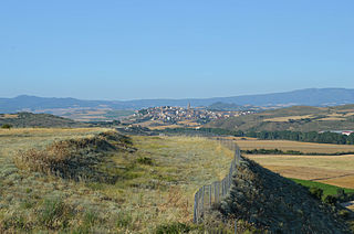
Sangal is a village in Belgaum district of Karnataka, India. [1]
Sangal | |
|---|---|
Village | |
| Country | |
| State | Karnataka |
| District | Belgaum |
| Talukas | Ramdurg |
| Languages | |
| • Official | Kannada |
| Time zone | UTC+5:30 (IST) |
Sangal is a village in Belgaum district of Karnataka, India. [1]

Borchgrevink Glacier is a large glacier in the Victory Mountains, Victoria Land, draining south between Malta Plateau and Daniell Peninsula, and thence projecting into Glacier Strait, Ross Sea, as a floating glacier tongue, the Borchgrevink Glacier Tongue, just south of Cape Jones. It was named by the New Zealand Geological Survey Antarctic Expedition, 1957–58, for Carsten Borchgrevink, leader of the British Antarctic Expedition, 1898–1900. Borchgrevink visited the area in February 1900 and first observed the seaward portion of the glacier.

Ansoain is a town and municipality located in the province and autonomous community of Navarra, northern Spain.
Mendigorría is a town and municipality located in the province and autonomous community of Navarre, northern Spain. The Battle of Mendigorría took place here in 1835.

Ens is a village in the Dutch province of Flevoland. It is a part of the municipality of Noordoostpolder, and lies about 10 km southeast of Emmeloord.

Hatod is a town and a nagar panchayat in Indore district in the Indian state of Madhya Pradesh.

Bracovce is a village and municipality in the Michalovce District in the Košice Region of Slovakia.

Davidov is a village and municipality in the Vranov nad Topľou District in the Prešov Region of Slovakia.
Beša is a village and municipality in Michalovce District in the Kosice Region of eastern Slovakia.
Tret is a village and union council of Murree Tehsil in the Rawalpindi District of Punjab, Pakistan. It is located in the south of the tehsil at 33°49′60″N 73°16′60″E and is bounded to the north by Khyber Pakhtunkhwa, to the north-east by Ghora Gali, to the east by Numbal and to the south by Angoori. During the British rule, Tret housed a few army installations and a Dak Bungalow

Byszewy is a village in the administrative district of Gmina Nowosolna, within Łódź East County, Łódź Voivodeship, in central Poland. It lies approximately 13 km (8 mi) north-east of the regional capital Łódź.
Wola Rowska is a village in the administrative district of Gmina Łaskarzew, within Garwolin County, Masovian Voivodeship, in east-central Poland. It lies approximately 6 kilometres (4 mi) north-east of Łaskarzew, 8 km (5 mi) south of Garwolin, and 61 km (38 mi) south-east of Warsaw.

The Pavana River is a notable river crossing the city of Pune, India. The river originates south of Lonavala from the Western Ghats, and flows a total of nearly 60 kilometres (37 mi) to meet Mula river in Pune City.
Keménfa is a village in Zala County, Hungary.
Paskalevo is a village in the municipality of Dobrichka, in Dobrich Province, in northeastern Bulgaria.

Drenova is a village in the municipality of Čajetina, western Serbia. According to the 2011 census, the village had a population of 96 inhabitants.
Rõstla is a village in Põltsamaa Parish, Jõgeva County in eastern Estonia.
Belgundi is a village in Belgaum district in the southern state of Karnataka, India. The local language is Marathi and the village is located at the state border of Karnataka and Maharashtra.
Oyratlı is a village in the District of Besni, Adıyaman Province, Turkey.
Gračac (pronounced [grǎtʃats] is a village in the municipality of Vrnjačka Banja, Serbia. According to the 2011 census, the village has a population of 1,833 people.

Kaynarca is a village in Bor district of Niğde Province, Turkey. It is at 37°50′N34°38′E to the east of Turkish state highway D805 which connects Niğde to the Mediterranean coast. The distance to Bor is 8 kilometres (5.0 mi) and to Niğde 15 kilometres (9.3 mi). The population of Kaynarca was 717 in 2011. The village is famous for white cabbage production.
Coordinates: 24°50′N73°38′E / 24.833°N 73.633°E
| | This article related to a location in Ramdurg taluk, Belgaum district, Karnataka, India is a stub. You can help Wikipedia by expanding it. |