Kolkata is the capital of the Indian state of West Bengal. Located on the east bank of the Hooghly River approximately 75 kilometres (47 mi) west of the border with Bangladesh, it is the principal commercial, cultural, and educational centre of East India, while the Port of Kolkata is India's oldest operating port and its sole major riverine port. The city is widely regarded as the "cultural capital" of India, and is also nicknamed the "City of Joy". According to the 2011 Indian census, it is the seventh most populous city; the city had a population of 4.5 million, while the suburb population brought the total to 14.1 million, making it the third-most populous metropolitan area in India. Recent estimates of Kolkata Metropolitan Area's economy have ranged from $60 to $150 billion making it third most-productive metropolitan area in India, after Mumbai and Delhi.
North Dumdum is a city and a municipality of North 24 Parganas district in the Indian state of West Bengal. It is a part of the area covered by Kolkata Metropolitan Development Authority (KMDA).
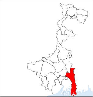
North 24 Parganas (abv. 24 PGS ) or sometimes North Twenty Four Parganas is a district in southern West Bengal, of eastern India. North 24 Parganas extends in the tropical zone from latitude 22º11'6" north to 23º15'2" north and from longitude 88º20' east to 89º5' east. It is bordered to Nadia by north, to Bangladesh by north and east, to South 24 Parganas and Kolkata by south and to Kolkata, Howrah and Hoogly by west. Barasat is the district headquarters of North 24 Parganas. North 24 Parganas is West Bengal's most populous district and also the most populated district in the whole of India. It is the tenth-largest district in the State by area.
Dum Dum is a city and a municipality of North 24 Parganas district in the Indian state of West Bengal. It is a part of the area covered by Kolkata Metropolitan Development Authority (KMDA).
Barrackpore Police Commissionerate or Barrackpore City Police, established on 20 January 2012, is a city police force with primary responsibilities in law enforcement and investigation within the area which roughly constitutes the Barrackpore subdivision, and is located within the northern part of Kolkata metropolitan area. The Commissionerate is part of the West Bengal Police, and is under the administrative control of Home Ministry of West Bengal. It was formed after bifurcation of the North 24 Parganas Police District, and has 12 police stations under its jurisdiction. Sanjoy Mukherjee was appointed as the first Commissioner of the Barrackpore Police Commissionerate.
In this Google map , published in the website of North Dum municipality, the outline of the limits of the municipal area is shown. On expanding the map, one can view the neighbourhoods and other locations in North Dumdum municipality.
North Dumdum municipality is included in the Kolkata Metropolitan Area for which the KMDA is the statutory planning and development authority.[4][5]
Kolkata Metropolitan Development Authority (KMDA) is the statutory planning and development authority for the Kolkata Metropolitan Area (KMA) in the state of West Bengal, India. The organisation used to be known as Calcutta Metropolitan Development Authority (CMDA) and retains the previous logo. KMDA is under the ministry of Municipal Affairs and Urban Development of West Bengal state government.
Sealdah is a neighbourhood of central Kolkata in Kolkata district in the Indian state of West Bengal.
Durga, identified as Adi Parashakti, is a principal and popular form of Hindu Goddess. She is the warrior goddess, whose mythology centres around combating evils and demonic forces that threaten peace, prosperity and dharma of the good. She is the fierce form of the protective mother goddess, willing to unleash her anger against wrong, violence for liberation and destruction to empower creation.
Kanchrapara is a city and a municipality of North 24 Parganas district in the Indian state of West Bengal. It is a part of the area covered by Kolkata Metropolitan Development Authority (KMDA).
Jetia is a census town in Barrackpore I CD Block in Barrackpore subdivision in North 24 Parganas district in the Indian state of West Bengal. It is a part of Kolkata Urban Agglomeration.
Halisahar is a city and a municipality of North 24 Parganas district in the Indian state of West Bengal. It is a part of the area covered by Kolkata Metropolitan Development Authority (KMDA).
Geography
Durganagar (West) has been a part of North Dum Dum Municipality since 2000, while Durganagar (East) belongs to Dum Dum Municipality. Previously it was known as Sultanpur. Its population is about 50,000. The literacy rate is 93% in females and 94% in males, which is much higher than the national average of 59.5%; 54% of the literates are male and 46% are female. Most of the people are Hindu. Only about 200–300 Muslims are residing to its eastern side.
This place is almost pollution free with much green all around. Facilities are adequate, with almost everything nearby. But this environment was seen some 10 years ago, now many flats and buildings are constructed by destroying many playground and ponds. The number of vehicles and people have increased in a huge form. Many trees have been cut down for the Construction. But there is no bus route from Drganagar station. Very few ponds are left as well as grounds. The sudden increase in the population has taken place mainly people from outsider are settling here due to its location and low real estate prices. But after the Delhi-road (Belghoria Expressway) the price per kata has taken the acclivity. Very old residential are still belong to this place and has contributed for its development and progress. Still there is very less opportunity for the place to develop since its roads can not be widened and transportation will be only gained from its boundaries and dependent on train will be always be there. The only transport to connect Durganagar to Airport 1 No. is rickshaws and auto-rickshaws. Sometimes, less than 1 km route takes time more than an hour to reach due to unavailability of auto-vehicles.
Climate
The climate is tropical — like the rest of the Gangetic West Bengal. The hallmark is the Monsoon — from early June to mid September. The weather remains dry during the winter (mid November to mid February) and humid during summer. The temperature is always approx. -2 °C less than the standard temperature of Kolkata's reading.
Temperature: 40 °C in May (max) and 10 °C in January (min)
Relative humidity: between 55% in March & 98% in July
Rainfall: 1,579mm (normal)[7]
Economy
Durganagar has demographics employed in different sectors like government jobs, businesses, private sectors etc.
Around a total of 32 lakh people from all around the city commute to Kolkata daily for work. In the Sealdah-Bangaon section there are 58 trains that carry commuters from 24 railway stations. In the Seadah-Hasnabad sections 32 trains carry commuters from 30 stations. [7]
It has its own post office, Allahabad Bank, AXIS Bank ATM, HDFC ATM,SBI Bank with ATM and UBI Bank with ATM a market and several playgrounds. Almost the whole population is constituted by 4-5 member small families with a single earning member. Many of them are servicemen (state/central govt. jobs), people working in IT industries and Doctors and Engineers. Residents commute daily to Kolkata through local train or by autoride to Airport which is a huge junction.
There are local markets but to avail most of the commodities like garments and jewelries people have to travel to Dum Dum Cant, the nearest place from Durganagar to have a big market.
Transport
Belghoria Expressway
Durganagar has seen its boost up to access easier transporting communicaton by means of Belghoria Expressway which plies nearby. Now anybody from Durganagar easily go to Howrah, Bally Hault, Dankuni, Kona Expressway, Dunlop, Dakhineswar, 1no Airport Gate, Madhyamgram, Rajharhat, Saltlake (Sector-V) and different other places through bus, taxi and other vehicles ply on this road. Other area people also access this road to different places from its bus stops Sreenagar–Durganagar and Badra–Durganagar.
This place is very near to several good schools in Kolkata. Some of them are:
Indira Gandhi Memorial High School
Julien Day School
St. Stephen's School
Kishore Bharati
Auxillium Convent
K K Hindu Academy
Christ Church Girls School
Aditya Academy
Motijheel Girls
Baidyanath High School
The literacy rate is 93% in female and 94% in male which is very higher than the national average of 59.5%; 54% of the literates are male and 46% are female.
Culture
The place is named after the goddess Durga. Almost 3–4 Durga puja's pandels are set up during the main festive season. The 2 main ancient Pujas are at Durganagar is "Durganagar adibasi brinda", 1st which is set up at the main (Durganagar sporting club ) playground near Durganagar X Roads (Chou rasta)it is organized by Durganagar Spoting Claub and 2nd one is Uttar Durganagar Odibasi brinda set up at the (Saraj sisu Uddan) near saha katgola it is mainly Organised by the members of Bandhu Milon sangha.
Durga Maa
he Durga Pujas now been taken by Kali Pujas. Every year there is a big Mela happened in Sporting Club and the club also organize a big New Year brash with renowned artists and fireworks at last.
People
Well-known personalities in Durganagar include the late Dr. Nirmal Kumar Roy Chowdhury, who founded Swarnamayi Smiriti Vidyalaya, Late Radhakanta Nandi a table musician who played with Late Manna Dey.[citation needed] Some other renowned persons are Late Josada Lal Saha, Late Chuni Saha, Late Madhab Chandra Saha,Hore Krishna Das, Late Sudhangshu Bikash Das and ex-goalkeeper of Indian Football Team Bhaskar Ganguly is from Durganagar.[citation needed]
Sports
Bhaskar Ganguly
Football (soccer) is a passion of all citizens,[citation needed] and home of te goalkeeper Bhaskar Ganguly. Football practice and training is often happening in the ground morning and evening.[citation needed] Cricket is also played.
Related Research Articles
Sodepur or Sodpur is a locality in Panihati Municipality of North 24 Parganas district in the Indian state of West Bengal. It is a part of the area covered by Kolkata Metropolitan Development Authority (KMDA).
Baranagar or Baranagore is a neighbourhood in Kolkata and a municipality of North 24 Parganas district in the Indian state of West Bengal. It is situated in the region of Greater Kolkata and therefore is a part of the area covered by Kolkata Metropolitan Development Authority (KMDA).
Jagatdal or Jagaddal is a locality in Bhatpara Municipality of North 24 Parganas district in the Indian state of West Bengal. It is a part of the area covered by Kolkata Metropolitan Development Authority (KMDA).
Birati is a locality in North Dumdum Municipality of North 24 Parganas district in the Indian state of West Bengal. It is a part of the area covered by Kolkata Metropolitan Development Authority (KMDA).
Garulia is a city and a municipality of North 24 Parganas district in the Indian state of West Bengal. It is a part of the area covered by Kolkata Metropolitan Development Authority (KMDA).
New Barrackpore is a city and a municipality of North 24 Parganas district in the Indian state of West Bengal. It is a part of the area covered by Kolkata Metropolitan Development Authority (KMDA).
North Barrackpur is a city and a municipality of North 24 Parganas district in the Indian state of West Bengal. It is a part of the area covered by Kolkata Metropolitan Development Authority (KMDA).
South Dumdum is a city and a municipality of North 24 Parganas district in the Indian state of West Bengal. It is a part of the area covered by Kolkata Metropolitan Development Authority (KMDA).
Belgharia is a locality in Kamarhati Municipality of North 24 Parganas district in the Indian state of West Bengal. It is a part of the area covered by Kolkata Metropolitan Development Authority (KMDA).
Ghola is a locality in Panihati Municipality of North 24 Parganas district in the Indian state of West Bengal. It is a part of the area covered by Kolkata Metropolitan Development Authority (KMDA).
Noapara is a locality in Baranagar Municipality of North 24 Parganas district in the Indian state of West Bengal. It is a part of the area covered by Kolkata Metropolitan Development Authority (KMDA).
Bangur Avenue is a locality in South Dumdum Municipality of North 24 Parganas district in the Indian state of West Bengal. It is a part of the area covered by Kolkata Metropolitan Development Authority (KMDA).
Nagerbazar is a locality in South Dumdum Municipality of North 24 Parganas district in the Indian state of West Bengal. It is a part of the area covered by Kolkata Metropolitan Development Authority (KMDA).
Agarpara is a locality in Panihati Municipality of North 24 Parganas district in the Indian state of West Bengal. It is a part of the area covered by Kolkata Metropolitan Development Authority (KMDA).
Sukchar is a locality in Panihati Municipality of North 24 Parganas district in the Indian state of West Bengal. It is a part of the area covered by Kolkata Metropolitan Development Authority (KMDA).
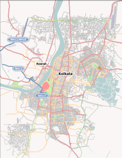
Durganagar is a neighbourhood of Kolkata in the North Dumdum municipality area, in the North 24 Parganas district in the state of West Bengal, India. It is located beside the Netaji Subhash Chandra Bose International Airport at Dum Dum. It is a town under the developmental jurisdiction of KMDA.
Teghari is a census town in Barrackpore II CD Block in Barrackpore subdivision of North 24 Parganas district in the state of West Bengal, India. It is a part of Kolkata Urban Agglomeration.
Nimta is a locality in North Dumdum Municipality of North 24 Parganas district in the Indian state of West Bengal. It is a part of the area covered by Kolkata Metropolitan Development Authority (KMDA).
Panpur is an outgrowth of Bhatpara in Barrackpore I CD Block in Barrackpore subdivision of North 24 Parganas district in the state of West Bengal, India. Panpur-Keutia is a gram panchayat. It is a part of Kolkata Urban Agglomeration.
↑ "District Statistical Handbook". North 24 Parganas 2013, Table 2.1. Department of Statistics and Programme Implementation, Government of West Bengal. Retrieved 11 June 2018.
This page is based on this Wikipedia article Text is available under the CC BY-SA 4.0 license; additional terms may apply. Images, videos and audio are available under their respective licenses.