A gram panchayat is the only grassroots-level of panchayati raj formalised local self-governance system in India at the village or small-town level, and has a sarpanch as its elected head.
Basirhat II is a community development block that forms an administrative division in Basirhat subdivision of North 24 Parganas district in the Indian state of West Bengal.
In India a community development block is a rural area administratively earmarked for development. The area is administered by a Block Development Officer, supported by several technical specialists and village level workers. A community development block covers several gram panchayats, local administrative unit at the village level.
The Chaita gram panchayat has six villages, named Ghona, Jagatpur, Kendua, Chaita, Malatipur and Kripalpur.
In Chaita village population of children with age 0-6 is 331 which makes up 13.85 % of total population of village. Average Sex Ratio of Chaita village is 967 which is higher than West Bengal state average of 950. Child Sex Ratio for the Chaita as per census is 1006, higher than West Bengal average of 956.
Chaita village has lower literacy rate compared to West Bengal. In 2011, literacy rate of Chaita village was 57.94 % compared to 76.26 % of West Bengal. In Chaita Male literacy stands at 59.14 % while female literacy rate was 56.69 %.
As per constitution of India and Panchyati Raaj Act, Chaita village is administrated by Sarpanch (Head of Village) who is elected representative of village.
A sarpanch is a decision-maker, elected by the village-level constitutional body of local self-government called the Gram Sabha in India. The sarpanch, together with other elected pancha (members), constitute the gram panchayat. The sarpanch is the focal point of contact between government officers and the village community.
Chandraketugarh Sahidullah Smriti Mahavidyalaya, established in 1997, is a general degree college in Berachampa. It offers undergraduate courses in arts. It is affiliated to West Bengal State University.
Taki Government College is public undergraduate college with about 6,000(Regular) & 3000 (Casual) students located in Taki, West Bengal, India.
Basirhat College, established in 1957, is a general degree college in Basirhat. It offers undergraduate courses in arts, commerce and sciences. It is affiliated to West Bengal State University.
High schools nearest to Chaita
Kaderia High Madrasa
Malatipur High School
Gopalpur Popular Academy
Gopalpur Girl's High School
Transport
Malatipur is the nearest railway station of Chaita. Haroa - Gopalpur More road ( STATE HIGHWAY NO 03 ) passed through edge of this village.
North 24 Parganas (abv. 24 PGS ) or sometimes North Twenty Four Parganas is a district in southern West Bengal, of eastern India. North 24 Parganas extends in the tropical zone from latitude 22º11'6" north to 23º15'2" north and from longitude 88º20' east to 89º5' east. It is bordered to Nadia by north, to Bangladesh by north and east, to South 24 Parganas and Kolkata by south and to Kolkata, Howrah and Hoogly by west. Barasat is the district headquarters of North 24 Parganas. North 24 Parganas is West Bengal's most populous district and also the most populated district in the whole of India. It is the tenth-largest district in the State by area.
Bidhannagar or Salt Lake is a city and a municipal corporation of North 24 Parganas district in the Indian state of West Bengal. It is a part of the area covered by Kolkata Metropolitan Development Authority (KMDA). It was developed between 1958 and 1965 to accommodate the burgeoning population of Kolkata.
Chevella is a town, mandal and suburb of Hyderabad in Ranga Reddy district of the Indian state of Telangana. It is the headquarters of surrounding villages with many government establishments like Judicial court, Revenue Division Office, Acp office under Cyberabad Metropolitan Police. It is also an Educational hub with many Schools, Junior colleges, Engineering colleges, Business schools etc. There are many Hospitals located along with a medical college Dr. Patnam Reddy Institute of Medical Sciences. It has become a part of Hyderabad Metropolitan Development Authority.
Chanchal subdivision is an administrative subdivision of the Malda district in the Indian state of West Bengal.
Malda Sadar subdivision is an administrative subdivision of the Malda district in the Indian state of West Bengal.
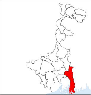
Basirhat subdivision is an administrative subdivision of the North 24 Parganas district in the Indian state of West Bengal.
Swarupnagar is a community development block that forms an administrative division in Basirhat subdivision of North 24 Parganas district in the Indian state of West Bengal.
Minakhan is a community development block that forms an administrative division in Basirhat subdivision of North 24 Parganas district in the Indian state of West Bengal.
Haroa is a community development block that forms an administrative division in Basirhat subdivision of North 24 Parganas district in the Indian state of West Bengal.
Panchla is a community development block that forms an administrative division in Howrah Sadar subdivision of Howrah district in the Indian state of West Bengal.
Debagram is a village under Kaliganj Police Station of Krishnanagar Sadar subdivision in Nadia district in the Indian state of West Bengal. The village is located on National Highway 34. The village is served by Debagram Railway Station that lies on the Sealdah–Ranaghat - Lalgola line under Eastern Railway.
Naldahari is a small village located in the Murshidabad district of the state of West Bengal, India. It is a part of Lalgola Block near the Indo-Bangladesh international border. It is situated about 225 kilometres (140 mi) north of Kolkata, near the head of the Ganges delta.
Shipur is a fast growing village under Egra I community development block of Purba Medinipur district in the state of West Bengal, India. Famous for its annual Charak Puja, this village has well-developed social facilities like schools, post office, market, telecommunication etc. A health centre is also proposed for this village. As per Constitution of India and Panchayati Raj Act, Shipur village is administrated by Sarpanch who is the elected representative of village. Shipur is under the administration of Sahara Gram Panchayat.
Tilkhoja is a village and Gram Panchayat located in Moyna Tehsil/ Block of Purba Medinipur district in the Indian state of West Bengal hosting 1318 families. Moyna is the nearest town.
Bheduasole is a medium sized Gram Panchayat and village in Indpur Block in Bankura District of the Indian state of West Bengal. It is located in Burdwan Division. It is located 23 KM towards west from District head quarters Bankura and 187 KM from State capital Kolkata.
Iswarchandrapur is a village in Hanspukuria Gram Panchayat in Tehatta II CD Block in Tehatta subdivision of Nadia district. It is situated beside the river Jalangi.
Jagatpur is a village in Shaheed Bhagat Singh Nagar district of Punjab State, India. It is located 2.2 kilometres (1.4 mi) away from postal head office Mukandpur, 9.3 kilometres (5.8 mi) from Banga, 12 kilometres (7.5 mi) from district headquarter Shaheed Bhagat Singh Nagar and 113 kilometres (70 mi) from state capital Chandigarh. The village is administrated by Sarpanch an elected representative of the village.
Jagatpur Theh is a village in Shaheed Bhagat Singh Nagar district of Punjab State, India. It is located 15 kilometres (9.3 mi) away from Banga, 10 kilometres (6.2 mi) from Phagwara, 26 kilometres (16 mi) from district headquarter Shaheed Bhagat Singh Nagar and 119 kilometres (74 mi) from state capital Chandigarh. The village is administrated by Sarpanch an elected representative of the village.
This page is based on this Wikipedia article Text is available under the CC BY-SA 4.0 license; additional terms may apply. Images, videos and audio are available under their respective licenses.