
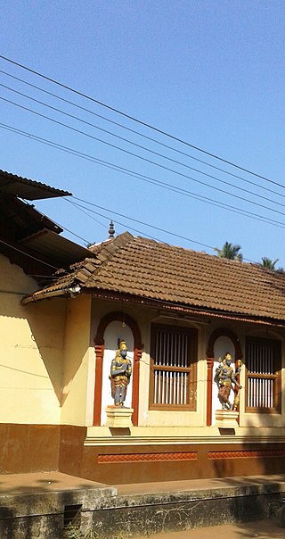
Kanara or Canara, also known as Karavali is the historically significant stretch of land situated by the southwestern coast of India, alongside the Arabian Sea in the present-day Indian state of Karnataka. The subregion comprises three civil districts, namely: Uttara Kannada, Udupi, and Dakshina Kannada. Kassergode was included prior to the States Reorganisation Act.

Dakshina Kannada district is located in the state of Karnataka in India, with its headquarters in the coastal city of Mangalore. It is part of the larger Tulu Nadu region. The district covers an area nestled in between the Western Ghats to its east and the Arabian Sea to its west. Dakshina Kannada receives abundant rainfall during the Indian monsoon. It is bordered by Udupi district to the north, Chikmagalur district to the northeast, Hassan district to the east, Kodagu to the southeast and Kasaragod district of Kerala to the south. According to the 2011 census of India, Dakshina Kannada district had a population of 2,083,625. It is the only district in Karnataka state to have all modes of transport like road, rail, water and air due to the presence of a major hub, Mangalore. This financial district is also known as the Cradle of Indian banking.
Bantwal is a suburb of Mangalore in Dakshina Kannada district, Karnataka, India, and the headquarters of Bantwal taluk. It is located 25 km (16 mi) East of Mangalore city center. BC Road-Kaikamba of Bantwal is one of the fastest developing areas in Dakshina Kannada district of Karnataka.
Thodikana is an Indian village nestled in the foothills of the Western Ghats in southern Karnataka. It is in the Sullia taluk of Dakshina Kannada district, about 100 km from Mangalore city. This village has much greenery and attracts visitors with its cultural and natural sites.
Hosabettu is a village located in Mangalore Taluk of Dakshina Kannada District in the Indian state of Karnataka. It is located near Moodbidri and Mangalore.
Talapady is a village near Mangaluru city in Ullal taluk of Dakshina Kannada district of Karnataka state in India. Talapady borders the states of Karnataka and Kerala. National Highway 66 passes through Talapady which is 14 km (9 mi) south of Mangalore city. The Karnataka-Kerala checkpost border is situated at Talapady. Another village Thalapady, Kasargod which is situated near Talapady in Manjeswar crossing Kerala border.
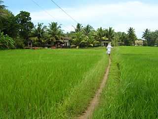
Pavanje is a village in Dakshina Kannada district of Karnataka state, India. It is sited on the north bank of the Nandini River, adjoining National Highway 66 between Udupi and Mangaluru. It lies just outside of Mangalore city and close to Mukka from where the Mangaluru city northern limits start. Pavanje bridge is the entrance to Mangalore city from north. Pavanje lies to south of Haleangadi. The Arabian sea is on west of this village. The village has lush green paddy fields and coconut plantations.
Aranthodu is a village in Sulya Taluk of Dakshina Kannada district in Karnataka. It is located 12 km south of Sullia town, towards Madikeri and Mysore. It is located at a distance of 97 km south-east of Mangalore city.
Addur is a village in the southern state of Karnataka, India. It is located in the Mangalore taluk of Dakshina Kannada district.
Aletty is a village in the southern state of Karnataka, India. It is located in the Sullia taluk of Dakshina Kannada district in Karnataka.
Golthamajal is a village in the southern state of Karnataka, India. It is located in the Bantwal taluk of Dakshina Kannada district in Karnataka. It is situated at a distance of 34 km towards the east of Mangalore city.
Harekala is a village in the southern state of Karnataka, India. It is located in the Mangalore taluk of Dakshina Kannada district.
Manchi is a village in the southern state of Karnataka, India. The village has most of the lands under agriculture. Over 90% of people are literate. nearest town is B.C Road which is 12 km from Manchi. In Manchi there is a primary school established in 1950 and a high school. Roads connect B.C Road, Vitla, Mangalore and Kalladka. It is located in the Bantwal taluk of Dakshina Kannada district in Karnataka. The office of the gram panchayath is in Kukkaje.
Manjanady is a village in the Indian state of Karnataka, India. It is located in the Mangalore taluk of Dakshina Kannada district in Karnataka.
Sampaje is a village in the southern state of Karnataka, India. It is located in the Madikeri taluk of Kodagu district in Karnataka. It lies on NH-275 which connects Mangalore city in Dakshina Kannada district with Madikeri town in Kodagu distrtict. It is a border village in between Kodagu and Dakshina kannada.
Thiruvail is a village in the southern state of Karnataka, India. It is located in the Mangalore taluk of Dakshina Kannada district.
Pavoor is a village in the southern state of Karnataka, India. It is located in the Mangalore taluk of Dakshina Kannada district.
Adyapady is a village in the southern state of Karnataka, India. It is located in the Mangalore taluk of Dakshina Kannada district.
Mangalore taluk is a taluk (subdistrict) in the Dakshina Kannada district, Karnataka on the western coast of India. Mangalore is the administrative headquarters of the taluk. It is made up of Mangalore City Corporation, Ullal City Municipality that govern the Mangalore Urban Agglomeration, Other than these there are forty-nine panchayat villages in Mangalore taluk. It covers an area of 834 square kilometres (322 sq mi). Mangalore, Ullal and Moodabidri are the top 3 highly populated towns.
Subrahmanya Road is a railway station on Mangalore–Hassan–Mysore line. It is located in Dakshina Kannada district, Karnataka state, India. The station consists of three platforms, which are not well sheltered.

