
Hall Gate is a street in the town centre of Doncaster, in South Yorkshire, England.
Hall Gate is a street in the town centre of Doncaster, in South Yorkshire, England.
The street originated as the alternative route of Ermine Street, passing by the fort of Danum. When new fortifications were built in the 12th century, Hall Gate formed the section of the street leading south-east away from the town, with one of four stone gates at the town end of the road. [1] It rises about 5 meters from north-west to south-east, forming a gentle hill. [2] Tilli's Cross was erected at the south-east end of the street, probably in the 12th century. In 1793, the brow of the hill was lowered, and the cross was demolished, with a replica built on a site further south-east, along South Parade. [3]
The street formed part of the Great North Road, and then the A1 road, until the A1(M) motorway was constructed as a by-pass. It continues the route of the town's High Street, and maintains the same width, and although it lacks any grand civic or commercial buildings, it does retain several Georgian houses. Doncaster Metropolitan Borough Council describes the street as a "secondary retail area" with a "down at heel" appearance, [2] this often being ascribed to the Frenchgate Shopping Centre taking business away from less central areas of the town. [4] In 2020, the council made the street one-way, in an attempt to make it more pedestrian-friendly. [5]
The street runs south-east, from the junction of High Street, Cleveland Street and Silver Street, to the junction of South Parade, Thorne Road and Waterdale. Prince's Street and Lazarus Court lead off its north-east side, and a footpath to Wood Street leads off its south-west side.
Notable buildings on the north east side of the street include the early-19th century 5, and 7 and 7A Hall Gate; [6] [7] mid-19th century 6 Hall Gate; [8] late-18th century 8, and 9 Hall Gate; [9] [10] 18 Hall Gate, built about 1790; [11] the Hall Gate United Reformed Church, built in 1804; [12] and the early-19th century 26, and 27 Hall Gate; [13] [14]
On the south-west side of the street are the early-19th century 53 and 54, 52, and 51 Hall Gate; [15] [16] [17] 50 Hall Gate, built about 1800; [18] the late-18th century 40, 41 and 41A Hall Gate; [19] and the mid-18th century Georgian House. [20]

Doncaster is a city in South Yorkshire, England. Named after the River Don, it is the administrative centre of the larger City of Doncaster, and is the second largest settlement in South Yorkshire after Sheffield. Noted for its horse racing and railway history, it is situated in the Don Valley on the western edge of the Humberhead Levels and east of the Pennines. The urban subdivision had a population of 113,566 at the 2021 census, whilst the City of Doncaster metropolitan borough had a population of 308,106.
Richmond is a town in south-west London, 8.2 miles (13.2 km) west-southwest of Charing Cross. It stands on the River Thames, and features many parks and open spaces, including Richmond Park, and many protected conservation areas, which include much of Richmond Hill. A specific Act of Parliament protects the scenic view of the River Thames from Richmond.
Retford, also known as East Retford, is a market town in the Bassetlaw District in Nottinghamshire, England. It lies on the River Idle and the Chesterfield Canal. Retford is located 26 miles (42 km) east of Sheffield, 23 miles (37 km) west of Lincoln and 31 miles (50 km) north-east of Nottingham. The population at the 2021 Census was 23,740. Retford railway station is on the East Coast Main Line and the town is bypassed by the A1 road.

Bawtry is a market town and civil parish in the City of Doncaster in South Yorkshire, England. It lies 8 miles (13 km) south-east of Doncaster, 10 miles (16 km) west of Gainsborough and 8 miles (13 km) north-west of Retford, on the border with Nottinghamshire and close to Lincolnshire. The town was historically divided between the West Riding of Yorkshire and Nottinghamshire. Its population of 3,204 in the 2001 UK census increased to 3,573 in 2011, and was put at 3,519 in 2019. Nearby settlements include Austerfield, Everton, Scrooby, Blyth, Bircotes and Tickhill.

Bassetlaw is a local government district in north Nottinghamshire, England. Its council is based in the town of Worksop; the other towns in the district are Retford, Tuxford and Harworth Bircotes. The district also contains numerous villages and surrounding rural areas.
Wiveliscombe is a town and civil parish in Somerset, England, situated 9 miles (14 km) west of Taunton. The town has a population of 2,893. The Square, fronted by several listed structures, held the former market. The parish includes the nearby hamlet of Maundown.

Ewell is a town in the Borough of Epsom and Ewell in Surrey, England. It is approximately 12 miles (19 km) south of central London and 2 miles (3.2 km) northeast of Epsom. In the 2011 Census, the town had a population of 34,872. The majority of which (73%) is in the ABC1 social class, except the Ruxley Ward that is C2DE.

Richmond Green is a recreation area near the centre of Richmond, a town of about 20,000 inhabitants situated in south-west London. Owned by the Crown Estate, it is leased to the London Borough of Richmond upon Thames. The Green, which has been described as "one of the most beautiful urban greens surviving anywhere in England", is roughly square in shape and its open grassland, framed with broadleaf trees, extends to roughly twelve acres. On the north-east side there is also a smaller open space called Little Green. Richmond Green and Little Green are overlooked by a mixture of period townhouses, historic buildings and municipal and commercial establishments including the Richmond Lending Library and Richmond Theatre.
Sprotbrough and Cusworth is a civil parish in the City of Doncaster in South Yorkshire, England, with most of its settlements on the western edge of the Doncaster built-up area. It lies between 1 mile (1.6 km) and 4 miles (6.4 km) to the west of Doncaster and is split by the A1(M) motorway. It had a population of 12,166 in 2001 and 12,134 at the 2011 Census. The parish covers some of Doncaster's outlying western suburbs and commuter belt including the villages of Sprotbrough, Cusworth, and a small part of Scawsby, in addition to several rural hamlets and farmsteads.

Dunham Massey is a civil parish in the Metropolitan Borough of Trafford, Greater Manchester, England. The parish includes the villages of Sinderland Green, Dunham Woodhouses and Dunham Town, along with Dunham Massey Hall and Park, formerly the home of the last Earl of Stamford and owned by the National Trust since 1976. Dunham Massey is in the historic county of Cheshire, but since 1974 has been part of Trafford Metropolitan Borough; the nearest town is Altrincham. At the 2001 census, the parish had a population of 475.

Aston is a residential village in the Metropolitan Borough of Rotherham, South Yorkshire, England. The village falls within the Holderness ward of the borough. Aston is approximately 2 miles (3 km) from Rother Valley Country Park.

Bath and North East Somerset is a unitary authority created on 1 April 1996, following the abolition of the County of Avon, which had existed since 1974. Part of the ceremonial county of Somerset, Bath and North East Somerset occupies an area of 220 square miles (570 km2), two-thirds of which is green belt. It stretches from the outskirts of Bristol, south into the Mendip Hills and east to the southern Cotswold Hills and Wiltshire border. The city of Bath is the principal settlement in the district, but BANES also covers Keynsham, Midsomer Norton, Radstock and the Chew Valley. The area has a population of 170,000, about half of whom live in Bath, making it 12 times more densely populated than the rest of the area.
There are more than 130 listed buildings in the town and borough of Eastbourne, a seaside resort on the coast of East Sussex in England. Eastbourne, whose estimated population in 2011 was 99,400, grew from a collection of farming hamlets into a fashionable holiday destination in the mid-19th century; close attention was paid to urban planning and architecture, and the main landowners the Dukes of Devonshire placed restrictions on the types and locations of development. As a result, much of the resort retains its "basic motif" of late Regency and early Victorian houses, hotels and similar buildings, and also has an extensive stock of 19th-century churches. Coastal fortifications have been strategically important for centuries, and structures such as Martello towers and fortresses have survived to be granted listed status. A few older buildings—priories, manor houses and the ancient parish church—are also spread throughout the borough, whose boundaries take in the dramatic cliffs at Beachy Head and its two listed lighthouses.

There are 48 Grade I listed buildings in Greater Manchester, England. In the United Kingdom, the term listed building refers to a building or other structure officially designated as being of special architectural, historical or cultural significance; Grade I structures are those considered to be "buildings of exceptional interest". In England, the authority for listing under the Planning Act 1990 rests with Historic England, a non-departmental public body sponsored by the Department for Culture, Media and Sport.

Castle Gate is an historic street near the centre of the English city of Nottingham. The street runs uphill, from a junction with Low Pavement, Lister Gate and Albert Street in the city centre, to Castle Road, near to the entrance to Nottingham Castle. The street is noted for its Georgian houses, many of which are listed buildings. There is also a complex of rock-cut caves, under buildings at the lower end of the street, which is a scheduled monument.

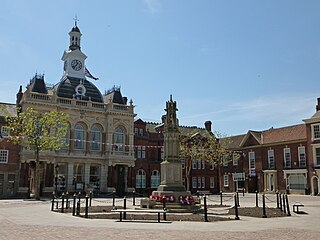
Doncaster Market lies in the centre of the city of Doncaster, in South Yorkshire, England.
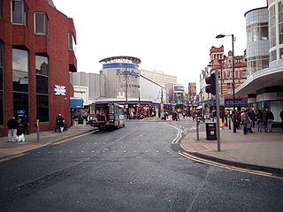
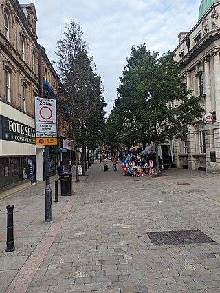
St Sepulchre Gate is a pedestrianised street in the city centre of Doncaster, in South Yorkshire, England.

High Street is a street in the city centre of Doncaster, in South Yorkshire, England.
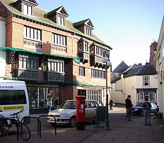
Baxter Gate is a pedestrianised street in the city centre of Doncaster, in South Yorkshire, England.
Town ward is a ward in the metropolitan borough of Doncaster, South Yorkshire, England. The ward contains 105 listed buildings that are recorded in the National Heritage List for England. Of these, two are listed at Grade I, the highest of the three grades, two are at Grade II*, the middle grade, and the others are at Grade II, the lowest grade. The ward contains the central part of the town of Doncaster. Most of the listed buildings in the ward are houses and associated structures, shops, offices, hotels and public houses, commercial buildings, market buildings, and public buildings. The town has an important railway history, and buildings associated with this, including some in Doncaster Works and Doncaster railway station are listed. The other listed buildings include a lock on the River Don Navigation, churches and associated structures, a former theatre, a war memorial, and a former swimming pool and health club.