Hamri (Algeria)

Last updated
Hamri
Commune and town
DZ 48 El Hamri.svg
Algeria location map.svg
Red pog.svg
Hamri
Coordinates: 36°1′16″N0°41′57″E / 36.02111°N 0.69917°E / 36.02111; 0.69917
CountryFlag of Algeria.svg  Algeria
Province Relizane Province
Time zone CET (UTC+1)

Hamri is a town and commune in Relizane Province, Algeria. [1]

Communes of Algeria administrative division of Algeria

The municipalities of Algeria form the second level of administrative subdivisions of Algeria. As of 2002, there were 1,541 municipalities in the country.

Relizane Province Province in Algeria

Relizane is a province (wilaya) of Algeria. Relizane is the capital. Other localities include Bendaoud, Bouzegza, Hamri, Kalaa, Mazouna and Zemmoura.

Algeria country in North Africa

Algeria, officially the People's Democratic Republic of Algeria, is a country in the Maghreb region of North Africa. The capital and most populous city is Algiers, located in the far north of the country on the Mediterranean coast. With an area of 2,381,741 square kilometres (919,595 sq mi), Algeria is the tenth-largest country in the world, the world's largest Arab country, and the largest in Africa. Algeria is bordered to the northeast by Tunisia, to the east by Libya, to the west by Morocco, to the southwest by the Western Saharan territory, Mauritania, and Mali, to the southeast by Niger, and to the north by the Mediterranean Sea. The country is a semi-presidential republic consisting of 48 provinces and 1,541 communes (counties). It has the highest human development index of all non-island African countries.

Related Research Articles

Achacha District District in Mostaganem, Algeria

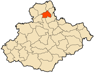
Achacha is a district situated within Mostaganem Province, lying on the Mediterranean Sea, northern Algeria. The district was named after its capital, Achacha.

Sidi Bellater Commune and town in Mostaganem Province, Algeria

Sidi Bellater or Sidi Belattar is a town and commune in Mostaganem Province, Algeria. It is located in Aïn Tédelès District. According to the 1998 census it has a population of 6,670.

Tazgait Commune and town in Mostaganem Province, Algeria

Tazgait is a town and commune in Mostaganem Province, Algeria. It is located in Sidi Ali District. According to the 1998 census it has a population of 8,763.

Ouled Malah is a town and commune in Mostaganem Province, Algeria. It is located in Sidi Ali District. According to the 1998 census it has a population of 8,948.

Nékmaria Commune and town in Mostaganem Province, Algeria

Nékmaria is a town and commune in Mostaganem Province, Algeria. It is located in Achacha District. According to the 1998 census it has a population of 9,104.

Khadra Commune and town in Mostaganem Province, Algeria

Khadra is a town and commune in Mostaganem Province, Algeria. It is located in Achacha District. According to the 1998 census it has a population of 12,294.

Ouled Boughalem is a town and commune in Mostaganem Province, Algeria. It is located in Achacha District. According to the 1998 census it has a population of 11,886.

Aïn Boudinar is a town and commune in Mostaganem Province, Algeria. It is located in Kheïr Eddine District. According to the 1998 census it has a population of 5,241.

Sidi Lakhdar, Mostaganem Commune and town in Mostaganem Province, Algeria

Sidi Lakhdar is a town and commune in Mostaganem Province, Algeria, about 300 km westof the capital, Algiers. It is the capital of Sidi Lakhdar District. According to the 1998 census, it has a population of 30,950. Under French colonial rule, the town was known as Lapasset. It changed its name in 1962.

Beni Zentis is a town and commune in Relizane Province, Algeria.

Mazouna Commune and town in Relizane Province, Algeria

Mazouna is a town and commune in Relizane Province, Algeria, also once was the capital of the ottomans west province,it is known by its vintage mosque "elzawya" which played the role of a well respected school for teaching the Quran.

Mediouna, Algeria Commune and town in Relizane Province, Algeria

Mediouna is a town and commune in Relizane Province, Algeria. famous men: Hayoute houcine

Ouarizane Commune and town in Relizane Province, Algeria

Ouarizane is a town and commune in Relizane Province, Algeria.

Sidi M'hamed Ben Ali is a town and commune in Relizane Province, Algeria.

Sidi Mhamed Benaouda Commune and town in Relizane Province, Algeria

Sidi M'hamed Benaouda is a town and commune in Relizane Province, Algeria.

Harbil is a town and commune in Sétif Province in north-eastern Algeria.

Akbil is a town and commune in Tizi Ouzou Province in northern Algeria.

Béni-Aïssi is a town and commune in Tizi Ouzou Province in northern Algeria.

El Guettar, Algeria Commune and town in Relizane Province, Algeria

El Guettar is a town and commune in Relizane Province, Algeria.

Al-Dana, Maarrat al-Numan Village in Idlib, Syria

Al-Dana, Maarrat al-Nu'man is a Syrian village located in Maarrat al-Nu'man Nahiyah in Maarrat al-Nu'man District, Idlib. According to the Syria Central Bureau of Statistics (CBS), Al-Dana, Maarrat al-Nu'man had a population of 2607 in the 2004 census.

References

  1. "Communes of Algeria". Statoids. Archived from the original on 29 November 2010. Retrieved December 12, 2010.

Coordinates: 36°01′16″N0°41′57″E / 36.02111°N 0.69917°E / 36.02111; 0.69917

Geographic coordinate system Coordinate system

A geographic coordinate system is a coordinate system that enables every location on Earth to be specified by a set of numbers, letters or symbols. The coordinates are often chosen such that one of the numbers represents a vertical position and two or three of the numbers represent a horizontal position; alternatively, a geographic position may be expressed in a combined three-dimensional Cartesian vector. A common choice of coordinates is latitude, longitude and elevation. To specify a location on a plane requires a map projection.