
Georgian architecture is the name given in most English-speaking countries to the set of architectural styles current between 1714 and 1830. It is named after the first four British monarchs of the House of Hanover, George I, George II, George III, and George IV, who reigned in continuous succession from August 1714 to June 1830.

Mayfair is an area of London, England, in the City of Westminster. It is in Central London and part of the West End. It is between Oxford Street, Regent Street, Piccadilly and Park Lane and one of the most expensive districts in the world.
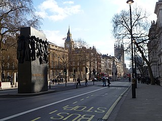
Whitehall is a road and area in the City of Westminster, Central London, England. The road forms the first part of the A3212 road from Trafalgar Square to Chelsea. It is the main thoroughfare running south from Trafalgar Square towards Parliament Square. The street is recognised as the centre of the Government of the United Kingdom and is lined with numerous departments and ministries, including the Ministry of Defence, Horse Guards and the Cabinet Office. Consequently, the name "Whitehall" is used as a metonym for the British civil service and government, and as the geographic name for the surrounding area.
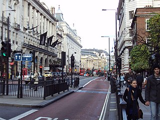
Piccadilly is a road in the City of Westminster, London, England, to the south of Mayfair, between Hyde Park Corner in the west and Piccadilly Circus in the east. It is part of the A4 road that connects central London to Hammersmith, Earl's Court, Heathrow Airport and the M4 motorway westward. St James's is to the south of the eastern section, while the western section is built up only on the northern side. Piccadilly is just under 1 mile (1.6 km) in length, and it is one of the widest and straightest streets in central London.
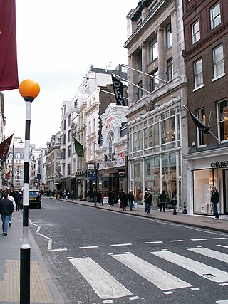
Bond Street in the West End of London links Piccadilly in the south to Oxford Street in the north. Since the 18th century the street has housed many prestigious and upmarket fashion retailers. The southern section is Old Bond Street and the longer northern section New Bond Street, a distinction not generally made in everyday usage.

Pall Mall is a street in the St James's area of the City of Westminster, Central London. It connects St James's Street to Trafalgar Square and is a section of the regional A4 road. The street's name is derived from pall-mall, a ball game played there during the 17th century, which in turn is derived from the Italian pallamaglio, literally "ball-mallet".

Grosvenor Square is a large garden square in the Mayfair district of Westminster, Greater London. It is the centrepiece of the Mayfair property of the Duke of Westminster, and takes its name from the duke's surname "Grosvenor". It was developed for fashionable residences in the 18th century. In the 20th it had an American and Canadian diplomatic presence, and currently is mixed use, commercial.

Great Marlborough Street is a thoroughfare in Soho, Central London. It runs east of Regent Street past Carnaby Street towards Noel Street.

James Gibbs was a Scottish architect. Born in Aberdeen, he trained as an architect in Rome, and practised mainly in England. He is an important figure whose work spanned the transition between English Baroque architecture and Georgian architecture heavily influenced by Andrea Palladio. Among his most important works are St Martin-in-the-Fields, the cylindrical, domed Radcliffe Camera at Oxford University, and the Senate House at Cambridge University.

Waterlow Park is a 26-acre (11 ha) park in the southeast of Highgate Village, in north London. It was given to the public by Sir Sydney Waterlow, as "a garden for the gardenless" in 1889. It is located to the west of Swain's Lane.

Dr Johnson's House is a writer's house museum in London in the former home of the 18th-century English writer and lexicographer Samuel Johnson. The house is a Grade I listed building.
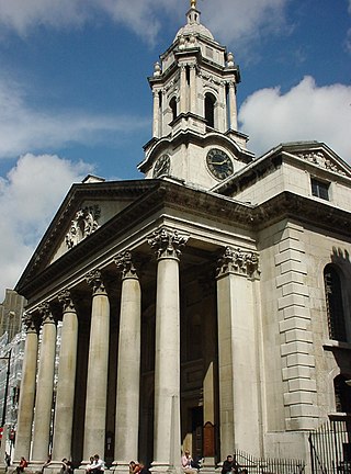
St George's, Hanover Square, is an Anglican church, the parish church of Mayfair in the City of Westminster, central London, built in the early eighteenth century as part of a project to build fifty new churches around London. The church was designed by John James; its site was donated by General William Steuart, who laid the first stone in 1721. The building is one small block south of Hanover Square, near Oxford Circus. Because of its location, it has frequently been the venue for society weddings.

St Benet Fink was a church and parish in the City of London located on what is now Threadneedle Street. Recorded since the 13th century, the church was destroyed in the Great Fire of London of 1666, then rebuilt to the designs of Sir Christopher Wren. The Wren church was demolished between 1841 and 1846.
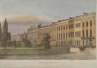
Portman Square is a garden square in Marylebone, central London, surrounded by townhouses. It was specifically for private housing let on long leases having a ground rent by the Portman Estate, which owns the private communal gardens. It marks the western end of Wigmore Street, which connects it to Cavendish Square to the east.

Conduit Street is a street in Mayfair, London. It connects Bond Street to Regent Street.
Monmouth House was a 17th-century mansion in Soho Square built for the Duke of Monmouth, the oldest illegitimate son of King Charles II. After the Duke's execution for attempting to lead a rebellion against the unpopular Catholic successor to Charles, James II, the house was owned by the Bateman family and loaned to various important people including the French ambassador before being demolished in 1773.

Devereux Court, a street in the City of Westminster located just south of the Strand and east of Essex Street, is completely pedestrianised. This narrow lane is lined with well-preserved seventeenth-century buildings. The court's distinctive dog-leg layout has remained unchanged since its establishment in the 1670s on the grounds of Essex House, a stately home renowned for its expansive gardens.

South Audley Street is a major shopping street in Mayfair, London. It runs north to south from the southwest corner of Grosvenor Square to Curzon Street.
This is a list of the etymology of street names in the London district of Mayfair, in the City of Westminster. It utilises the generally accepted boundaries of Mayfair viz. Marble Arch/Cumberland Gate and Oxford Street to the north, Regent Street to the east, Piccadilly to the south and Park Lane to the west.
Abercorn Place is a street in St John's Wood in London. Located in the City of Westminster, it runs west to east from the Edgware Road at Maida Vale until it joins Abbey Road not far from the Abbey Road Studios to the south. It is crossed by Hamilton Terrace. The street is named after the Duke of Abercorn, an Anglo-Irish aristocrat. It was part of an estate originally owned by Harrow School of which Abercorn was a governor with other nearby streets similarly named. The street contains a mixture of housing from the 1820s onwards. Several buildings in the street are listed today. The Anglican St Mark's Church was built in 1847 at the intersection with Hamilton Terrace. It was designed in the Gothic style by the architect Thomas Cundy.


