
Troms is a county in northern Norway. It borders Finnmark county to the northeast and Nordland county in the southwest. Norrbotten Län in Sweden is located to the south and further southeast is a shorter border with Lapland Province in Finland. To the west is the Norwegian Sea. The county had a population of 169,610 in 2024.
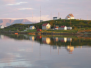
Karlsøy is an island municipality in Troms county, Norway. The administrative centre of the municipality is the village of Hansnes. Other villages include Dåfjord, Hessfjord, Karlsøya, Torsvåg, Vannvåg, and Vannareid. The municipality is made up of many islands including Ringvassøya, Reinøya, Vannøya, Karlsøya, and Rebbenesøya plus several uninhabited islands. Some of the currently uninhabited islands include Helgøya, Nordkvaløya, Grøtøya, and Nordfugløya.

Helgøy is a former municipality in Troms county, Norway. The 659-square-kilometre (254 sq mi) island municipality existed from 1886 until its dissolution in 1964. It was located in the western part of the present-day Karlsøy Municipality. The municipality included the islands of Helgøya, Grøtøya, and Nordkvaløya, large parts of the nearby islands of Rebbenesøya, Ringvassøya, Vannøya, and many smaller surrounding islands. The administrative centre was located on the south side of the island of Helgøya in a small village where Helgøy Church is also located.

Kvaløya or Sállir (Northern Sami) is an island in Tromsø Municipality in Troms county, Norway. At 737 square kilometres (285 sq mi), it is the fifth largest island in mainland Norway. It is connected to the neighboring island of Tromsøya to the east by the Sandnessund Bridge, to the island of Ringvassøya to the north by the sub-sea Kvalsund Tunnel, to the small island of Sommarøya to the west by the Sommarøy Bridge, and to the mainland to the south by the Rya Tunnel. The island of Sommarøy, on the southwest coast, is a popular recreation area with magnificent coastal scenery.
Hoffland or Hovland is a village in Ålesund Municipality in Møre og Romsdal county, Norway. The village is located on the western end of the island of Ellingsøya, about 3 kilometres (1.9 mi) northeast of the town of Ålesund and about 5 kilometres (3.1 mi) west of the village of Myklebost.

Ringvassøya (Norwegian) or Ráneš (Northern Sami) is a large island in Troms county, Norway. It is divided between Tromsø Municipality and Karlsøy Municipality. Several islands surround Ringvassøya including Kvaløya to the south; Reinøya and Karlsøya to the east; Vannøya, Helgøya, and Nordkvaløya to the north; and Rebbenesøya to the north west. The island is connected to the neighboring island by the Kvalsund Tunnel on the south shore of the island.
Karlsøya (Norwegian) or Gálsá (Northern Sami) is an island in Karlsøy Municipality in Troms county, Norway. The 7.91-square-kilometre (3.05 sq mi) island of Karlsøya lies directly south of the island of Vannøya and northeast of the island of Reinøya, along the western side of the Ullsfjorden. The one village area on the island is known as Karlsøy and in 2001, it had a population of 70.
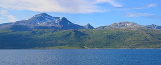
Vannøya or Vanna (Norwegian) or Várdná (Northern Sami) is a rocky island in Karlsøy Municipality in Troms county, Norway. At 232 square kilometres (90 sq mi), Vanna is the 17th largest island in Norway by area. The highest peak is the mountain Vanntinden at a height of 1,031 metres (3,383 ft) above sea level. The population of the island (2017) is 799. Vannvåg and Vannareid are the two main population centres on the island. Sengskroken Church is located on the western coast of the island.
Reinøya (Norwegian) or Ráidna (Northern Sami) is an island in Karlsøy Municipality in Troms county, Norway. The 147-square-kilometre (57 sq mi) lies directly east of the large island of Ringvassøya, and the small island of Karlsøya lies to the north of the island. The Ullsfjorden lies along the eastern coast of the island.

Bremangerlandet is an island in Bremanger Municipality in the traditional district of Nordfjord in Vestland county, Norway. The 153-square-kilometre (59 sq mi) island is one of the largest islands in the county. The highest point on the island is the 889-metre (2,917 ft) tall mountain Svartevassegga, however the cliff at Hornelen, located 1 kilometre (0.62 mi) to the east, is more well-known and has an elevation of 860 metres (2,820 ft). The 4-kilometre (2.5 mi) long lake Dalevatnet is located in the central part of the island.
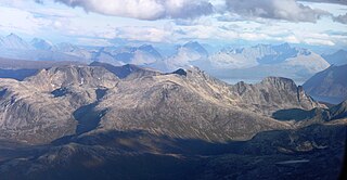
Soltindan is the highest mountain on the island of Ringvassøya which is located in Karlsøy Municipality in Troms county, Norway. It is located just north of the border with Tromsø Municipality, about 14 km (8.7 mi) southwest of the village of Hansnes. The 1,051-metre (3,448 ft) mountain has a topographic prominence of 1,051 metres (3,448 ft) and a topographic isolation of 16 kilometres (9.9 mi). Just to the north of the peak is the small glacial lake, Brevatnet.
Nordkvaløya (Norwegian) or Fálá (Northern Sami) is an island in Karlsøy Municipality in Troms county, Norway. The island is situated north of the islands of Ringvassøya and west of Helgøya. The Norwegian Sea borders to the northwest. The 84.4-square-kilometre (32.6 sq mi) island of Nordkvaløya is very rugged and mountainous. The highest point is Storalangen at 736 m (2,415 ft). In 2017, the island had 3 residents.
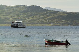
Rebbenesøya (Norwegian) or Ruobbá (Northern Sami)) is an island in Troms county, Norway. The southern third of the 80.6-square-kilometre (31.1 sq mi) island is part of Tromsø Municipality while the northern (larger) portion of the island is part of Karlsøy Municipality. There is a regular ferry connection from Bromnes on the eastern end on Rebbensøya to Mikkelvik on the northwestern end of the neighboring island of Ringvassøya.
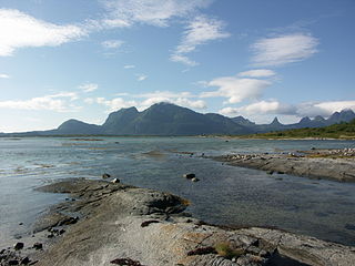
Finnøya is an island in Hamarøy Municipality in Nordland county, Norway. The island is situated northwest of the village of Innhavet with which it is connected by bridge. The mountainous island has an area of 68 square kilometres (26 sq mi) and the highest point is the 436-metre (1,430 ft) tall mountain Straumfjellet. In 2016, the island of Finnøya had a population of 75.

Lepsøya is a populated island in Haram Municipality in Møre og Romsdal county, Norway. The 12.1-square-kilometre (4.7 sq mi) island in the northern part of the municipality. It is located in the ocean in the northwestern part of the municipality, with the Haramsfjorden and the island of Haramsøya to the northeast; the Vigrafjorden and the island of Vigra to the southwest; and the islands of Bjørnøya and Terøya along with the mainland to the southeast.

Ullsfjorden (Norwegian) or Olggosvuotna (Northern Sami) is a fjord in Troms county, Norway. The fjord runs through the municipalities of Tromsø, Karlsøy, and Lyngen. The 75-kilometre (47 mi) fjord flows from the village of Sjøvassbotn northwards along the west side of the Lyngen Peninsula. The Kjosen fjord branches off to the east side and the Grøtsundet strait branches off to the west. The islands of Reinøya and Karlsøya lie along the western side of the fjord. The southern part of the Ullsfjorden is also known as Sørfjorden. The area surrounding the Ullsfjorden was part of Ullsfjord Municipality for about 60 years during the 20th century.
Helgøya (Norwegian) or Áilu (Northern Sami) is an island in Karlsøy Municipality in Troms county, Norway. The 42.92-square-kilometre (16.57 sq mi) island is surrounded by a number of islands: Vannøya to the northeast; Karlsøya and Reinøya to the southeast; Ringvassøya to the south; and Nordkvaløya to the west.

Karlsøy Church is a historic parish church of the Church of Norway in Karlsøy Municipality in Troms county, Norway. It is located on the island of Karlsøya. It is the former main church for the Karlsøy parish which is part of the Tromsø domprosti (arch-deanery) in the Diocese of Nord-Hålogaland. The church is no longer in regular use, since it is on a remote island that is now sparsely populated. The church holds special services occasionally, including one summer service each year. The white, wooden church was built in a long church style using plans drawn up by the architect Hans Linstow. The church seats about 570 people.

Ringvassøy Church is a parish church of the Church of Norway in Karlsøy Municipality in Troms county, Norway. It is located in the village of Hansnes on the island of Ringvassøya. It is the main church for the Karlsøy parish which is part of the Tromsø domprosti (arch-deanery) in the Diocese of Nord-Hålogaland.

Grøtsundet (Norwegian) or Ruohtnuorri (Northern Sami) is a strait between Tromsø Municipality and Karlsøy Municipality in Troms county, Norway. The 25-kilometre (16 mi) long strait separates the islands of Reinøya and Ringvassøya from the mainland to the south. The strait has a width of 4–5 kilometres (2.5–3.1 mi). The strait is one of the main shipping lanes into the city of Tromsø, which lies about 10 kilometres (6.2 mi) southwest of the strait.


