Related Research Articles

Park County is a county in the U.S. state of Montana. At the 2020 census, the population was 17,191. Its county seat is Livingston. A small part of Yellowstone National Park is in the southern part of the county.

Glacier County is located in the U.S. state of Montana. As of the 2020 census, the population was 13,778. The county is located in northwestern Montana between the Great Plains and the Rocky Mountains, known to the Blackfeet as the "Backbone of the World". The county is geographically and culturally diverse and includes the Blackfeet Indian Reservation, Glacier National Park, and Lewis and Clark National Forest. The county is bordered by 75 miles of international boundary with two ports of entry open year-round and one seasonal international border crossing into Alberta, Canada.

Big Horn County is a county located in the U.S. state of Montana. As of the 2020 census, the population was 13,124. The county seat is Hardin. The county, like the river and the mountain range, is named after the bighorn sheep in the Rocky Mountains. The county was founded in 1913.

Crow Agency is a census-designated place (CDP) in Big Horn County, Montana, United States and is near the actual location for the Little Bighorn National Monument and re-enactment produced by the Real Bird family known as Battle of the Little Bighorn Reenactment. The population was 1,616 at the 2010 census. It is the governmental headquarters of the Crow Nation Native Americans. It is also the location of the "agency offices" where the federal Superintendent of the Crow Indian Reservation and his staff interacts with the Crow Tribe, pursuant to federal treaties and statutes.

Fort Smith is a census-designated place (CDP) in Big Horn County, Montana, United States. The population was 161 at the 2010 census. The town is named for the former Fort C.F. Smith. The North District of Bighorn Canyon National Recreation Area is accessed at Fort Smith.
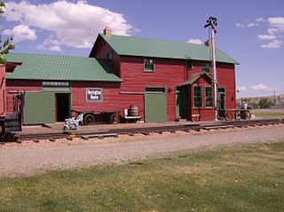
Hardin is a city in and the county seat of Big Horn County, Montana, United States. The population was 3,818 at the 2020 census.

Bozeman is a city in and the county seat of Gallatin County, Montana, United States. Located in southwest Montana, the 2020 census put Bozeman's population at 53,293 making it the fourth-largest city in Montana. It is the principal city of the Bozeman, Montana, Micropolitan Statistical Area, consisting of all of Gallatin County with a population of 118,960. It is the fastest growing micropolitan statistical area in the United States in 2018, 2019 and 2020, as well as the second-largest of all Montana's statistical areas.

Bighorn Canyon National Recreation Area is a national recreation area established by an act of Congress on October 15, 1966, following the construction of the Yellowtail Dam by the Bureau of Reclamation. It is one of over 420 sites managed by the U.S. National Park Service. The recreation area spans 120,296.22 acres, straddling the border between Wyoming and Montana. It is divided into two distinct areas, the North District accessed via Fort Smith, Montana and the South District accessed through Lovell, Wyoming. There is no thru road inside the recreation area connecting the two districts. The Yellowtail Dam is located in the North District. It is named after the famous Crow leader Robert Yellowtail, harnesses the waters of the Bighorn River by turning that variable watercourse into Bighorn Lake. The lake extends 71 miles (114 km) through Wyoming and Montana, 55 miles (89 km) of which lie within the national recreation area. The lake provides recreational boating, fishing, water skiing, kayaking, and birding opportunities to visitors. About one third of the park unit is located on the Crow Indian Reservation. Nearly one-quarter of the Pryor Mountains Wild Horse Range lies within the Bighorn Canyon National Recreation Area.

The Little Bighorn River is a 138-mile-long (222 km) tributary of the Bighorn River in the United States in the states of Montana and Wyoming. The Battle of the Little Bighorn, also known as the Battle of the Greasy Grass, was fought on its banks on June 25–26, 1876, as well as the Battle of Crow Agency in 1887.

The Crow Indian Reservation is the homeland of the Crow Tribe. Established 1868, the reservation is located in parts of Big Horn, Yellowstone, and Treasure counties in southern Montana in the United States. The Crow Tribe has an enrolled membership of approximately 11,000, of whom 7,900 reside in the reservation. 20% speak Crow as their first language.

Interstate 90 (I-90) is an east–west transcontinental Interstate Highway across the northern United States, linking Seattle to Boston. The portion in the state of Montana is 552.54 miles (889.23 km) in length, passing through 14 counties in central and southern Montana. It is the longest segment of I-90 within a single state.
Silver Gate is an unincorporated community and census-designated place (CDP) in Park County, Montana, United States. As of the 2010 census, it had a population of 20. Prior to 2010, it was part of the Cooke City-Silver Gate CDP.
Fort Custer was established during the Indian wars in the Department of Dakota by the U.S. Army to subjugate the Sioux, Cheyenne and Crow Indians near present-day Hardin, Montana. The post was named for General George Armstrong Custer who died at the Battle of the Little Big Horn.

The Regional designations of Montana vary widely within the U.S state of Montana. The state is a large geographical area that is split by the Continental Divide, resulting in watersheds draining into the Pacific Ocean, Gulf of Mexico and Hudson's Bay. The state is approximately 545 miles (877 km) east to west along the Canada–United States border and 320 miles (510 km) north to south. The fourth largest state in land area, it has been divided up in official and unofficial ways into a variety of regions. Additionally, Montana is part of a number of larger federal government administrative regions.
Royal High School is a public high school educating students grades 9–12 located in unincorporated Waller County, Texas, United States, adjacent to Pattsion, 1.5 miles from Brookshire, Texas, and 3 miles from the Katy city limits. It is one of the two secondary schools and the only high school part of the Royal Independent School District. It is attended by students residing in the city of Brookshire and unincorporated communities in Waller County, including Pattison and Sunny Side. Students compete in UIL Region 4A. In 2022, the school received a "C" rating from the Texas Education Agency.
Hardin High School is a public high school serving students grades 9–12 located in the city of Hardin, Liberty County, Texas, United States. As part of the Hardin Independent School District, it is attended by students in the city of Hardin, a portion of Big Thicket Lake Estates, and a section of Liberty. It alo includes unincorporated communities of Moss Hill, Rye, Romayor, Franklin and others within Liberty County. It is one of the two secondary schools and the only high school in the district. It participates in UIL region 3A. In 2022, the school received a "B" rating by the Texas Education Agency.
Hardin High School is a public high school serving students grades 9–12 located in the city of Hardin, Big Horn County, Montana, United States. As part of the Hardin High School District, it is attended by students residing within the city of Hardin and unincorporated communities in Big Horn County, including Crow Agency, Montana, Dunmore, Garryowen, St. Xavier, Fort Smith, Yellowtail, Toluca, Foster, and Corinth. It is the only high school within the Hardin High School District and one of the only two secondary schools part of the Hardin School District. It participates in Montana High School Association classified as Southeastern A. In 2022, the school received the classification of "Universal Support School" by the Montana Office of Public Instruction.
Liberty High School is a public high school serving students grades 9–12 located in the city of Liberty, Liberty County, Texas, United States. As one of the only two secondary schools and the only high school part of the Liberty Independent School District, it is attended by students from the cities of Liberty, and Ames as well as the unincorporated communities within Liberty County, including Moss Hill west of the Trinity River. Students compete in UIL region 4A. In 2022, the school received a "B" rating from the Texas Education Agency.
High Island School or High Island High School is a public school serving students grades PK–12 located in the High Island community of Galveston County, Texas, United States. It is the only school in the High Island Independent School District. Approximately 30 miles from the City of Galveston, it is zoned within the Bolivar Peninsula. It is attended by students residing in unincorporated communities within the Bolivar Peninsula Census-designated place, including High Island, Caplen, and Gilchrist. Students compete in UIL Conference 1A. In 2022, the school received an "A" rating from the Texas Education Agency.
References
- ↑ "Schools". www.hardin.k12.mt.us. Retrieved June 4, 2023.
- ↑ "Search for Public Schools - School Detail for Hardin High School". nces.ed.gov. Retrieved June 4, 2023.
- ↑ "Search for Public Schools - Search Results". nces.ed.gov. Retrieved June 4, 2023.
- ↑ "Index of /geo/maps/DC2020/PL20/st30_mt/schooldistrict_maps/c30003_big_horn". www2.census.gov. Retrieved June 4, 2023.
- ↑ "Hardin High School District · Montana". Google Maps. Retrieved June 4, 2023.
- ↑ "Search for Public Schools - Search Results". nces.ed.gov. Retrieved June 4, 2023.