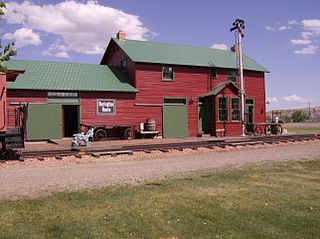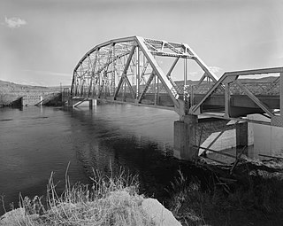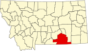
Big Horn County is a county located in the U.S. state of Montana. As of the 2020 census, the population was 13,124. The county seat is Hardin. The county, like the river and the mountain range, is named after the bighorn sheep in the Rocky Mountains. The county was founded in 1913. It is located on the south line of the state.

Crow Agency is a census-designated place (CDP) in Big Horn County, Montana, United States and is near the actual location for the Little Bighorn National Monument and re-enactment produced by the Real Bird family known as Battle of the Little Bighorn Reenactment. The population was 1,616 at the 2010 census. It is the governmental headquarters of the Crow Nation Native Americans. It is also the location of the "agency offices" where the federal Superintendent of the Crow Indian Reservation and his staff interacts with the Crow Tribe, pursuant to federal treaties and statutes.

Hardin is a city in and the county seat of Big Horn County, Montana, United States. The population was 3,818 at the 2020 census.

The Bighorn River is a tributary of the Yellowstone, approximately 461 miles (742 km) long, in the states of Wyoming and Montana in the western United States. The river was named in 1805 by fur trader François Larocque for the bighorn sheep he saw along its banks as he explored the Yellowstone.

The Little Bighorn River is a 138-mile-long (222 km) tributary of the Bighorn River in the United States in the states of Montana and Wyoming. The Battle of the Little Bighorn, also known as the Battle of the Greasy Grass, was fought on its banks on June 25–26, 1876, as well as the Battle of Crow Agency in 1887.

Houston is an unincorporated community in northern Loramie Township, Shelby County, Ohio, United States. It has a post office, a dollar general, and a grain elevator.
Rockglen is a town in the Burning Hills of the Wood Mountain Uplands, in Saskatchewan, Canada. It offers various amenities including a school, community hall, public library and five parks, as well a local service industry. The municipal office of the Rural Municipality of Poplar Valley No. 12 lies within the boundaries of Rockglen, and Rockglen businesses are supported primarily by agriculture. In the Burning Hills agriculture consists of dry land farming and cattle. Rockglen is located along Highway 2 south of Assiniboia, Highway 18 west of Coronach, and Highways 2 and 18 north of Port Poplar River. Fife Lake is 9.3 kilometres (5.8 mi) to the east.
Dooley is a ghost town in northeastern Sheridan County, Montana, United States. The town was established as a station stop and one of the first four depots along the Soo Line Railroad branch line to Whitehall.
The Rocky Mountain Regional Detention Facility, formerly known as the Two Rivers Regional Detention Facility, is a privately owned, government-operated detention facility located in Hardin, Montana, which was first proposed as economic development in 2004, and was completed in the summer of 2007. It first held prisoners in 2014, substantially under capacity, until it was closed in 2016. Two Rivers Authority concluded a lease arrangement with the Bureau of Indian Affairs in December 2018; the BIA took possession and began operations in April 2019.

Mondak is a ghost town in Roosevelt County, Montana, United States, which flourished c. 1903–1919, in large measure by selling alcohol to residents of North Dakota, then a dry state.
American Police Force (APF), and under its revised name American Private Police Force, was a fraudulent entity claiming to be a private military company. It never possessed any legitimacy to operate in the United States. The company's previous logo was an exact copy of the Serbian state coat of arms which caused some controversy and resulted in the Serbian government threatening legal action against APF if it did not remove or change the logo.
Fort Custer was established during the Indian wars in the Department of Dakota by the U.S. Army to subjugate the Sioux, Cheyenne and Crow Indians near present-day Hardin, Montana. The post was named for General George Armstrong Custer who died at the Battle of the Little Big Horn.
Comanche is an unincorporated community in Yellowstone County, Montana, United States. It lies on Montana Highway 3, 16 miles northwest of the city of Billings and shares a postal ZIP code with Acton (59002). Comanche is at an elevation of 3,747 ft. ; its coordinates are 45|59|51|N|108|46|24|W
Quietus is the site of a former town, centered on a post office now closed, and a community in the surrounding area. It was located in Big Horn County, Montana, United States. No one lives at the site of the former town. The surrounding area is now an unincorporated community. It appears on the U.S. Geological Survey Map.
Kirby was an unincorporated community in Big Horn County, Montana, United States. The community location is at an elevation of 3,878 feet (1,182 m). The site is on the west bank of Rosebud Creek. Rosebud Battlefield State Park lies approximately twelve miles south of the community, just west of Rosebud Creek.
Molt is an unincorporated rural village located in Stillwater County, Montana, United States, which has a post office ZIP code (59057) and several granaries. A hardware store still stands, which stood as the Prairie Winds cafe for many years; today the building remains unoccupied.
Wheat Basin is a ghost town in Stillwater County, Montana, United States. Wheat Basin is sourced from the USGS. The town has a total area of 6.5 acres.
Cleves is an unincorporated community in Hardin County, Iowa, United States, with a bank, a repair shop, and a grain elevator.
Hardin School District is a school district based in Hardin, Big Horn County, Montana, United States. It is composed of the Hardin High School District and Hardin Elementary School District.
Hardin High School is a public high school serving students grades 9–12 located in the city of Hardin, Big Horn County, Montana, United States. As part of the Hardin High School District, it is attended by students residing within the city of Hardin and unincorporated communities in Big Horn County, including Crow Agency, Montana, Dunmore, Garryowen, St. Xavier, Fort Smith, Yellowtail, Toluca, Foster, and Corinth. It is the only high school within the Hardin High School District and one of the only two secondary schools part of the Hardin School District. It participates in Montana High School Association classified as Southeastern A. In 2022, the school received the classification of "Universal Support School" by the Montana Office of Public Instruction.


