Wray is the home rule municipality that is the county seat of Yuma County, Colorado, United States. The population was 2,358 at the 2020 United States census. It is located 9 miles west of the Nebraska state line in the northeast Colorado Plains.
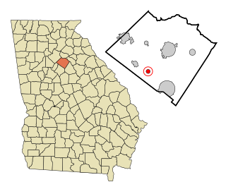
Jersey is a town in Walton County, Georgia, United States. The population was 146 at the 2020 census.

Bearcreek is an incorporated town in Carbon County, Montana, United States. It is part of the Billings, Montana Metropolitan Statistical Area. The population was 91 at the 2020 census. Bearcreek uses the Mayor/Council form of government.

Belfry is a census-designated place (CDP) in Carbon County, Montana, United States. It is an unincorporated town, and is part of the Billings, Montana Metropolitan Statistical Area. The population was 218 at the 2010 census. It is located approximately 11 miles (18 km) from the Wyoming border, roughly halfway between Billings, Montana and Cody, Wyoming.
Belgrade is a city in Gallatin County, Montana, United States. The population was 10,460 at the 2020 census. Belgrade is part of the Bozeman, MT Micropolitan Statistical Area. It is the most populous city in Montana that is not a county seat.

Troy is a city in Lincoln County, Montana, United States. The population was 797 at the 2020 census. It lies at the lowest elevation of any settlement in Montana. The town is on U.S. Route 2, near Montana Highway 56, in the Kootenai River gorge by the Kootenai National Forest.

Winnett is a town in and the county seat of Petroleum County, Montana, United States. The population was 188 at the 2020 census.

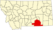
Hysham is a town in and the county seat of Treasure County, Montana, United States. The population was 276 at the 2020 census.

St. Marie or Saint Marie is a census-designated place (CDP) in Valley County, Montana, United States. The population was 264 at the 2010 census. It is located at the site of the former Glasgow Air Force Base.

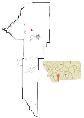
Laurel is a city in Yellowstone County, Montana, United States and the third largest community in the Billings Metropolitan Statistical Area. Laurel is located in the Yellowstone Valley as an east–west terminal division point of the BNSF Railway. The population was 7,222 at the 2020 census.

Libby is a city in northwestern Montana, United States and the county seat of Lincoln County. The population was 2,775 at the 2020 census.

Munford is a city in Tipton County, Tennessee. The population was 5,927 at the 2010 census, when it was listed as a town.
A census-designated place (CDP) is a concentration of population defined by the United States Census Bureau for statistical purposes only.

Jump River is an census-designated place in the towns of Jump River and McKinley in Taylor County, Wisconsin, United States. It is located on the north bank of the Jump River, from which the hamlet takes its name. As of the 2010 census, its population was 52.

Cucumber, West Virginia is a census-designated place (CDP) located in McDowell County, West Virginia, USA. As of the 2020 census, Cucumber had a population of only 74 people, making it one of the smallest communities in the state. Despite its small size, Cucumber is a unique community that plays a role in the coal industry of the region, contributing to the history and culture of the coal mining areas in West Virginia.

Temvik is a ghost town in Emmons County, North Dakota, United States. It is situated between Linton and Hazelton. The town had a school and several grain elevators early in the twentieth century; all that remains today is a farm.

Twodot or Two Dot is a census-designated place (CDP) in west-central Wheatland County, Montana, United States, along the route of U.S. Route 12.

Helmsburg is an unincorporated community in southern Jackson Township, Brown County, in the U.S. state of Indiana. It lies along State Road 45 north of the town of Nashville, the county seat of Brown County. Its elevation is 666 feet (203 m). Although Helmsburg is unincorporated, it has a post office, with the ZIP code of 47435.
Hesper is an unincorporated community in western Yellowstone County, Montana, United States. It is located northeast of Laurel and west of Billings. Hesper appears on the Mossmain U.S. Geological Survey Map.

Hinsdale is an unincorporated community and census-designated place in Valley County, Montana, United States. The town's population was 217 and the community's population as a whole was 583 as of the 2010 census. The community is located on the Milk River and U.S. Route 2, with Montana Highway 537 headed north out of town and South Bench Road crossing the railroad tracks and running south of town. Hinsdale has a post office with ZIP code 59241.