Hardy Peninsula

Last updated
Peninsula Hardy
Chile location map.svg
Red pog.svg
Peninsula Hardy
Geography
Coordinates 55°30′S68°12′W / 55.500°S 68.200°W / -55.500; -68.200
Administration
Hardy Peninsula of the Hoste Hosteisland.svg
Hardy Peninsula of the Hoste

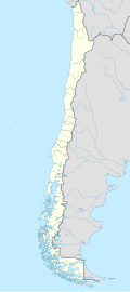
Peninsula Hardy (sometimes called "Pen Hardy") is a peninsula at one of the most southerly extremes of South America. It is the southern landform which extends into the Drake Passage to make the Bahia Nassau. It is part of a large island called Hoste, next to Isla Navarino and Isla Grande de Tierra del Fuego. It is located in the Commune of Cabo de Hornos, belonging to the Antártica Chilena Province of the Magallanes y Antártica Chilena Region, Chile. False Cape Horn is located at the southern tip of this peninsula. [1]

Peninsula Hardy forms the transition zone of the Hardy Formation, a late Jurassic-Early Cretaceous volcanic arc. [2] [3] [4]
Species

Related Research Articles

<span class="mw-page-title-main">Tierra del Fuego</span> Archipelago off the south of South America

Tierra del Fuego is an archipelago off the southernmost tip of the South American mainland, across the Strait of Magellan.

<span class="mw-page-title-main">Patagonia</span> Geographical region in South America

Patagonia is a geographical region that encompasses the southern end of South America, governed by Argentina and Chile. The region comprises the southern section of the Andes Mountains with lakes, fjords, temperate rainforests, and glaciers in the west and deserts, tablelands, and steppes to the east. Patagonia is bounded by the Pacific Ocean on the west, the Atlantic Ocean to the east, and many bodies of water that connect them, such as the Strait of Magellan, the Beagle Channel, and the Drake Passage to the south.

<span class="mw-page-title-main">Magallanes Region</span> First-level administrative division of Chile

The Magallanes Region, officially the Magallanes y la Antártica Chilena Region, is one of Chile's 16 first order administrative divisions. It is the southernmost, largest, and second least populated region of Chile. It comprises four provinces: Última Esperanza, Magallanes, Tierra del Fuego, and Antártica Chilena.

<span class="mw-page-title-main">Strait of Magellan</span> Strait in southern Chile between the Atlantic and Pacific

The Strait of Magellan, also called the Straits of Magellan, is a navigable sea route in southern Chile separating mainland South America to the north and Tierra del Fuego to the south. The strait is considered the most important natural passage between the Atlantic and Pacific oceans. The strait is approximately 570 km long and 2 km wide at its narrowest point. In 1520, the Spanish expedition of the Portuguese navigator Ferdinand Magellan, after whom the strait is named, became the first Europeans to discover it.

<span class="mw-page-title-main">Isla Grande de Tierra del Fuego</span> Island of Argentina and Chile

Isla Grande de Tierra del Fuego also formerly Isla de Xátiva is an island near the southern tip of South America from which it is separated by the Strait of Magellan. The western portion (61.4%) of the island is in Chile, while the eastern portion is in Argentina. It forms the major landmass in an extended group of islands or archipelago also known as Tierra del Fuego.

<span class="mw-page-title-main">Southernmost settlements</span> Worlds most southerly settlements

Southernmost settlements are cities, towns, weather stations or permanent military bases which are farther south than latitude 45°S. They are closely related to the Southern Ocean or either the Roaring Forties or Furious Fifties. Antarctic bases are excluded due to not having a permanent population.

<span class="mw-page-title-main">Antártica Chilena Province</span> Province in Magallanes y Antártica Chilena, Chile

Antártica Chilena Province is the southernmost of the four provinces in Chile's southernmost region, Magallanes and Antártica Chilena Region (XII). The capital is Puerto Williams. The province comprises the extreme southern part of Isla Grande de Tierra del Fuego, the islands south and west of Isla Grande, and Chile's claims in Antarctica. The province is administratively divided into two communes (comunas): Cabo de Hornos, located at the southern tip of South America, and Antártica, a wedge-shaped claim of Antarctica, which is not internationally recognized. Its total area of 1,265,853.7 km2 (488,749 sq mi) makes it almost twice as large as all other provinces of Chile combined.

<span class="mw-page-title-main">Scotia Plate</span> Minor oceanic tectonic plate between the Antarctic and South American plates

The Scotia Plate is a minor tectonic plate on the edge of the South Atlantic and Southern oceans. Thought to have formed during the early Eocene with the opening of the Drake Passage that separates Antarctica and South America, it is a minor plate whose movement is largely controlled by the two major plates that surround it: the Antarctic Plate and the South American Plate. The Scotia Plate takes its name from the steam yacht Scotia of the Scottish National Antarctic Expedition (1902–04), the expedition that made the first bathymetric study of the region.

<span class="mw-page-title-main">Tierra del Fuego Province, Chile</span> Province in Magallanes y Antártica Chilena, Chile

Tierra del Fuego Province is one of four provinces in the southern Chilean region of Magallanes and Antártica Chilena (XII). It includes the Chilean or western part of the main island of Tierra del Fuego, except for the part south of the Cordillera Darwin, which is in Antártica Chilena Province.

<span class="mw-page-title-main">Alberto de Agostini National Park</span>

Alberto de Agostini National Park is a protected area that was created on January 22, 1965, on land that was formerly part of the "Hollanda" forest reserve and "Hernando de Magallanes National Park". It covers 1,460,000 hectares and includes the Cordillera Darwin mountain range, which is the final land-based stretch of the Andes before it becomes a chain of mountains appearing as small islands that sink into the Pacific Ocean and the Beagle Channel.

<span class="mw-page-title-main">Guafo Island</span> Island in Chile

Guafo Island is an island located southwest of Chiloé Island and northwest of Chonos Archipelago, Chile. This location and the prevailing westerly winds bring frequent rainstorms to the island. Ocean currents bring an abundance of fish into this area, making it one of the most productive marine areas in the Southern Pacific Ocean. Because of this, numerous marine vertebrates such as fur seals, sea lions and penguins come to the island to feed and reproduce.

<span class="mw-page-title-main">Chilean Antarctic Territory</span> Place in Magallanes and Chilean Antarctica, Chile

The Chilean Antarctic Territory, or Chilean Antarctica, is a part of West Antarctica and nearby islands claimed by Chile. It comprises the region south of 60°S latitude and between longitudes 53°W and 90°W, partially overlapping the Antarctic claims of Argentina and of the United Kingdom. It constitutes the Antártica commune of Chile.

<span class="mw-page-title-main">Punta Arenas</span> Place in Magallanes y Antártica Chilena, Chile

Punta Arenas is the capital city of Chile's southernmost region, Magallanes and Antarctica Chilena. Although officially renamed as Magallanes in 1927, the name was changed back to Punta Arenas in 1938. The city is the largest south of the 46th parallel south and the most populous southernmost city in Chile and the Americas. Due to its location, it is also the coldest coastal city with more than 100,000 inhabitants in Latin America. Punta Arenas is one of the world's most southerly ports and serves as an Antarctic gateway city.

<span class="mw-page-title-main">Aguilera (volcano)</span> Mountain in Chile

Aguilera is a stratovolcano in southern Chile. The volcano rises above the edge of the Southern Patagonian Ice Field. It is a remote volcano that was identified as such in 1985. The first ascent only occurred in 2014, making it the last unclimbed major Andean volcano.

<i>Aristonectes</i> Extinct genus of marines reptiles

Aristonectes is an extinct genus of large elasmosaurid plesiosaurs that lived during the Maastrichtian stage of the Late Cretaceous. Two species are known, A. parvidens and A. quiriquinensis, whose fossil remains were discovered in what are now Patagonia and Antarctica. Throughout the 20th century, Aristonectes was a difficult animal for scientists to analyze due to poor fossil preparation, its relationships to other genera were uncertain. After subsequent revisions and discoveries carried out from the beginning of the 21st century, Aristonectes is now recognised as the type genus of the subfamily Aristonectinae, a lineage of elasmosaurids characterized by an enlarged skull and a reduced length of the neck.

Teresa Torres is a Chilean palaeontologist best known for her work linking Antarctic fossils to those found in Patagonia, Chile. She is a professor at the Universidad de Chile, and was one of the first Chilean women to study petrified forests in Antarctica.

Tobífera Formation is a volcano-sedimentary formation of Middle to Late Jurassic age. The formation is crops out in the Magallanes Region in southern Patagonia and Tierra del Fuego of Chile, the Santa Cruz Province of southern Argentina, and in the subsurface of the Malvinas Basin offshore Argentina and the Falkland Islands.

Fueguino is a volcanic field in Chile. The southernmost volcano in the Andes, it lies on Tierra del Fuego's Cook Island and also extends over nearby Londonderry Island. The field is formed by lava domes, pyroclastic cones, and a crater lake.

<span class="mw-page-title-main">Pali-Aike volcanic field</span> Cluster of volcanoes in Argentina and Chile

The Pali-Aike volcanic field is a volcanic field along the Argentina–Chile border. It is part of a family of back-arc volcanoes in Patagonia, which formed from processes involving the collision of the Chile Ridge with the Peru–Chile Trench. It lies farther east than the Austral Volcanic Zone, the volcanic arc that makes up the Andean Volcanic Belt at this latitude. Pali-Aike formed over sedimentary rock of Magallanes Basin, a Jurassic-age basin starting from the late Miocene as a consequence of regional tectonic events.

<i>Huallasaurus</i> Extinct genus of dinosaur

Huallasaurus is an extinct genus of saurolophine hadrosaur from the Late Cretaceous Los Alamitos Formation of Patagonia in Argentina. The type and only species is H. australis. Originally named as a species of Kritosaurus in 1984, it was long considered a synonym of Secernosaurus before being recognized as its own distinct genus in a 2022 study, different from other members of Kritosaurini.

References

  1. "PENINSULA HARDY Geography Population Map cities coordinates location - Tageo.com". www.tageo.com. Retrieved 2024-04-10.
  2. Miller, Christopher A; Barton, Michael; Hanson, Richard E; Fleming, Thomas H (October 1994). "An Early Cretaceous volcanic arc/marginal basin transition zone, Peninsula hardy, southernmost Chile". Journal of Volcanology and Geothermal Research. 63 (1–2): 33–58. doi:10.1016/0377-0273(94)90017-5.
  3. Poblete, F.; Roperch, P.; Arriagada, C.; Ruffet, G.; Ramírez de Arellano, C.; Hervé, F.; Poujol, M. (8 February 2016). "Late Cretaceous–early Eocene counterclockwise rotation of the Fueguian Andes and evolution of the Patagonia–Antarctic Peninsula system". Tectonophysics. 668–669: 15–34. doi:10.1016/j.tecto.2015.11.025.
  4. Poblete, Fernando (9 September 2015). Formación del Oroclino Patagónico y evolución paleogeográfica del sistema Patagonia-Península Antártica (PhD thesis) (in Spanish). université de Rennes 1 ; Universidad de Chile.
  5. Waterhouse, G.R. (July 1840). "XXXIX.— Description of a new species of the genus Lophotus, from the collection of Charles Darwin, Esq". Annals and Magazine of Natural History. 5 (32): 329–332. doi:10.1080/00222934009496837. ISSN   0374-5481.
  6. Valenzuela-A, A; Raski, DJ (July 1985). "Pratylenchus australis n. sp. and Eutylenchus fueguensis n. sp. (Nematoda: Tylenchina) from southern Chile". Journal of Nematology . 17 (3). Society of Nematologists: 330–6. PMC   2618453 . PMID   19294102.