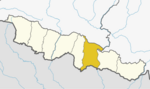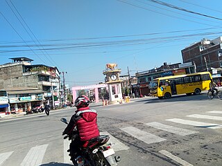
Gaighat is an administrative centre within Triyuga Municipality and the headquarter of Udayapur District located in Province No. 1 of Nepal. Gaighat is divided into 2 wards called Gaighat Bazar and Old Gaighat. The Gaighat is located in Ward No. 11 and Old Gaighat is in Ward No. 12 of Triyuga Municipality. Total area of two wards is 16.11 square kilometres (6.22 sq mi) and total population is 14,243 with 2832 households.

A village development committee in Nepal was the lower administrative part of its Ministry of Federal Affairs and Local Development. Each district had several VDCs, similar to municipalities but with greater public-government interaction and administration. There were 3,157 village development committees in Nepal. Each village development committee was further divided into several wards depending on the population of the district, the average being nine wards.
Sarkuwa is a village development committee of the Baglung District of the Dhaulagiri Zone, situated in western Nepal. At the 1991 Nepal census it had a population of 2,516 and 495 houses.
Patan is a municipality in Baitadi District in the Mahakali Zone in Sudurpaschim Province of Far-western Nepal. The new municipality was formed by merging six existing villages Sakar, Silanga, Bhumeswor Gujar Basantapur and Patan on 2 December 2014. The office of the municipality is that of the former Patan village development committee. There are 10 wards in Patan

Takukot is a Ward of Barpak sulikot Rural Municipality in Gorkha District in the Gandaki Province of northern-central Nepal. At the time of the 1991 Nepal census it had a population of 4,234 and had 801 houses in the town.
Patarasi is a rural municipality located in Jumla District of Karnali Province of Nepal.

Ratmate is a ward under Belkotgadhi Municipality but was village development committee in Nuwakot District in the Bagmati Province of central Nepal. At the time of the 1991 Nepal census it had a population of 2997 people living in 567 individual households. Bhubaneshwor Nepal is the president of this ward after local election held in 2079 BS where Mr. Nepal secured total of 835 votes. There are Villages like of Mahadevphant, ratmate and Chandretar. Mahadev Secondary School is the main educational hub. There are few brick company factory and there are huge sand/aggregate excavation from Trishuli river.

Kakani is a Gaunpalika and former village development committee in Nuwakot District in Bagmati Province of central Nepal. At the time of the 1991 Nepal census, the Kakani village development committee administered a population of 7816 living in 1343 individual households.
Raipur (राइपुर) is part of Shuklagandaki Municipality in Tanahu District of Gandaki Province [Province No. 4], in central Nepal. The whole previous Raipur Village Development Committee is now included as the Ward No 11 of Shuklagandaki Municipality in March 2017. The head of the Raipur Ward No 11 is Shalikram Bhattarai. According to the Population Census of 1991, it had a population of 4581 people living in 850 individual households. Raipur is situated in about 18 km west from Dulegaunda Town & about 15 km from Putalibazar of Syangja District. From this village Of the top part called Raipurkot, we can have a panoramic view of Annapurna and Dhaulagiri Macchapuchre Range in the north, green hills, fertile land in the river banks, terraces and many others places with seasonal fruits and vegetables. The lifestyle of people living in Raipur is simple, and the majority of them are farmers. Most of the people from Raipur are migrated to Dulegaunda, Belchautara, Dhorfridi, Pokhara, Syangja, Chitwan, Kathmandu and other urban areas. About 90% of youths of Raipur are at Third Countries and Gulf for unskilled and low skilled employments.. Recently the village is connected with the national grid of electricity network. Not all the areas of Raipur has good drinking water facilities. People, in the hillside such as Bishauna, Chilaunekhark, Baaspani (Gaunpahal), Thumkidada, Simleshwara, Samtari, Bangalekhola have to spend most of their morning time in collecting drinking water from pond.
Kolhuwa Bagiya is a village in Ekdara Rural Municipality in Mahottari District in the Janakpur Zone of south-eastern Nepal. At the time of the 1991 Nepal census it had a population of 5193 people living in 947 individual households. It is located in Ekdara Rural Municipality Ward No 6. Especially Kolhuwa is Most visited village for holy Goddess Mahodari Mata in the village pond. On Sundays and Tuesdays people come to bathe in the pond and wish for their goodness. Village also connected with National Highway(B.P. Highway). One of Oldest Schools of Nepal Shree Janta Higher Secondary School situated in Kolhuwa.
Parsa is a rural municipality in Sarlahi District, a part of Madhesh Province in Nepal. It is situated 10 km East from Malangwa which is headquarter of Sarlahi district. It was formed in 2016 occupying current 6 sections (wards) from previous 6 former VDCs. It occupies an area of 23.12 km2 with a total population of 21,650. The major language spoken in the rural municipality are Maithili and Bajjika.
Dhaulakot is a village development committee in Darchula District in the Mahakali Zone of western Nepal. At the time of the 1991 Nepal census it had a population of 2094 people living in 337 individual households.
Gamhariya was a village development committee in Rautahat District in the Narayani Zone of south-eastern Nepal.

Katahariya is a municipality in Rautahat District in the Narayani Zone of south-eastern Nepal. Before September 2017, Katahariya was one of the Village Development Committees (VDC) with 8 wards. At the time of the 1991 Nepal census, it had a population of 4,619 people living in 835 individual households. Katahariya is famous for its unique moton dish. A well known moton dish named “Katiya : कटिया” is origin from Katahariya Bazar. It has a well-maintained Farmers' market (vegetable) and Cattle (domestic-animal) market. Katahariya is a fast-growing municipality, with the main occupations of local people being business and farming.

Letang, "लेटाङ " is a municipality in Morang District in the Koshi Province of Nepal. It was formed by merging the existing Village Development Committees of Letang, Jante, Warrangi and Bhogateni. This municipality is situated in Hilly Region as well as Terai Region. Previously it was called Letang Bhogateni but now it's known as Letang.
Pathari Shanishchare (पथरी-शनिश्चरे) is a Municipality in Morang District in the Koshi Zone of south-eastern Nepal. It was formed by merging three existing village development committees i.e. Hasandaha, Pathari and Sanischare in May 2014.

Gokarneshwor is a municipality in Kathmandu District in the Bagmati Province of Nepal that was established on 2 December 2014 by merging the former Village development committees Sundarijal, Nayapati, Baluwa, Jorpati and Gokarna. The office of the municipality is that of the former Jorpati village development committee. The river Bagmati has its origin as the name Bagh Dwar situated in the middle of the Shivapuri jungle in this municipality.
Sundar Haraicha is a municipality in Morang District of Koshi Province in Nepal. It is centered around Biratchowk town which is the gateway to Biratnagar. It borders Itahari Sub- Metropolitan city to the west, Dharan Sub- Metropolitan city to the Northwest and Belbari municipality to the east and is connected by Mahendra Highway. It is one of the fastest growing cities in eastern Nepal and the second largest city of Morang district after Biratnagar, with 121,305 inhabitants living in 26,677 households. It consists of the town centres of Biratchowk and Gothgaun which are parts of the Greater Birat Development Area which incorporates the cities of Biratnagar-Itahari-Gothgau-Biratchowk-Dharan primarily located on the Koshi Highway in Eastern Nepal, with an estimated total urban agglomerated population of 804,300 people living in 159,332 households.
Harinagar is a rural municipality (gaunpalika) out of six rural municipality located in Sunsari District of Koshi Province of Nepal. There are a total of 12 municipalities in Sunsari in which 6 are urban and 6 are rural.

Byas is a rural municipality located in Darchula District of Sudurpashchim Province of Nepal.