
Shimla is the capital and the largest city of the northern Indian state of Himachal Pradesh. In 1864, Shimla was declared as the summer capital of British India. After independence, the city became the capital of East Punjab and was later made the capital city of Himachal Pradesh. It is the principal commercial, cultural and educational centre of the state.

Solan is a city in the Indian state of Himachal Pradesh and the district headquarters of Solan district. It is located 45.5 kilometres (28 mi) south of the state capital, Shimla. Solan has an average elevation of 1,550 metres (5,090 ft). The city is situated between Chandigarh and Shimla on the Kalka-Shimla National Highway-5. The narrow-gauge Kalka-Shimla railway passes through Solan. Located on the Punjab-Himachal Border, Solan is nestled in the Shivalik hills of the Himalayas.
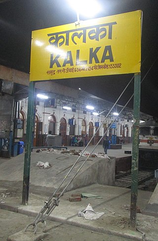
Kalka is a town in the Panchkula district of Haryana, India. It is near Panchkula city. The name of the town is derived from the Hindu goddess Kali. It is situated in the foothills of the Himalayas and is a gateway to the neighbouring state of Himachal Pradesh. It is on the National Highway 5 between Chandigarh and Shimla, and it is the terminus of the Kalka-Shimla Railway. To the south of Kalka is Pinjore, and the industrial village of Parwanoo is to the north on NH 22. Railways and Industrial development have led to a continuous urban belt from Pinjore to Parwanoo, but Kalka gained major economic benefits due to only highway until 2010, Shimla. It is the tehsil of 253 nearby sub-villages. Nearby is Chandimandir Cantonment, where the Western Command of the Indian army is based. In 2013, the municipal committee of Kalka was dissolved and the administration was reassigned to Panchkula Municipal Corporation.

Manali is a town, near Kullu town in Kullu district in the Indian state of Himachal Pradesh. It is situated in the northern end of the Kullu Valley, formed by the Beas River. The town is located in the Kullu district, approximately 270 kilometres (170 mi) north of the state capital of Shimla and 544 kilometres (338 mi) northeast of the national capital of New Delhi. With a population of 8,096 people recorded in the 2011 Indian census Manali is the beginning of an ancient trade route through Lahaul (H.P) and Ladakh, over the Karakoram Pass and onto Yarkand and Hotan in the Tarim Basin of China. Manali is a popular tourist destination in India and serves as the gateway to the Lahaul and Spiti district as well as the city of Leh in Ladakh.

Nahan is a town in Himachal Pradesh in India and is the headquarters of the Sirmaur District It was the capital of the former Sirmur princely state.Nahan is also known as the Town of ponds.
Bilaspur is a town and a municipal council in Bilaspur district in the Indian state of Himachal Pradesh.

Kullu is a municipal council town that serves as the administrative headquarters of the Kullu district of the Indian state of Himachal Pradesh. It is located on the banks of the Beas River in the Kullu Valley about 10 kilometres (6.2 mi) north of the airport at Bhuntar, Kullu.

Jubbal is a tehsil, town and a nagar panchayat in Shimla district in the Indian state of Himachal Pradesh which shares its boundary with the state of Uttrakhand towards south-east. Jubbal is recognised as a major apple producing area in Shimla district along with Kotgarh, Kumarsain, Kotkhai and Chopal. It is famous for its Hindu temples, picturesque mountains and its royal palace situated in the town.

Chamba is a town in the Chamba district in the Indian state of Himachal Pradesh. According to the 2001 Indian census, Chamba has a population of 20,312 people. Located at an altitude of 1,006 metres (3,301 ft) above mean sea level, the town is situated on the banks of the Ravi River, at its confluence with the Sal River.
Rajgarh is a town and a nagar panchayat in Sirmaur district in the Indian state of Himachal Pradesh. It was a Princely State ruled by Raja of Raghuvanshi lineage.
The Renuka Sanctuary is a nature sanctuary. It is situated in Sirmour district in Himachal Pradesh and is connected to a network of roads. It covers about 4.028 square kilometres. Also known as Renuka Reserve Forest, it has been formally declared a sanctuary. A further area of roughly about 3 square kilometres that lies outside the sanctuary has been declared as a buffer area.
Bharmour, also known as Machu Pichu of Himachal, formally known as Brahmpura, was the ancient capital of Chamba district in Himachal Pradesh, India. Situated at an altitude of 2,100 metres in the Budhil valley, forty miles to the south-east of Chamba, Bharmour is known for its scenic beauty and for its ancient temples. Some of the temples are believed to date from the 10th century.

Sarahan is a small town in Himachal Pradesh of India. It is the site of the Bhimakali Temple, originally known as Bhimadevi Temple, dedicated to the mother goddess Bhimakali, presiding deity of the rulers of the former Bushahr State. The temple is situated about 170 kilometres from Shimla and is one of 51 Shakti Peethas. The town is known as the "gateway of Kinnaur" it being near the old Indo-Tibetan Road. Seven kilometers below Sarahan is the river Satluj. Sarahan is identified with the Shonitpur mentioned in Puranas. Sarahan Bushahr has been the summer capital of Bushahr kingdom, with Rampur Bushahr considered the winter capital. The former Chief Minister of Himachal Pradesh Shree Virbhadra Singh is a member of royal family and is popularly known as "Raja Sahab" at Sarahann. He has been member of the Assembly/Parliament since 1962 and has held the post of Chief Minister six times. His wife Rani Pratibha Devi is also a member of Assembly.

Kandaghat is a small town and tehsil (sub-district), near Solan city in the Solan district of Himachal Pradesh, India which is on the Kalka-Shimla National Highway No. 22. The road to the famous tourist destination of Chail turns from Kandaghat which is at a distance of 29 km. The capital of Himachal Pradesh, Shimla is at a distance of 30 km.
Kala Amb is the industrial capital of the Sirmaur district in Himachal Pradesh. It is a small town and an industrial area in Sirmour District in the state of Himachal Pradesh, India.
Dhaulakuan or Dhaula Kuan is a small town in the Paonta Sahib tehsil of Sirmour district in the northern Indian state of Himachal Pradesh. It is located between Nahan, one of the tehsils of Sirmour district, and Paonta Sahib. It lies on National Highway 72 between Dehradun and Shimla. It is situated on the foothills between Renuka and Dadahu, another town in Nahan tehsil.
Badi Ki Dhar also known as Badi Dhar is a holy place situated, near Solan city in Solan district, around 56 kilometres (35 mi) from Shimla in the Indian state of Himachal Pradesh. It is about 10 kilometres (6.2 mi) from Piplughat and can be seen from the famous Ridge ground of Shimla. Badi Dhar is situated at an altitude of 6781 feet above sea level. At the time of Britishers, they surveyed the Badi Dhar to establish Shimla, but people use to say that they were not successful to make is Shimla. Beautiful sights of Shimla as well as Pinjore-Zirakpur road can be seen from the top of the hill. Although only few can spot Pinjore-Zirakpur road from the top of the hill that is also during the nights only. The place is famous for its Lord Shiva temple and annual fair which is organised on 14/15 June. It is expected to rain on the fair day every year, which makes it popular in the whole District. Gathering of around 5,000 to 10,000 people is expected on that day.

Kumarsain, also known as Kumharsain, is a sub-division, a tehsil and a town in Shimla District in the Indian state of Himachal Pradesh. Formerly under the British Raj, it was the capital of princely state of Kumharsain, which was one of the several states of the Punjab States Agency.It is about 80 km from Shimla and famous for apple and cherry orchards.

Sri Renukaji Assembly constituency is one of the 68 constituencies in the Himachal Pradesh Legislative Assembly of Himachal Pradesh a northern state of India. It is also part of Shimla Lok Sabha constituency.

Paonta Sahib Assembly constituency is one of the 68 constituencies in the Himachal Pradesh Legislative Assembly of Himachal Pradesh a northern state of India. Paonta Sahib is also part of Shimla Lok Sabha constituency.