Kendall County is a county located on the Edwards Plateau in the U.S. state of Texas. In 2020 census, its population was 44,279. Its county seat is Boerne. The county is named for George Wilkins Kendall, a journalist and Mexican–American War correspondent.

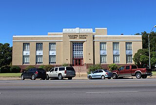
Gillespie County is a county located on the Edwards Plateau in the U.S. state of Texas. As of the 2020 census, its population was 26,725. The county seat is Fredericksburg. It is located in the heart of the rural Texas Hill Country in Central Texas. Gillespie is named for Robert Addison Gillespie, a soldier in the Mexican–American War. It is known as the birthplace of 36th president of the United States of America Lyndon B. Johnson.

Quitman is a city in and the county seat of Clarke County, Mississippi, United States, along the Chickasawhay River. The population was 2,323 at the 2010 census.

Nash is a city in Bowie County, Texas, United States, and a suburb of Texarkana. It is part of the Texarkana metropolitan area. The population was 2,960 at the 2010 census, up from 2,169 at the 2000 census. In 2020, its population was 3,814, representing continued population growth as a suburban community.

Fulshear is a city in northwestern Fort Bend County, Texas, United States, and is located on the western edge of the Houston–The Woodlands–Sugar Land metropolitan area. The population was 16,856 as of the 2020 census, and according to 2023 census estimates, the city is estimated to have a population of 43,317.

Marshall is a city in the U.S. state of Texas. It is the county seat of Harrison County and a cultural and educational center of the Ark-La-Tex region. At the 2020 U.S. census, the population of Marshall was 23,392. The population of the Greater Marshall area, comprising all of Harrison County, was 65,631 in 2010 and 66,726 in 2018.

Hempstead is a city in and the county seat of Waller County, Texas, United States, part of the Houston–The Woodlands–Sugar Land metropolitan area.

Decatur is the county seat of Wise County, Texas, United States. Its population was 6,538 in 2020.

Bullard is a small town in Smith and Cherokee counties in the east-central part of the U.S. state of Texas. U.S. Route 69 and Farm-to-Market Roads 2137, 2493, and 344 intersect here, about 15 miles (24 km) south of the larger city of Tyler. Its population was 3,318 at the 2020 census, up from 2,463 at the 2010 census.

The Gettysburg Battlefield is the area of the July 1–3, 1863, military engagements of the Battle of Gettysburg in and around Gettysburg, Pennsylvania. Locations of military engagements extend from the 4-acre (1.6 ha) site of the first shot at Knoxlyn Ridge on the west of the borough, to East Cavalry Field on the east. A military engagement prior to the battle was conducted at the Gettysburg Railroad trestle over Rock Creek, which was burned on June 27.

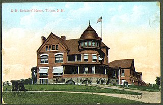
An old soldiers' home is a military veterans' retirement home, nursing home, or hospital, or sometimes an institution for the care of the widows and orphans of a nation's soldiers, sailors, and marines, etc.

High Hill is an unincorporated community in southwestern Fayette County, Texas, United States. It is located on Farm to Market Road 2672, three miles northwest of Schulenburg, Texas.
Brandon is an unincorporated community located in Hill County in Central Texas, United States. It is located at the intersection of State Highway 22 and FM 1243, approximately ten miles east of Hillsboro.
Confederate monuments and memorials in the United States include public displays and symbols of the Confederate States of America (CSA), Confederate leaders, or Confederate soldiers of the American Civil War. Many monuments and memorials have been or will be removed under great controversy. Part of the commemoration of the American Civil War, these symbols include monuments and statues, flags, holidays and other observances, and the names of schools, roads, parks, bridges, buildings, counties, cities, lakes, dams, military bases, and other public structures. In a December 2018 special report, Smithsonian Magazine stated, "over the past ten years, taxpayers have directed at least $40 million to Confederate monuments—statues, homes, parks, museums, libraries, and cemeteries—and to Confederate heritage organizations."
Moffat is a small unincorporated community in Bell County, Texas, United States. It is part of the Killeen–Temple–Fort Hood Metropolitan Statistical Area.
Osage is a ghost town in northwestern Colorado County in the U.S. state of Texas. The one-time settlement was situated on Harvey Creek near the junction of County Roads 205 and 208 a few miles to the northeast of Weimar. At the time of the Civil War, the community was substantial enough to provide a company of soldiers to a Texas regiment in the Confederate States Army. A notable school flourished in Osage starting in the 1870s, but in that decade the railroad was built through Weimar instead. By 1900, the local commercial establishments had moved to Weimar and the town faded out of existence. In 2013, the area was sparsely settled.
Dido is a ghost town in Tarrant County, Texas. It is located 16 miles northwest of Fort Worth on the eastern shore of Eagle Mountain Lake.

There are more than 160 Confederate monuments and memorials to the Confederate States of America and associated figures that have been removed from public spaces in the United States, all but five of which have been since 2015. Some have been removed by state and local governments; others have been torn down by protestors.
Grassyville is a ghost town located in Bastrop County, Texas, United States. The community was founded in the northeastern corner of the county, near the intersection of Farm to Market Road 2104 and Farm to Market Road 2239, six miles south of Paige, 14 miles east of Bastrop, and 50 miles east of Austin.
Terryville, Texas is a populated place at the intersection of Farm to Market Road 682 and Farm to Market Road 1447 in eastern DeWitt County, Texas. It was named after early settlers James Terry and John Terry, who opened a store there in 1852. James D. Terry served as DeWitt County judge from 1883 to 1891.


