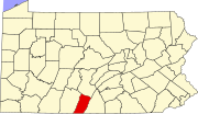
Bedford County is a county in the Commonwealth of Pennsylvania. As of the 2020 census, the population was 47,577. The county seat is Bedford.

McKean County is a rural county in the Commonwealth of Pennsylvania. As of the 2020 census, the population was 40,432. Its county seat is Smethport. The county was created in 1804 and organized in 1826. It was named in honor of former Pennsylvania Governor and Declaration of Independence signer Thomas McKean.
Fulton County is a county in the Commonwealth of Pennsylvania. As of the 2020 census, the population was 14,556, making it the fourth-least populous county in Pennsylvania. Its county seat is McConnellsburg. The county was created on April 19, 1850, from a part of Bedford County and named after inventor Robert Fulton.

Franklin County is a county in the Commonwealth of Pennsylvania. As of the 2020 census, the population was 155,932. Its county seat is Chambersburg.

Everett is a borough in Bedford County, Pennsylvania, United States. The population was 1,765 at the 2020 census.
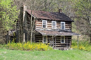
Mann Township is a township that is located in Bedford County, Pennsylvania, United States. The population was 506 at the time of the 2020 census.

Shoemakersville is a borough in Berks County, Pennsylvania, United States. The population was 1,360 at the 2020 census, a decline from the figure of 1,378 tabulated in 2010.

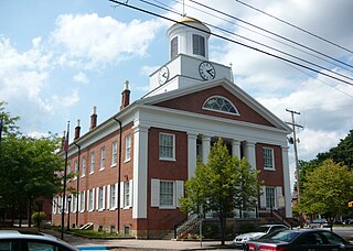
McConnellsburg is a borough and the county seat of Fulton County, Pennsylvania, United States. The population was 1,150 at the 2020 census.

Union Township is a township located in Fulton County, Pennsylvania, United States. As of the 2020 census, the township had a total population of 748.

White Haven is a borough in Luzerne County, Pennsylvania, United States. It is located along the Lehigh River. The population was 1,163 at the 2020 census.

Larimer Township is a township in Somerset County, Pennsylvania, United States. The population was 543 at the 2020 census. It is part of the Johnstown, Pennsylvania, Metropolitan Statistical Area. Larimer Township was named for General William Larimer, Jr., president of the Pittsburgh & Connellsville Railroad.

New Baltimore is a borough in Somerset County, Pennsylvania, United States. The population was 137 at the 2020 census. It is part of the Johnstown, Pennsylvania, Metropolitan Statistical Area.
Licking Creek is a 56.6-mile-long (91.1 km) tributary of the Potomac River in Pennsylvania and Maryland in the United States.

Pennsylvania Route 655 is an 83-mile-long (134 km) north–south state highway located in central Pennsylvania. The southern terminus of the route is at the Mason–Dixon line in Thompson Township, where the road becomes a local road in Hancock, Maryland. The northern terminus is at State Route 1005, the former alignment of U.S. Route 322, in Reedsville.
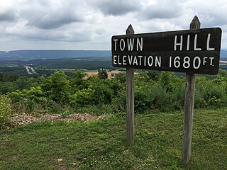
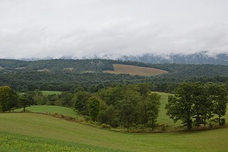
Town Hill is a mountain range that is located in Allegany County, Maryland and Bedford and Fulton counties in Pennsylvania.
Wakefield is an unincorporated community and census-designated place (CDP) within Fulton Township, Lancaster County, Pennsylvania, United States. As of the 2010 census, the population was 609. It is the largest community within the "Peach Bottom" ZIP code, with the area post office on Pennsylvania Route 272, just north of town.
Porters Sideling is an unincorporated community located in Heidelberg Township in York County, Pennsylvania, United States. Porters Sideling is located approximately one mile southeast of Pennsylvania Route 116 and is about eight miles away from Codorus State Park.
The following is a list of former state routes in Pennsylvania. These roads are now either parts of other routes or no longer carry a traffic route number. This list also includes original routes of numbers that were decommissioned and later reactivated in other locations in which most of these are still active today.
Welsh is an unincorporated community in Meigs County, in the U.S. state of Ohio.
The Pennsylvania State Game Lands Number 25 are Pennsylvania State Game Lands in Elk County in Pennsylvania in the United States providing hunting, bird watching, and other activities.