Sikar is a city and municipal council in the Sikar district of the state of Rajasthan in India. It is the administrative headquarters of the Sikar district. It is largest city of the Shekhawati region, which consists of Sikar, Churu and Jhunjhunu. After Kota, Sikar is one of the major coaching hubs in the country for competitive examination preparations and has a number of engineering and medical coaching institutes.
Thathawata is a village located in Churu District of Rajasthan state in India. At the 2001 census, the village had a total population of 2500.
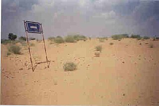
Harsawa is a village located in the Sikar district of Shekhawati region, in Rajasthan state, India. Harsawa is within the Fatehpur Tehsil, 8 km south along National Highway-11 from Fatehpur town. Sand dunes of the Thar Desert can be seen from Harsawa. As of 2001, the village had a total population of 1695.

Mahendragarh district is one of the 22 districts of Haryana state in northern India. The district occupies an area of 1,899 km² and has a population of 922,088 (2021census). District have 3 Sub-divisions : Narnaul, Mahendragarh and Kanina

Nagaur District is one of the 50 districts of the state of Rajasthan in western India. Panchayati Raj was introduced here. It is the fifth largest district in Rajasthan and the area of the district is 17,718 km2 (6,841 sq mi). The city of Nagaur is the district headquarters.
Katrathal is a village in Sikar tehsil of Sikar district in Rajasthan, India. It is situated at a distance of 10 kilometres (6.2 mi) from Sikar on State Highway No. 8
Fadanpura is a village in Fatehpur tehsil of Sikar district in Rajasthan, 5 km away from Fatehpur City by road. There are about 450 houses in the village, with a total population above 1100 people. Five temples in this village and most oldest temple of "THAKUR Ji" made by Shekhawat's situated in middle of this village. Other temples name are Sati Dadi Jamvay Maa Jasnath ji Maharaj and Lord Hanuman. Sati Dadi's temple, made by Khetaram Jangid, is 2km away from this village. Jasnath ji Mharaj's temple made by Jyani is the first temple you can see when you come in this village by road.
Ladhana is a village in Danta Ramgarh tehsil in Sikar district in Rajasthan, India. As of 2001 census the population of the village is 7714, out of which 1410 are S.C. and 227 are ST tribes.
Bhuma is a Jat community village in Laxmangarh tehsil in Sikar district in Rajasthan. Bhuma has two habitations : Bhuma Bada and Bhuma Chhota. At the 2001 census the population of the village was 5,743, of which 1,420 are SC people. Bhuma Bara is located 10.9 km dwest of Town Lachhmangarh( also written as Laxmangarh). Bhuma Bara is 30.2 km far from Sikar and 130 km far from Jaipur.
Dhanop is an ancient village in Bhilwara district on Shahpur-Vijainagar state highway at a distance of 85 km from Bhilwara city in Rajasthan. Its PIN code is 311023. Dhanop village is in Phooliya Kalan tehsil(pin code 311407). It had a population of 3,592 at the 2001 census, out of them 616 are Scheduled Caste and 30 Scheduled tribe people. It is known for Dhanop sheetla Mata Temple.
Danta Ramgarh is a census town and a tehsil tehsil of Sikar district in the Indian state of Rajasthan. Ex vice president of India Bhairon Singh Shekhawat, was born in village Khachariyaws close by to east of Ramgarh. Dantaramgarh tehsil is the largest tehsil in Sikar district and its population is above 300,000. This village is famous for its strategic fort built by Guman Singh Ladkhani in the year 1744. The topography of the surroundings from the top of the fort is breaths taking. Baba Balinath was a very popular saint about 400 years back. He is regarded as a village deity in the area..

Harshnath Temple is an ancient Hindu temple dedicated to Lord Shiva which is situated in the Sikar district of the Indian state of Rajasthan. It is located 14 km from district headquarters Sikar.
Lachhmangarh Assembly constituency is one of constituencies of Rajasthan Legislative Assembly in the Sikar.
Dhod Assembly constituency is one of constituencies of Rajasthan Legislative Assembly in the Sikar.
Sikar Assembly constituency is one of constituencies of Rajasthan Legislative Assembly in the Sikar.
Danta Ramgarh Assembly constituency is one of constituencies of Rajasthan Legislative Assembly in the Sikar.

Chomu Assembly constituency is one of constituencies of Rajasthan Legislative Assembly in the Sikar. Dr. Shikha Meel is currently serving as MLA of Chomu.
Kathumar is one of the 200 Legislative Assembly constituencies of Rajasthan state in India.
Darunda is a village located in the Sikar district of Shekhawati region, in Rajasthan state, India. Darunda is within the Fatehpur Tehsil. Sand dunes of the Thar Desert can be seen in Darunda. As of 2011, the village had a total population of 1870.
Dhandhan is a village located in the Sikar district of Shekhawati region, in Rajasthan state, India. Dhandhan is within the Fatehpur Tehsil. The village had a total population of 3271.

