
The Inn is a river in Switzerland, Austria and Germany. The 518 km (322 mi) long river is a right tributary of the Danube, being the third largest tributary of the Danube by discharge. The highest point of its drainage basin is the summit of Piz Bernina at 4,049 m (13,284 ft). The Engadine, the valley of the En, is the only Swiss valley whose waters end up in the Black Sea.

The Innviertel is a traditional Austrian region southeast of the Inn river. It forms the western part of the state of Upper Austria and borders the German state of Bavaria. The Innviertel is one of the four traditional "quarters" of Upper Austria, the others being Hausruckviertel, Mühlviertel, and Traunviertel.

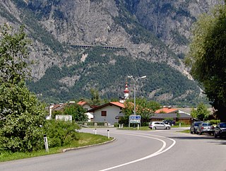
Fließ is a municipality in the Landeck district in the Austrian state of Tyrol located 5 km south of Landeck on the upper course of the river Inn, in the upper part of Upper Inn Valley. It has nine hamlets and was already populated at the Roman age; the village itself was founded around the 6th century. After a conflagration in 1933 Fließ was restored more spacious. The main source of income is tourism.

The Kaunertal is a municipality and alpine valley in the Landeck district in the Austrian state of Tyrol. The municipality is located about 15 km (9.3 mi) southeast of Landeck at the upper course of the Inn river.
Kematen in Tirol is a municipality in the district Innsbruck-Land located about 12 km west of Innsbruck. The Melach river flows into the Inn river in Kematen. Kematen was first mentioned as "Caminata" around 600.

Altheim is a town in eastern Austria. It is situated within the District of Braunau am Inn in the traditional region of Innviertel in the state of Upper Austria. It lies on the small river known as the Mühlheimer Ache, a tributary of the River Inn.

Burgkirchen is a municipality in the district Braunau am Inn in the Austrian state of Upper Austria.

Haigermoos is a municipality in the district of Braunau am Inn in the Austrian state of Upper Austria. Today nothing remains of the infamous Weyer concentration camp for Roma placed here before 1945.

Höhnhart is a municipality in the district of Braunau am Inn in the Austrian state of Upper Austria.
Moosbach is a municipality in the Braunau am Inn in the Austrian state of Upper Austria.

Ostermiething is a municipality in the district of Braunau am Inn in the Austrian state of Upper Austria.
Roßbach is a municipality in the district of Braunau am Inn in the Austrian state of Upper Austria.

Kirchdorf am Inn is a municipality in the district of Ried im Innkreis in the Austrian state of Upper Austria.

Mühlheim am Inn is a municipality in the district of Ried im Innkreis in the Austrian state of Upper Austria.
Obernberg am Inn is a municipality in the district of Ried im Innkreis in the Austrian state of Upper Austria.

St. Georgen bei Obernberg am Inn is a municipality in the district of Ried in the Austrian state of Upper Austria.

Sankt Florian am Inn is a municipality in the district of Schärding in the Austrian state of Upper Austria.

Wernstein am Inn is a municipality in the district of Schärding in the Austrian state of Upper Austria.
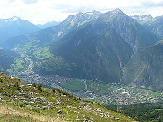
The Inntal is the valley containing the Inn river in Switzerland, Austria and Germany. The valley has a total length of 517 km and the biggest city located in Inntal is Innsbruck.

