Senftenbach

Last updated
Senftenbach
Senftenbach - Kirche (1).JPG
Wappen at senftenbach.png
Coat of arms
Austria adm location map.svg
Red pog.svg
Senftenbach
Location within Austria
Coordinates: 48°15′34″N13°25′08″E / 48.25944°N 13.41889°E / 48.25944; 13.41889 Coordinates: 48°15′34″N13°25′08″E / 48.25944°N 13.41889°E / 48.25944; 13.41889
Country Austria
State Upper Austria
District Ried im Innkreis
Government
   Mayor Georg Schrattenecker (ÖVP)
Area
[1]
  Total9.73 km2 (3.76 sq mi)
Elevation
414 m (1,358 ft)
Population
(2018-01-01) [2]
  Total772
  Density79/km2 (210/sq mi)
Time zone UTC+1 (CET)
  Summer (DST) UTC+2 (CEST)
Postal code
4973
Area code 07751
Vehicle registration RI
Website www.oberoesterreich.
at/senftenbach

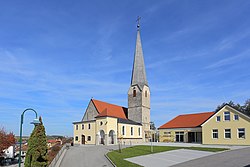
Senftenbach is a community in Upper Austria in the district of Ried im Innkreis.

Austria Federal republic in Central Europe

Austria, officially the Republic of Austria, is a country in Central Europe comprising 9 federated states. Its capital, largest city and one of nine states is Vienna. Austria has an area of 83,879 km2 (32,386 sq mi), a population of nearly 9 million people and a nominal GDP of $477 billion. It is bordered by the Czech Republic and Germany to the north, Hungary and Slovakia to the east, Slovenia and Italy to the south, and Switzerland and Liechtenstein to the west. The terrain is highly mountainous, lying within the Alps; only 32% of the country is below 500 m (1,640 ft), and its highest point is 3,798 m (12,461 ft). The majority of the population speaks local Bavarian dialects as their native language, and German in its standard form is the country's official language. Other regional languages are Hungarian, Burgenland Croatian, and Slovene.

Geography

Senftenbach lies 414 meters above sea level. North to south, it is 3.3 km. From east to west, it is 5 km. The total area is 9.8 km². 19.4% of the area is wooded, while 73.5% of it is used for agriculture. The meaning of the name Senftenbach is "gentle brook", referring to Senftenbach Brook.

Related Research Articles

Auerbach, Upper Austria Place in Upper Austria, Austria

Auerbach is a town in Upper Austria, Austria. Its length from north to south is 4.3 km and from east to west is 5 km; its area is 10.78 km2. In 2015, it had 565 inhabitants.

Theresienfeld Place in Lower Austria, Austria

Theresienfeld is a town in the Wiener Neustadt-Land district of Lower Austria, in eastern Austria. It lies 5 km (3 miles) north of Wiener Neustadt, in the southern part of the Vienna Basin. Of its 11.47 km2 area, 3.40% is forested.

Frastanz Place in Vorarlberg, Austria

Frastanz is a market town in the Feldkirch district in the Austrian state of Vorarlberg. It used to be known for its production of tobacco.

Oberperfuss Place in Tyrol, Austria

Oberperfuss is a municipality in the district of Innsbruck-Land in the Austrian state of Tyrol located about 15 km (9.3 mi) west of Innsbruck at the entrance of the Sellrain Valley. It was mentioned in documents around 1083 for the first time.

Schwoich Place in Tyrol, Austria

Schwoich is a municipality in the Kufstein district in the Austrian state of Tyrol located 5.50 km south of Kufstein at the southern side of the Inn River. The village has nine hamlets. Settlement of the area began in the 6th century but the community was mentioned for the first time as „Swiuch / Schweng“ in 1280.

Pfunds Place in Tyrol, Austria

Pfunds is a municipality in the district of Landeck in the Austrian state of Tyrol located 19.7 km south of the city of Landeck and 5 km north of the border to Switzerland. The village was first mentioned in documents in 1282. The main source of income is tourism.

Natters Place in Tyrol, Austria

Natters is a municipality in the district Innsbruck-Land in the Austrian state of Tyrol located 3.5 km south of Innsbruck. The village was mentioned in documents around 1151 for the first time. Natters as well as Mutters received connection with Innsbruck thanks to the Stubaitalbahn in 1904. It has 1918 inhabitants and an own hospital. The popular Natterer See is a treasure for tourists in summer.

Unterperfuss Place in Tyrol, Austria

Unterperfuss is a municipality in the district of Innsbruck-Land in the Austrian state of Tyrol located 15 km west of Innsbruck and is one of the smallest villages of Tyrol. The area is restricted in the north by the Inn River and in the east by the Melach River. Unterperfuss has many facilities for horse-riding.

Tulfes Place in Tyrol, Austria

Tulfes is a municipality in the district of Innsbruck-Land in the Austrian state of Tyrol, located 12 km east of Innsbruck and 6 km above Hall in Tirol. The village was mentioned as “Tellevo” for the first time in 1240. Main source of income is tourism. Tulfes became a popular area of settlement due to the cities of Innsbruck and Hall.

Thaur Place in Tyrol, Austria

Thaur is a municipality in the district of Innsbruck-Land in the Austrian state of Tyrol located 5 km east of Innsbruck between Rum, Austria and Hall in Tirol.

Schönberg im Stubaital Place in Tyrol, Austria

Schönberg im Stubaital is a municipality in the district of Innsbruck-Land, Tyrol, Austria. It is 9 km (5.6 mi) south of Innsbruck at the entrance of the Stubaital. The village was mentioned as “Schönenberge” for the first time in 1180.

Reith bei Seefeld Place in Tyrol, Austria

Reith bei Seefeld is a municipality in the district of Innsbruck-Land in the Austrian state of Tyrol located 12.3 km northwest of Innsbruck and 3 km south of Seefeld in Tirol. The village was founded in 1350. At that time stone oil (=petroleum) was found and is used for healing purposes until now.

Pflach Place in Tyrol, Austria

Pflach is a municipality in the district of Reutte in the Austrian state of Tyrol. It is 3 km north of the centre of Reutte town, and 2.5 km south of the German border.

Tarrenz Place in Tyrol, Austria

Tarrenz is a municipality in the Imst district and is located 3.60 km north of Imst at the lower course of the Gurgl brook. The village is an agriculture community with emphasis in sheep breeding and a settlement for commuters. In the last years Tarrenz was able to increase its economy and also to beautify the picture of the village. It has 2568 inhabitants.

Mils bei Imst Place in Tyrol, Austria

Mils bei Imst is a municipality in the Imst district and is located 5 km west of Imst. Thanks to a motorway tunnel the location is free of heavy traffic. Mils possesses a flood-meadow which is a popular recreation area.

Nassereith Place in Tyrol, Austria

Nassereith is a municipality in the Imst district and is located 11 km north of Imst on the upper course of the Gurgl brook. The village was mentioned in documents for the first time in 1150 but settlement had already began 200-300BC. The main source of income is tourism but Nassereith is now also a community for commuters.

Obsteig Place in Tyrol, Austria

Obsteig is a municipality in the Imst district and is located 15 km northeast of Imst and 3 km above Mötz. The village has 14 parts and is a popular area for skiing. Main sources of income is Winter tourism.

Statzendorf Place in Lower Austria, Austria

Statzendorf is a municipality in the district of Sankt Pölten-Land in Lower Austria, Austria. It consists of the following towns:

Eitzing Place in Upper Austria, Austria

Eitzing is a municipality in the district of Ried im Innkreis in the Austrian state of Upper Austria.

Ulrichsberg Place in Upper Austria, Austria

Ulrichsberg is a municipality in the district of Rohrbach in the Austrian state of Upper Austria.

References

  1. "Dauersiedlungsraum der Gemeinden Politischen Bezirke und Bundesländer - Gebietsstand 1.1.2018". Statistics Austria. Retrieved 10 March 2019.
  2. "Einwohnerzahl 1.1.2018 nach Gemeinden mit Status, Gebietsstand 1.1.2018". Statistics Austria. Retrieved 9 March 2019.