Pramet | |
|---|---|
 | |
 Coat of arms | |
 Location in the district | |
 Pramet Location within Austria | |
| Coordinates: 48°08′32″N13°29′12″E / 48.14222°N 13.48667°E | |
| Country | Austria |
| State | Upper Austria |
| District | Ried im Innkreis |
| Government | |
| • Mayor | Eduard Seib (ÖVP) |
| Area | |
• Total | 13.9 km2 (5.4 sq mi) |
| Elevation | 512 m (1,680 ft) |
| Population (2018-01-01) [2] | |
• Total | 1,030 |
| • Density | 74.1/km2 (192/sq mi) |
| Time zone | UTC+1 (CET) |
| • Summer (DST) | UTC+2 (CEST) |
| Postal code | 4925 |
| Area code | 0 77 54 |
| Vehicle registration | RI |
| Website | www.pramet.at |
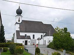
Pramet is a municipality in the district of Ried im Innkreis in the Austrian state of Upper Austria.
