
Huarochirí Province or Waruchiri is located in the Lima Region of Peru. Its capital is Matucana. The western section is part of the Lima Metropolitan Area.

The Yauyos Province is a province located in the Lima Region of Peru. It is one of the eleven that make up that region.

Colquepucro or Collquepucro is a mountain in the Pariacaca or Huarochirí mountain range in the Andes of Peru, about 5,658 metres (18,563 ft) high. It is situated in the Junín Region, Jauja Province, Canchayllo District and in the Lima Region, Huarochiri Province, Quinti District. Colquepucro lies north-east of the mountains Corihuasi and Pariacaca.
Putka is a mountain in the Cordillera Central in the Andes of Peru, about 5,100 metres (16,732 ft) high. It is slocated in the Lima Region, Huarochirí Province, Chicla District.
Quñuq P'ukru is a mountain in the Cordillera Central in the Andes of Peru, about 5,000 m (16,404 ft) high. It is situated in the Lima Region, Huarochirí Province, Chicla District.
Wararayuq is a 5,354-metre-high (17,566 ft) mountain in the Paryaqaqa mountain range in the Andes of Peru. It is located in the Lima Region, Huarochirí Province, Quinti District. Wararayuq lies northwest of Qullqi P'ukru.
Pariauccro or Pariaucro is a massif in the Huayhuash mountain range in the Andes of Peru. This mountain has two summits, the highest one reaching an altitude of 5,572 m (18,281 ft). It is located in the Lima Region, Cajatambo Province, Cajatambo District. Pariauccro lies on a sub-range west of the main range, north of Mitopunta and northeast of Huacshash.
Ukrupata is a mountain in the Andes of Peru, about 5,300 m (17,388 ft) high. It is situated in the Lima Region, Huarochirí Province, on the border of the districts of Chicla and Carampoma. Ukrupata lies northwest of Millpu and east of Wamp'ar and the two lakes named Wamp'arqucha and Wachwaqucha.
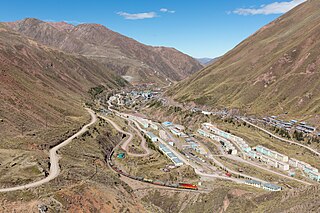
Chuqi Chukchu is a 5,154-metre-high (16,909 ft) mountain in the Cordillera Central in the Andes of Peru. It is situated in the Lima Region, Huarochiri Province, Chicla District. Chuqi Chukchu lies near the Antikuna mountain pass, northwest of Wayrakancha and northeast of Quñuq P'ukru. The mining village of Q'asa P'allqa (Casapalca) lies at its feet.
Llawa P'ukru is a mountain in the Andes of Peru, about 5,200 m (17,060 ft) high. It is situated in the Lima Region, Huarochirí Province, Chicla District. Llawa P'ukru lies southwest of Sillaqaqa and Inka Kancha, east of Qunchupata and southeast of Quriqucha.
Nina Ukru is a mountain in the Paryaqaqa or Waruchiri mountain range in the Andes of Peru, about 5,400 metres (17,717 ft) high. It is situated in the Lima Region, Huarochirí Province, Quinti District. Nina Ukru lies southwest of Qullqip'ukru and west of Paryaqaqa.
Uqsha is a mountain in the Cordillera Central in the Andes of Peru, about 4,800 m (15,748 ft) high. It is located in the Lima Region, Huarochirí Province, Quinti District, and in the Yauyos Province, Tanta District, southwest of the lake named P'itiqucha. Uqsha lies northeast of Waswa Punta and southeast of Hatun Ukru. It is situated on the western border of the Nor Yauyos-Cochas Landscape Reserve.
Qayqu is a mountain in the Paryaqaqa mountain range in the Andes of Peru, about 5,100 metres (16,732 ft) high. It is situated in the Lima Region, Huarochirí Province, Quinti District. It lies southwest of Qullqi P'ukru.
Kinwa Ukru is a 5,006-metre-high (16,424 ft) mountain in the Andes of Peru. It is located in the Lima Region, Oyón Province, Oyón District. Kinwa Ukru lies west of a mountain named Aququcha.
Hatun Ukru is a 4,650-metre-high (15,260 ft) mountain in the Andes of Peru. It is located in the Pasco Region, Pasco Province, Ticlacayan District, northwest of the Waqurunchu mountain range.
Wank'a Ukru Punta is a 4,410-metre-high (14,470 ft) mountain in the Andes of Peru. It is located in the Huánuco Region, Dos de Mayo Province, Marías District. Wank'a Ukru Punta lies northwest of Tikti Punta and north of a lake named Saqsaqucha.
Kimsa Ukru Punta is a mountain in the Andes of Peru which reaches a height of approximately 4,400 m (14,400 ft). It is located in the Huánuco Region, Yarowilca Province, Aparicio Pomares District.
Ukru Ukru is a mountain in the Cordillera Central in the Andes of Peru which reaches a height of approximately 4,800 metres (15,748 ft). It is located in the Lima Region, Yauyos Province, Tanta District. Ukru Ukru lies northwest of Paqarin Pawka and Saqsa and north of Muki at a lake named Pawqarqucha.
Sankha Ukru is a mountain in the Cordillera Central in the Andes of Peru which reaches a height of approximately 4,600 metres (15,092 ft). It is located in the Lima Region, Yauyos Province, Huancaya District.
Artisa Ukru is a mountain in the Andes of Peru which reaches a height of approximately 4,400 m (14,436 ft). It is located in the Huánuco Region, Huamalíes Province, Llata District.


